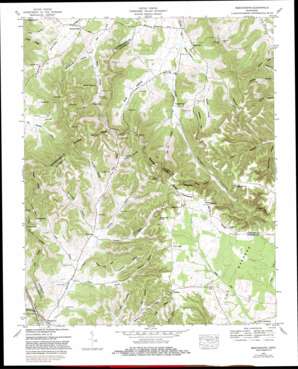
Beechgrove Topo Map Tennessee
To zoom in, hover over the map of Beechgrove
USGS Topo Quad 35086f2 - 1:24,000 scale
| Topo Map Name: | Beechgrove |
| USGS Topo Quad ID: | 35086f2 |
| Print Size: | ca. 21 1/4" wide x 27" high |
| Southeast Coordinates: | 35.625° N latitude / 86.125° W longitude |
| Map Center Coordinates: | 35.6875° N latitude / 86.1875° W longitude |
| U.S. State: | TN |
| Filename: | o35086f2.jpg |
| Download Map JPG Image: | Beechgrove topo map 1:24,000 scale |
| Map Type: | Topographic |
| Topo Series: | 7.5´ |
| Map Scale: | 1:24,000 |
| Source of Map Images: | United States Geological Survey (USGS) |
| Alternate Map Versions: |
Beech Grove TN 1936 Download PDF Buy paper map Beech Grove TN 1953, updated 1958 Download PDF Buy paper map Beechgrove TN 1953, updated 1981 Download PDF Buy paper map Beechgrove TN 2010 Download PDF Buy paper map Beechgrove TN 2013 Download PDF Buy paper map Beechgrove TN 2016 Download PDF Buy paper map |
1:24,000 Topo Quads surrounding Beechgrove
> Back to 35086e1 at 1:100,000 scale
> Back to 35086a1 at 1:250,000 scale
> Back to U.S. Topo Maps home
Beechgrove topo map: Gazetteer
Beechgrove: Cliffs
Mason Bluff elevation 382m 1253′Beechgrove: Populated Places
Beechgrove elevation 267m 875′Bradyville elevation 230m 754′
Donnell Chapel elevation 254m 833′
Fudgearound elevation 393m 1289′
Gossburg elevation 285m 935′
Hoodoo elevation 378m 1240′
Hopewell (historical) elevation 239m 784′
Jernigan (historical) elevation 232m 761′
Robinson (historical) elevation 399m 1309′
Thyatira (historical) elevation 237m 777′
Tolbertsville (historical) elevation 238m 780′
Beechgrove: Post Offices
Beech Grove Post Office elevation 268m 879′Beechgrove: Ridges
Douglas Ridge elevation 412m 1351′Morgan Ridge elevation 403m 1322′
Robinson Ridge elevation 338m 1108′
Teal Ridge elevation 333m 1092′
Beechgrove: Streams
Jernigan Branch elevation 280m 918′Lawrence Branch elevation 280m 918′
Norton Branch elevation 273m 895′
Possumpaw Branch elevation 283m 928′
Shelton Branch elevation 218m 715′
Sutton Branch elevation 274m 898′
Beechgrove: Summits
Bread Tray Hill elevation 372m 1220′Carson Hills elevation 296m 971′
Dickens Hill elevation 313m 1026′
Gilly Hill elevation 386m 1266′
Prater Hill elevation 378m 1240′
Weber Hill elevation 367m 1204′
Beechgrove: Valleys
Armstrong Hollow elevation 262m 859′Blair Hollow elevation 308m 1010′
Broyles Hollow elevation 313m 1026′
Burk Hollow elevation 261m 856′
Bynum Hollow elevation 233m 764′
Dug Hollow elevation 226m 741′
Dug Hollow elevation 297m 974′
Harrold Hollow elevation 297m 974′
Hettie Hollow elevation 315m 1033′
Howland Hollow elevation 293m 961′
Jackson Hollow elevation 304m 997′
Jacob Hollow elevation 247m 810′
Jernigans Hollow elevation 280m 918′
Mill Bluff Hollow elevation 277m 908′
Patton Hollow elevation 290m 951′
Possumpaw Hollow elevation 284m 931′
Ramp Hollow elevation 258m 846′
Rile Hill Hollow elevation 236m 774′
Taylor Hollow elevation 265m 869′
Tolbert Hollow elevation 238m 780′
Beechgrove digital topo map on disk
Buy this Beechgrove topo map showing relief, roads, GPS coordinates and other geographical features, as a high-resolution digital map file on DVD:


