Rally Hill Topo Map Tennessee
To zoom in, hover over the map of Rally Hill
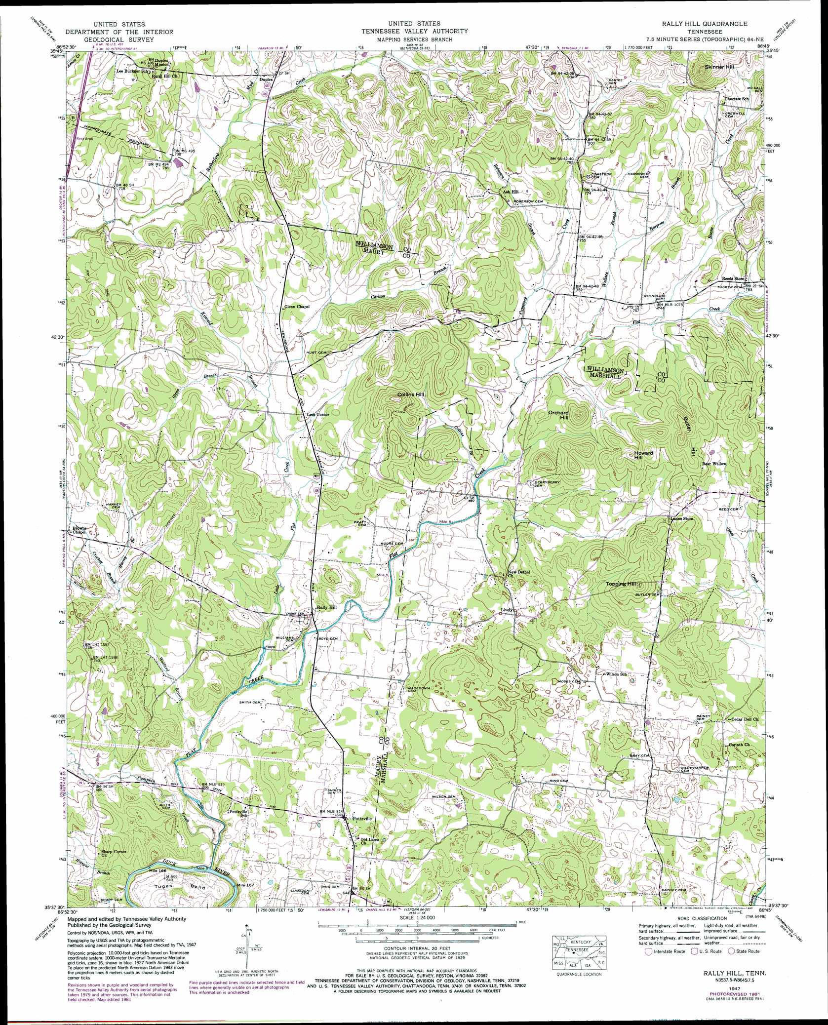
USGS Topo Quad 35086f7 - 1:24,000 scale
| Topo Map Name: | Rally Hill |
| USGS Topo Quad ID: | 35086f7 |
| Print Size: | ca. 21 1/4" wide x 27" high |
| Southeast Coordinates: | 35.625° N latitude / 86.75° W longitude |
| Map Center Coordinates: | 35.6875° N latitude / 86.8125° W longitude |
| U.S. State: | TN |
| Filename: | o35086f7.jpg |
| Download Map JPG Image: | Rally Hill topo map 1:24,000 scale |
| Map Type: | Topographic |
| Topo Series: | 7.5´ |
| Map Scale: | 1:24,000 |
| Source of Map Images: | United States Geological Survey (USGS) |
| Alternate Map Versions: |
Rally Hill TN 1936 Download PDF Buy paper map Rally Hill TN 1947, updated 1948 Download PDF Buy paper map Rally Hill TN 1947, updated 1965 Download PDF Buy paper map Rally Hill TN 1947, updated 1974 Download PDF Buy paper map Rally Hill TN 1947, updated 1982 Download PDF Buy paper map Rally Hill TN 2010 Download PDF Buy paper map Rally Hill TN 2013 Download PDF Buy paper map Rally Hill TN 2016 Download PDF Buy paper map |
1:24,000 Topo Quads surrounding Rally Hill
Fairview |
Leipers Fork |
Franklin |
Nolensville |
Smyrna |
Theta |
Spring Hill |
Bethesda |
College Grove |
Rockvale |
Godwin |
Carters Creek |
Rally Hill |
Chapel Hill |
Rover |
Columbia |
Glendale |
Verona |
Farmington |
Unionville |
Lynnville |
Campbells Station |
Lewisburg |
Belfast |
Bedford |
> Back to 35086e1 at 1:100,000 scale
> Back to 35086a1 at 1:250,000 scale
> Back to U.S. Topo Maps home
Rally Hill topo map: Gazetteer
Rally Hill: Bends
Tugas Bend elevation 207m 679′Rally Hill: Populated Places
Bear Wallow elevation 248m 813′Duplex elevation 231m 757′
Duplex Mission elevation 243m 797′
Lees Corner elevation 217m 711′
Lively elevation 214m 702′
Pottsville elevation 198m 649′
Rally Hill elevation 207m 679′
Rally Hill: Streams
Boone Creek elevation 216m 708′Carlton Branch elevation 216m 708′
Collins Branch elevation 206m 675′
Comstock Creek elevation 209m 685′
Crockett Branch elevation 202m 662′
Flat Creek elevation 180m 590′
Glenn Branch elevation 210m 688′
Hargrove Branch elevation 223m 731′
Harvey Branch elevation 204m 669′
Hotspur Branch elevation 184m 603′
Kincaid Branch elevation 205m 672′
Little Flat Creek elevation 191m 626′
Mud Creek elevation 218m 715′
Pumpkin Creek elevation 182m 597′
Roberson Branch elevation 216m 708′
Wallace Branch elevation 212m 695′
Wollard Branch elevation 186m 610′
Rally Hill: Summits
Butler Hill elevation 279m 915′Collins Hill elevation 280m 918′
Howard Hill elevation 275m 902′
Orchard Hill elevation 274m 898′
Skinner Hill elevation 342m 1122′
Topping Hill elevation 275m 902′
Rally Hill digital topo map on disk
Buy this Rally Hill topo map showing relief, roads, GPS coordinates and other geographical features, as a high-resolution digital map file on DVD: