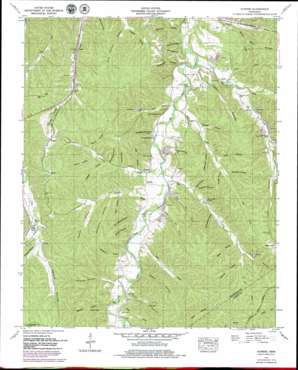
Sunrise Topo Map Tennessee
To zoom in, hover over the map of Sunrise
USGS Topo Quad 35087f4 - 1:24,000 scale
| Topo Map Name: | Sunrise |
| USGS Topo Quad ID: | 35087f4 |
| Print Size: | ca. 21 1/4" wide x 27" high |
| Southeast Coordinates: | 35.625° N latitude / 87.375° W longitude |
| Map Center Coordinates: | 35.6875° N latitude / 87.4375° W longitude |
| U.S. State: | TN |
| Filename: | o35087f4.jpg |
| Download Map JPG Image: | Sunrise topo map 1:24,000 scale |
| Map Type: | Topographic |
| Topo Series: | 7.5´ |
| Map Scale: | 1:24,000 |
| Source of Map Images: | United States Geological Survey (USGS) |
| Alternate Map Versions: |
Sunrise TN 1936 Download PDF Buy paper map Sunrise TN 1952, updated 1957 Download PDF Buy paper map Sunrise TN 1952, updated 1980 Download PDF Buy paper map Sunrise TN 2010 Download PDF Buy paper map Sunrise TN 2013 Download PDF Buy paper map Sunrise TN 2016 Download PDF Buy paper map |
1:24,000 Topo Quads surrounding Sunrise
> Back to 35087e1 at 1:100,000 scale
> Back to 35086a1 at 1:250,000 scale
> Back to U.S. Topo Maps home
Sunrise topo map: Gazetteer
Sunrise: Falls
Jenkins Falls elevation 200m 656′Sunrise: Mines
Blue Buck Creek Mines elevation 177m 580′Coleman Hollow Prospect elevation 193m 633′
Copperas Branch Prospect elevation 253m 830′
Falls Branch Mine elevation 181m 593′
Hutchinson Spring Mines elevation 184m 603′
Indian Creek Mines elevation 194m 636′
Jenkins Branch Mine elevation 262m 859′
Little Piney Creek Mine elevation 167m 547′
Lower Pine Branch Mines elevation 173m 567′
Mathis Hollow Mine elevation 264m 866′
Meetinghouse Hollow Mine elevation 169m 554′
Nun Hollow Mine elevation 189m 620′
Roderick Hollow Mine elevation 194m 636′
Short Branch Mine elevation 189m 620′
Simmons Branch Mines elevation 202m 662′
Swan Bluff-Haw Branch Mines elevation 182m 597′
Swan Creek Mines elevation 155m 508′
Totty Hollow Mines elevation 170m 557′
Ugly Creek Mines elevation 184m 603′
Upper Pine Branch Mines elevation 177m 580′
Sunrise: Populated Places
Bond elevation 154m 505′Buffalo elevation 264m 866′
Deans elevation 169m 554′
Sunrise elevation 177m 580′
Swan Bluff elevation 155m 508′
Watson elevation 251m 823′
Sunrise: Springs
Hutchison Spring elevation 176m 577′Peery Spring elevation 184m 603′
Swan Bluff Spring elevation 169m 554′
Sunrise: Streams
Blue Buck Creek elevation 149m 488′Coopers Bluebuck Creek elevation 149m 488′
Copperas Branch elevation 162m 531′
Falls Branch elevation 158m 518′
Haw Branch elevation 155m 508′
Horse Branch elevation 165m 541′
Jones Branch elevation 171m 561′
Lower Pine Branch elevation 159m 521′
Muddy Branch elevation 201m 659′
Prickett Branch elevation 156m 511′
Short Branch elevation 153m 501′
Simmons Branch elevation 158m 518′
Ugly Creek elevation 164m 538′
Upper Pine Branch elevation 164m 538′
Sunrise: Summits
Grimmett Hill elevation 217m 711′Robinson Hill elevation 214m 702′
Sunrise: Valleys
Big Hollow elevation 168m 551′Big Hollow elevation 184m 603′
Buck Hollow elevation 195m 639′
Buffalo Hollow elevation 189m 620′
Burns Hollow elevation 196m 643′
Cave Hollow elevation 176m 577′
Clagett Hollow elevation 172m 564′
Coleman Hollow elevation 171m 561′
Davidson Hollow elevation 196m 643′
Devore Hollow elevation 210m 688′
Gordon Hollow elevation 162m 531′
Greenbrier Hollow elevation 183m 600′
House Hollow elevation 194m 636′
Hurricane Hollow elevation 175m 574′
Jenkins Hollow elevation 171m 561′
Lovell Hollow elevation 193m 633′
Mathis Hollow elevation 209m 685′
Meetinghouse Hollow elevation 169m 554′
Millstone Hollow elevation 177m 580′
Morgan Hollow elevation 194m 636′
Morris Hollow elevation 151m 495′
Nun Hollow elevation 178m 583′
Pettas Hollow elevation 183m 600′
Righhand Hollow elevation 191m 626′
Rochelle Hollow elevation 146m 479′
Roderick Hollow elevation 172m 564′
Rube Hollow elevation 183m 600′
Scotch Hollow elevation 171m 561′
Shop Hollow elevation 172m 564′
Shop Hollow elevation 178m 583′
Simmons Hollow elevation 177m 580′
Spring Hollow elevation 205m 672′
Steep Hollow elevation 172m 564′
Stewart Hollow elevation 181m 593′
Stillhouse Hollow elevation 156m 511′
Storehouse Hollow elevation 179m 587′
Sugarcamp Hollow elevation 176m 577′
Tatum Hollow elevation 193m 633′
Totty Hollow elevation 150m 492′
Trestle Hollow elevation 202m 662′
York Hollow elevation 196m 643′
Sunrise digital topo map on disk
Buy this Sunrise topo map showing relief, roads, GPS coordinates and other geographical features, as a high-resolution digital map file on DVD:


