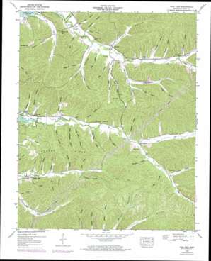
Pine View Topo Map Tennessee
To zoom in, hover over the map of Pine View
USGS Topo Quad 35087f8 - 1:24,000 scale
| Topo Map Name: | Pine View |
| USGS Topo Quad ID: | 35087f8 |
| Print Size: | ca. 21 1/4" wide x 27" high |
| Southeast Coordinates: | 35.625° N latitude / 87.875° W longitude |
| Map Center Coordinates: | 35.6875° N latitude / 87.9375° W longitude |
| U.S. State: | TN |
| Filename: | o35087f8.jpg |
| Download Map JPG Image: | Pine View topo map 1:24,000 scale |
| Map Type: | Topographic |
| Topo Series: | 7.5´ |
| Map Scale: | 1:24,000 |
| Source of Map Images: | United States Geological Survey (USGS) |
| Alternate Map Versions: |
Pine View TN 1936 Download PDF Buy paper map Pine View TN 1949, updated 1953 Download PDF Buy paper map Pine View TN 1949, updated 1974 Download PDF Buy paper map Pine View TN 2010 Download PDF Buy paper map Pine View TN 2013 Download PDF Buy paper map Pine View TN 2016 Download PDF Buy paper map |
1:24,000 Topo Quads surrounding Pine View
> Back to 35087e1 at 1:100,000 scale
> Back to 35086a1 at 1:250,000 scale
> Back to U.S. Topo Maps home
Pine View topo map: Gazetteer
Pine View: Crossings
Toms Creek Ford elevation 126m 413′Pine View: Populated Places
Pine View elevation 124m 406′Spring Creek elevation 125m 410′
Pine View: Ridges
Sparks Ridge elevation 175m 574′Pine View: Springs
Cave Spring elevation 127m 416′Pine View: Streams
North Fork Lick Creek elevation 133m 436′North Fork Toms Creek elevation 141m 462′
Owl Hollow Branch elevation 116m 380′
Patrey Branch elevation 137m 449′
South Fork Toms Creek elevation 140m 459′
Willsdorf Branch elevation 126m 413′
Pine View: Summits
Bunker Hill elevation 183m 600′Pine View: Valleys
Beakley Hollow elevation 115m 377′Bell Hollow elevation 129m 423′
Bridge Hollow elevation 144m 472′
Carlton Hollow elevation 115m 377′
Choate Hollow elevation 152m 498′
Cotton Hollow elevation 148m 485′
Deerlick Hollow elevation 132m 433′
Dickson Hollow elevation 126m 413′
Forehand Hollow elevation 120m 393′
Gamblin Hollow elevation 147m 482′
Gean Hollow elevation 132m 433′
George Hollow elevation 144m 472′
Goblet Hollow elevation 127m 416′
Gotthardt Hollow elevation 123m 403′
Hatton Hollow elevation 121m 396′
Hill Hollow elevation 119m 390′
Hopkins Hollow elevation 139m 456′
Horner Hollow elevation 117m 383′
Horner Hollow elevation 128m 419′
Horner Hollow elevation 137m 449′
Hull Hollow elevation 135m 442′
Ledbetter Hollow elevation 135m 442′
Left Fork Horner Hollow elevation 141m 462′
Lewis Hollow elevation 125m 410′
Lower Ledbetter Hollow elevation 119m 390′
Madden Hollow elevation 119m 390′
Marshall Hollow elevation 136m 446′
McKnight Hollow elevation 122m 400′
Mill Hollow elevation 153m 501′
Myat Hollow elevation 127m 416′
Nix Hollow elevation 116m 380′
O'Guin Hollow elevation 121m 396′
Owl Hollow elevation 119m 390′
Patrey Hollow elevation 138m 452′
Pitts Hollow elevation 122m 400′
Porter Hollow elevation 126m 413′
Right Fork Horner Hollow elevation 144m 472′
Scary Hollow elevation 153m 501′
Silvers Hollow elevation 154m 505′
Sparks Hollow elevation 114m 374′
Strickland Hollow elevation 140m 459′
Sugar Camp Hollow elevation 120m 393′
Twilley Hollow elevation 123m 403′
Wilsdorf Hollow elevation 129m 423′
Pine View digital topo map on disk
Buy this Pine View topo map showing relief, roads, GPS coordinates and other geographical features, as a high-resolution digital map file on DVD:


