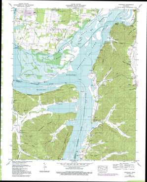
Hustburg Topo Map Tennessee
To zoom in, hover over the map of Hustburg
USGS Topo Quad 35087h8 - 1:24,000 scale
| Topo Map Name: | Hustburg |
| USGS Topo Quad ID: | 35087h8 |
| Print Size: | ca. 21 1/4" wide x 27" high |
| Southeast Coordinates: | 35.875° N latitude / 87.875° W longitude |
| Map Center Coordinates: | 35.9375° N latitude / 87.9375° W longitude |
| U.S. State: | TN |
| Filename: | o35087h8.jpg |
| Download Map JPG Image: | Hustburg topo map 1:24,000 scale |
| Map Type: | Topographic |
| Topo Series: | 7.5´ |
| Map Scale: | 1:24,000 |
| Source of Map Images: | United States Geological Survey (USGS) |
| Alternate Map Versions: |
Hustburg TN 1936 Download PDF Buy paper map Hustburg TN 1949, updated 1953 Download PDF Buy paper map Hustburg TN 1949, updated 1967 Download PDF Buy paper map Hustburg TN 1949, updated 1978 Download PDF Buy paper map Hustburg TN 1949, updated 1992 Download PDF Buy paper map Hustburg TN 2010 Download PDF Buy paper map Hustburg TN 2013 Download PDF Buy paper map Hustburg TN 2016 Download PDF Buy paper map |
1:24,000 Topo Quads surrounding Hustburg
> Back to 35087e1 at 1:100,000 scale
> Back to 35086a1 at 1:250,000 scale
> Back to U.S. Topo Maps home
Hustburg topo map: Gazetteer
Hustburg: Basins
Duck River Dewatering Area elevation 107m 351′Hustburg: Bends
Duck Bottom elevation 110m 360′Lower Big Bottom elevation 107m 351′
Upper Big Bottom elevation 108m 354′
Hustburg: Canals
Clear Lake Drain elevation 107m 351′Grassy Lake Drain elevation 107m 351′
Hustburg: Cliffs
Honey Point elevation 116m 380′Hustburg: Dams
Foote Mineral Company Dam Number One elevation 115m 377′Hustburg: Flats
Sycamore Bottom elevation 109m 357′Hustburg: Gaps
Dughill Gap elevation 138m 452′Hustburg: Guts
Broad Slough elevation 107m 351′Overcup Slough elevation 107m 351′
Hustburg: Islands
Rockport Island (historical) elevation 109m 357′Hustburg: Lakes
Clear Lake (historical) elevation 107m 351′Cypress Pond (historical) elevation 109m 357′
Old Cathole (historical) elevation 109m 357′
Hustburg: Parks
Duck River Unit Tennessee National Wildlife Refuge elevation 110m 360′Tennessee National Wildlife Refuge elevation 109m 357′
Hustburg: Populated Places
Dughill (historical) elevation 114m 374′Eagle Creek elevation 119m 390′
Hustburg elevation 122m 400′
Polecat elevation 121m 396′
Hustburg: Reservoirs
Foote Mineral Company Tailings Pond elevation 115m 377′Hustburg: Ridges
Sinkhole Ridge elevation 181m 593′Hustburg: Springs
Clear Spring elevation 120m 393′Hustburg: Streams
Beason Branch elevation 110m 360′Blue Creek elevation 109m 357′
Briar Creek elevation 109m 357′
Burnett Branch elevation 109m 357′
Chappell Hollow Branch elevation 110m 360′
Clear Branch elevation 109m 357′
Dry Branch elevation 121m 396′
Duck River elevation 109m 357′
Duncan Branch elevation 112m 367′
Eagle Creek elevation 109m 357′
Haggard Branch elevation 115m 377′
Harmon Creek elevation 110m 360′
Hustburg Creek elevation 107m 351′
Lawrence Creek elevation 107m 351′
Opossum Creek elevation 109m 357′
Opossum Creek elevation 109m 357′
Pond Creek elevation 116m 380′
Roberts Creek elevation 109m 357′
Simmons Branch elevation 109m 357′
Stribling Branch elevation 110m 360′
Tanyard Branch elevation 109m 357′
Hustburg: Valleys
Capps Hollow elevation 122m 400′Carroll Hollow elevation 114m 374′
Chalk Hollow elevation 111m 364′
Craig Hollow elevation 125m 410′
Cuba Hollow elevation 112m 367′
Fry Hollow elevation 129m 423′
Lewis Hollow elevation 129m 423′
Polecat Hollow elevation 120m 393′
Squirrel Hollow elevation 135m 442′
Swader Hollow elevation 119m 390′
Willbanks Hollow elevation 140m 459′
Hustburg digital topo map on disk
Buy this Hustburg topo map showing relief, roads, GPS coordinates and other geographical features, as a high-resolution digital map file on DVD:


