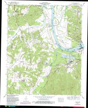
Counce Topo Map Tennessee
To zoom in, hover over the map of Counce
USGS Topo Quad 35088a3 - 1:24,000 scale
| Topo Map Name: | Counce |
| USGS Topo Quad ID: | 35088a3 |
| Print Size: | ca. 21 1/4" wide x 27" high |
| Southeast Coordinates: | 35° N latitude / 88.25° W longitude |
| Map Center Coordinates: | 35.0625° N latitude / 88.3125° W longitude |
| U.S. State: | TN |
| Filename: | o35088a3.jpg |
| Download Map JPG Image: | Counce topo map 1:24,000 scale |
| Map Type: | Topographic |
| Topo Series: | 7.5´ |
| Map Scale: | 1:24,000 |
| Source of Map Images: | United States Geological Survey (USGS) |
| Alternate Map Versions: |
Counce TN 1936 Download PDF Buy paper map Counce TN 1949, updated 1952 Download PDF Buy paper map Counce TN 1972, updated 1974 Download PDF Buy paper map Counce TN 1972, updated 1985 Download PDF Buy paper map Counce TN 1972, updated 1988 Download PDF Buy paper map Counce TN 2010 Download PDF Buy paper map Counce TN 2013 Download PDF Buy paper map Counce TN 2016 Download PDF Buy paper map |
1:24,000 Topo Quads surrounding Counce
> Back to 35088a1 at 1:100,000 scale
> Back to 35088a1 at 1:250,000 scale
> Back to U.S. Topo Maps home
Counce topo map: Gazetteer
Counce: Bars
Big Bend Shoals elevation 110m 360′Counce: Bends
Big Bend elevation 118m 387′Hindman Bottom elevation 119m 390′
Counce: Canals
Lick Creek Canal elevation 118m 387′Counce: Crossings
Callens Ferry (historical) elevation 110m 360′Hamburg Ferry (historical) elevation 110m 360′
Pickwick Ferry (historical) elevation 110m 360′
Tucker Landing elevation 111m 364′
Counce: Dams
Tennessee River Pulp and Paper Company East Dam elevation 120m 393′Tennessee River Pulp and Paper Company West Dam elevation 121m 396′
Counce: Flats
Fraley Field elevation 148m 485′Counce: Gaps
Sand Gap elevation 165m 541′Counce: Lakes
Hatley Pond elevation 115m 377′Counce: Populated Places
Childers Hill elevation 160m 524′Counce elevation 148m 485′
Damon elevation 129m 423′
Hamburg elevation 119m 390′
Nixon elevation 152m 498′
Pyburn elevation 155m 508′
Shiloh elevation 157m 515′
Slab Town (historical) elevation 125m 410′
Southside elevation 165m 541′
Counce: Post Offices
Counce Post Office elevation 146m 479′Counce: Reservoirs
Tennessee River Pulp and Paper East Lake elevation 120m 393′Tennessee River Pulp and Paper West Lake elevation 121m 396′
Counce: Streams
Barbwood Branch elevation 115m 377′Barnes Branch elevation 120m 393′
Batey Branch elevation 117m 383′
Battles Branch elevation 116m 380′
Blevins Branch elevation 119m 390′
Bluff Spring Branch elevation 116m 380′
Booker Branch elevation 127m 416′
Browder Branch elevation 113m 370′
Center Hill Branch elevation 112m 367′
Chambers Creek elevation 110m 360′
Chambers Creek elevation 110m 360′
Hatley Creek elevation 111m 364′
Hindman Branch elevation 116m 380′
Hoover Branch elevation 116m 380′
Houston Branch elevation 118m 387′
Johnson Slough elevation 112m 367′
Kelley Branch elevation 129m 423′
Leath Creek elevation 112m 367′
Lick Creek elevation 110m 360′
Little Creek elevation 118m 387′
Littlejohn Branch elevation 119m 390′
Murdock Branch elevation 117m 383′
Pinkston Branch elevation 118m 387′
Pinkston Branch elevation 118m 387′
Pisgah Branch elevation 117m 383′
Robinson Creek elevation 111m 364′
Spain Branch elevation 112m 367′
Turner Branch elevation 114m 374′
Watkins Branch elevation 123m 403′
Woods Branch elevation 118m 387′
Worley Branch elevation 115m 377′
Counce: Summits
Pisgah Hill elevation 141m 462′Counce: Valleys
Austin Hollow elevation 125m 410′Wildcat Hollow elevation 120m 393′
Counce digital topo map on disk
Buy this Counce topo map showing relief, roads, GPS coordinates and other geographical features, as a high-resolution digital map file on DVD:


