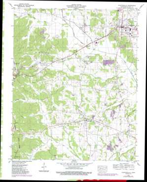
Stantonville Topo Map Tennessee
To zoom in, hover over the map of Stantonville
USGS Topo Quad 35088b4 - 1:24,000 scale
| Topo Map Name: | Stantonville |
| USGS Topo Quad ID: | 35088b4 |
| Print Size: | ca. 21 1/4" wide x 27" high |
| Southeast Coordinates: | 35.125° N latitude / 88.375° W longitude |
| Map Center Coordinates: | 35.1875° N latitude / 88.4375° W longitude |
| U.S. State: | TN |
| Filename: | o35088b4.jpg |
| Download Map JPG Image: | Stantonville topo map 1:24,000 scale |
| Map Type: | Topographic |
| Topo Series: | 7.5´ |
| Map Scale: | 1:24,000 |
| Source of Map Images: | United States Geological Survey (USGS) |
| Alternate Map Versions: |
Stantonville TN 1936 Download PDF Buy paper map Stantonville TN 1949, updated 1952 Download PDF Buy paper map Stantonville TN 1949, updated 1974 Download PDF Buy paper map Stantonville TN 1949, updated 1992 Download PDF Buy paper map Stantonville TN 2010 Download PDF Buy paper map Stantonville TN 2014 Download PDF Buy paper map Stantonville TN 2016 Download PDF Buy paper map |
1:24,000 Topo Quads surrounding Stantonville
> Back to 35088a1 at 1:100,000 scale
> Back to 35088a1 at 1:250,000 scale
> Back to U.S. Topo Maps home
Stantonville topo map: Gazetteer
Stantonville: Dams
Tanyard Springs Dam elevation 129m 423′Stantonville: Populated Places
Adamsville elevation 157m 515′Gilchrist elevation 146m 479′
Hickory Flats elevation 139m 456′
Mount Vinson elevation 139m 456′
New Lawton elevation 144m 472′
Old Lawton elevation 166m 544′
Stantonville elevation 147m 482′
West Shiloh elevation 145m 475′
Stantonville: Reservoirs
Tanyard Springs Lake elevation 129m 423′Stantonville: Streams
Ausburn Branch elevation 130m 426′Brown Branch elevation 120m 393′
Burks Branch elevation 122m 400′
Clarey Branch elevation 118m 387′
Fulwood Branch elevation 135m 442′
Garrison Branch elevation 122m 400′
Graham Creek elevation 114m 374′
Horse Creek elevation 125m 410′
Howell Branch elevation 126m 413′
Lick Creek elevation 121m 396′
Little Snake Creek elevation 122m 400′
McDaniel Branch elevation 128m 419′
Middle Fork Owl Creek elevation 137m 449′
Needham Branch elevation 139m 456′
South Fork Owl Creek elevation 133m 436′
Stanley Creek elevation 115m 377′
Statonville Branch elevation 130m 426′
Tanner Branch elevation 128m 419′
Teuton Branch elevation 119m 390′
Todd Branch elevation 137m 449′
Winningham Branch elevation 126m 413′
Yellow Bank Creek elevation 132m 433′
Stantonville: Valleys
Bateman Hollow elevation 143m 469′Dutchman Hollow elevation 130m 426′
Stantonville digital topo map on disk
Buy this Stantonville topo map showing relief, roads, GPS coordinates and other geographical features, as a high-resolution digital map file on DVD:


