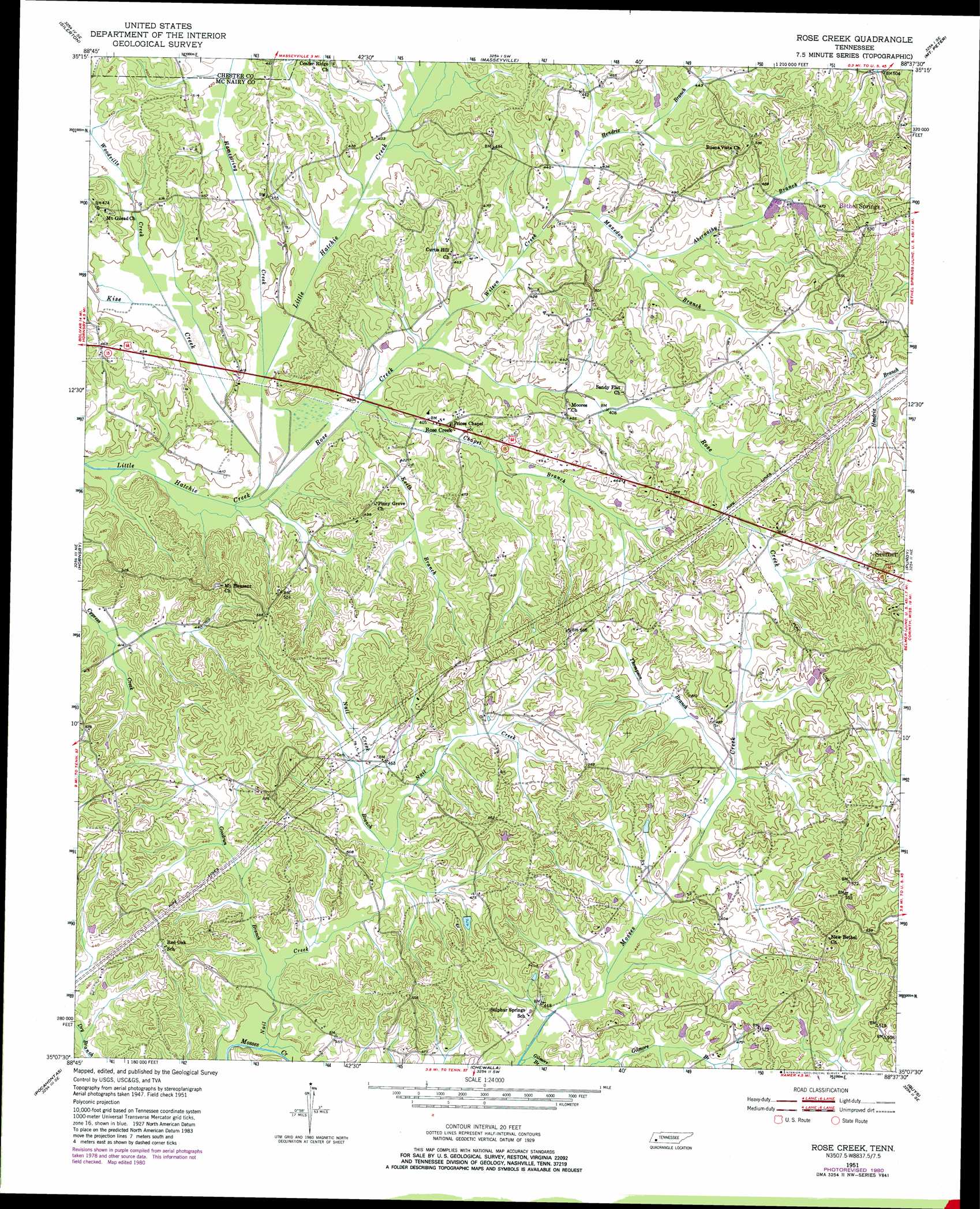
Rose Creek Topo Map Tennessee
To zoom in, hover over the map of Rose Creek
USGS Topo Quad 35088b6 - 1:24,000 scale
| Topo Map Name: | Rose Creek |
| USGS Topo Quad ID: | 35088b6 |
| Print Size: | ca. 21 1/4" wide x 27" high |
| Southeast Coordinates: | 35.125° N latitude / 88.625° W longitude |
| Map Center Coordinates: | 35.1875° N latitude / 88.6875° W longitude |
| U.S. State: | TN |
| Filename: | o35088b6.jpg |
| Download Map JPG Image: | Rose Creek topo map 1:24,000 scale |
| Map Type: | Topographic |
| Topo Series: | 7.5´ |
| Map Scale: | 1:24,000 |
| Source of Map Images: | United States Geological Survey (USGS) |
| Alternate Map Versions: |
Rose Creek TN 1951, updated 1952 Download PDF Buy paper map Rose Creek TN 1951, updated 1972 Download PDF Buy paper map Rose Creek TN 1951, updated 1981 Download PDF Buy paper map Rose Creek TN 2010 Download PDF Buy paper map Rose Creek TN 2013 Download PDF Buy paper map Rose Creek TN 2016 Download PDF Buy paper map |
1:24,000 Topo Quads surrounding Rose Creek
Teague |
Medon |
Henderson |
Jacks Creek |
Enville |
Bolivar East |
Silerton |
Masseyville |
Mount Peter |
Leapwood |
Hebron |
Hornsby |
Rose Creek |
Purdy |
Stantonville |
Middleton |
Pocahontas |
Chewalla |
Guys |
Michie |
Walnut |
Chalybeate |
Kossuth North |
Corinth |
Kendrick |
> Back to 35088a1 at 1:100,000 scale
> Back to 35088a1 at 1:250,000 scale
> Back to U.S. Topo Maps home
Rose Creek topo map: Gazetteer
Rose Creek: Airports
Whitehurst Airport elevation 121m 396′Rose Creek: Populated Places
Rose Creek elevation 123m 403′Sulphur Springs elevation 133m 436′
Rose Creek: Streams
Abernathy Branch elevation 124m 406′Chapel Branch elevation 119m 390′
Gilmore Branch elevation 127m 416′
Goodrun Branch elevation 123m 403′
Hamestring Creek elevation 116m 380′
Hendrix Branch elevation 122m 400′
Hodger Branch elevation 120m 393′
Keith Branch elevation 116m 380′
Kise Creek elevation 116m 380′
Maxedon Branch elevation 122m 400′
Nail Creek elevation 121m 396′
Nail Creek Branch elevation 130m 426′
Rose Creek elevation 115m 377′
Thompson Branch elevation 137m 449′
Wilson Creek elevation 118m 387′
Woodville Creek elevation 119m 390′
Rose Creek digital topo map on disk
Buy this Rose Creek topo map showing relief, roads, GPS coordinates and other geographical features, as a high-resolution digital map file on DVD: