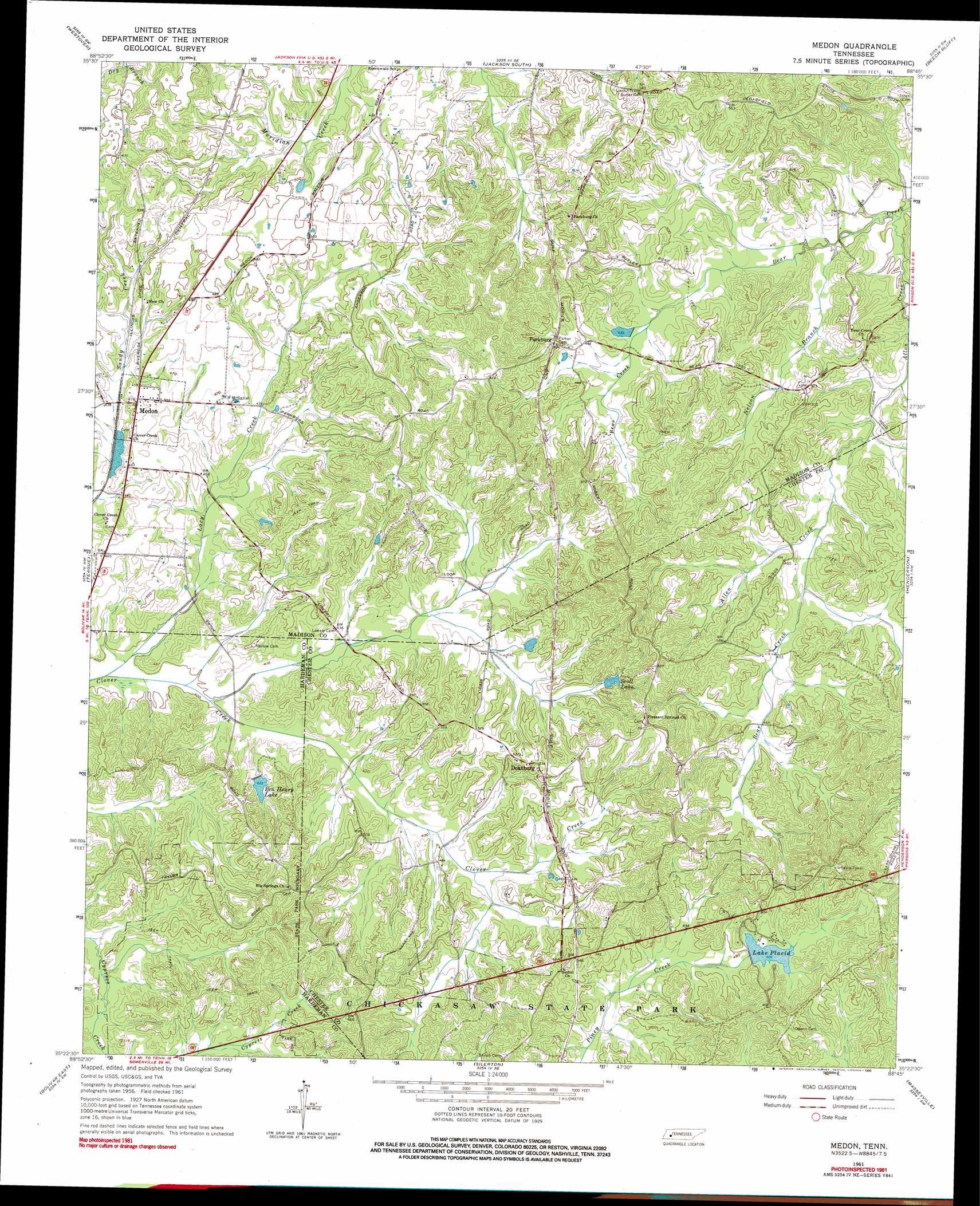
Medon Topo Map Tennessee
To zoom in, hover over the map of Medon
USGS Topo Quad 35088d7 - 1:24,000 scale
| Topo Map Name: | Medon |
| USGS Topo Quad ID: | 35088d7 |
| Print Size: | ca. 21 1/4" wide x 27" high |
| Southeast Coordinates: | 35.375° N latitude / 88.75° W longitude |
| Map Center Coordinates: | 35.4375° N latitude / 88.8125° W longitude |
| U.S. State: | TN |
| Filename: | o35088d7.jpg |
| Download Map JPG Image: | Medon topo map 1:24,000 scale |
| Map Type: | Topographic |
| Topo Series: | 7.5´ |
| Map Scale: | 1:24,000 |
| Source of Map Images: | United States Geological Survey (USGS) |
| Alternate Map Versions: |
Medon TN 1961, updated 1964 Download PDF Buy paper map Medon TN 1961, updated 1976 Download PDF Buy paper map Medon TN 1961, updated 1990 Download PDF Buy paper map Medon TN 2010 Download PDF Buy paper map Medon TN 2013 Download PDF Buy paper map Medon TN 2016 Download PDF Buy paper map |
1:24,000 Topo Quads surrounding Medon
Bells |
Adair |
Jackson North |
Claybrook |
Juno |
Denmark |
Westover |
Jackson South |
Beech Bluff |
Luray |
Mercer |
Teague |
Medon |
Henderson |
Jacks Creek |
Bolivar West |
Bolivar East |
Silerton |
Masseyville |
Mount Peter |
Middleburg |
Hebron |
Hornsby |
Rose Creek |
Purdy |
> Back to 35088a1 at 1:100,000 scale
> Back to 35088a1 at 1:250,000 scale
> Back to U.S. Topo Maps home
Medon topo map: Gazetteer
Medon: Dams
Ben Henry Lake Dam elevation 130m 426′Deanburg Hills Dam elevation 142m 465′
King Dam elevation 141m 462′
Lake Placid Dam elevation 154m 505′
Wilderwood Dam elevation 168m 551′
Medon: Populated Places
Deanburg elevation 162m 531′Medon elevation 142m 465′
Parkburg elevation 155m 508′
Medon: Reservoirs
Ben Henry Lake elevation 130m 426′Deanburg Hills Lake elevation 142m 465′
King Lake elevation 141m 462′
Lake Placid elevation 154m 505′
Scott Lake elevation 149m 488′
Wilderwood Lake elevation 168m 551′
Medon: Streams
Allen Creek elevation 122m 400′Bear Creek elevation 131m 429′
Lacy Creek elevation 119m 390′
Nelson Branch elevation 122m 400′
Medon: Trails
Fern Loop Nature Trail elevation 156m 511′Forked Pine Nature Trail elevation 162m 531′
Lakeshore Nature Trail elevation 155m 508′
Medon digital topo map on disk
Buy this Medon topo map showing relief, roads, GPS coordinates and other geographical features, as a high-resolution digital map file on DVD: