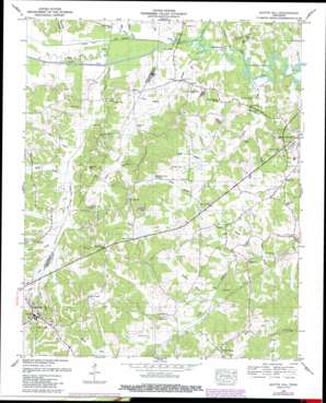
Scotts Hill Topo Map Tennessee
To zoom in, hover over the map of Scotts Hill
USGS Topo Quad 35088e2 - 1:24,000 scale
| Topo Map Name: | Scotts Hill |
| USGS Topo Quad ID: | 35088e2 |
| Print Size: | ca. 21 1/4" wide x 27" high |
| Southeast Coordinates: | 35.5° N latitude / 88.125° W longitude |
| Map Center Coordinates: | 35.5625° N latitude / 88.1875° W longitude |
| U.S. State: | TN |
| Filename: | o35088e2.jpg |
| Download Map JPG Image: | Scotts Hill topo map 1:24,000 scale |
| Map Type: | Topographic |
| Topo Series: | 7.5´ |
| Map Scale: | 1:24,000 |
| Source of Map Images: | United States Geological Survey (USGS) |
| Alternate Map Versions: |
Scotts Hill TN 1936 Download PDF Buy paper map Scotts Hill TN 1950, updated 1952 Download PDF Buy paper map Scotts Hill TN 1950, updated 1977 Download PDF Buy paper map Scotts Hill TN 1950, updated 1987 Download PDF Buy paper map Scotts Hill TN 2010 Download PDF Buy paper map Scotts Hill TN 2013 Download PDF Buy paper map Scotts Hill TN 2016 Download PDF Buy paper map |
1:24,000 Topo Quads surrounding Scotts Hill
> Back to 35088e1 at 1:100,000 scale
> Back to 35088a1 at 1:250,000 scale
> Back to U.S. Topo Maps home
Scotts Hill topo map: Gazetteer
Scotts Hill: Cliffs
Bumpers Bluff elevation 115m 377′Scotts Hill: Dams
Festus Jackson Dam elevation 142m 465′Lewis Lacy Dam Number Two elevation 123m 403′
Scotts Hill: Lakes
Old Ponta Pond elevation 114m 374′Scotts Hill: Populated Places
Dixie Mills elevation 116m 380′Garrett elevation 120m 393′
Scotts Hill elevation 158m 518′
Scotts Hill: Reservoirs
Festus Jackson Lake elevation 142m 465′Lewis Lacy Lake Number Two elevation 123m 403′
Scotts Hill: Springs
Whites Spring elevation 116m 380′Scotts Hill: Streams
Arms Creek elevation 114m 374′Bear Creek elevation 114m 374′
Beech River Slough elevation 114m 374′
Betsy Branch elevation 120m 393′
Big Creek elevation 114m 374′
Blue Creek elevation 122m 400′
Cane Creek elevation 114m 374′
Darden Branch elevation 114m 374′
Flat Creek elevation 114m 374′
Johnson Creek elevation 114m 374′
Lacy Branch elevation 115m 377′
Laster Branch elevation 125m 410′
Millpond Branch elevation 125m 410′
Mills Branch elevation 114m 374′
Panther Creek elevation 114m 374′
Pearcy Branch elevation 114m 374′
Polly Branch elevation 119m 390′
Powers Branch elevation 117m 383′
Powers Branch elevation 116m 380′
Pudding Branch elevation 131m 429′
Skull Branch elevation 114m 374′
Thompson Branch elevation 127m 416′
Turkey Creek elevation 115m 377′
Scotts Hill: Valleys
Buckner Hollow elevation 114m 374′Scotts Hill digital topo map on disk
Buy this Scotts Hill topo map showing relief, roads, GPS coordinates and other geographical features, as a high-resolution digital map file on DVD:


