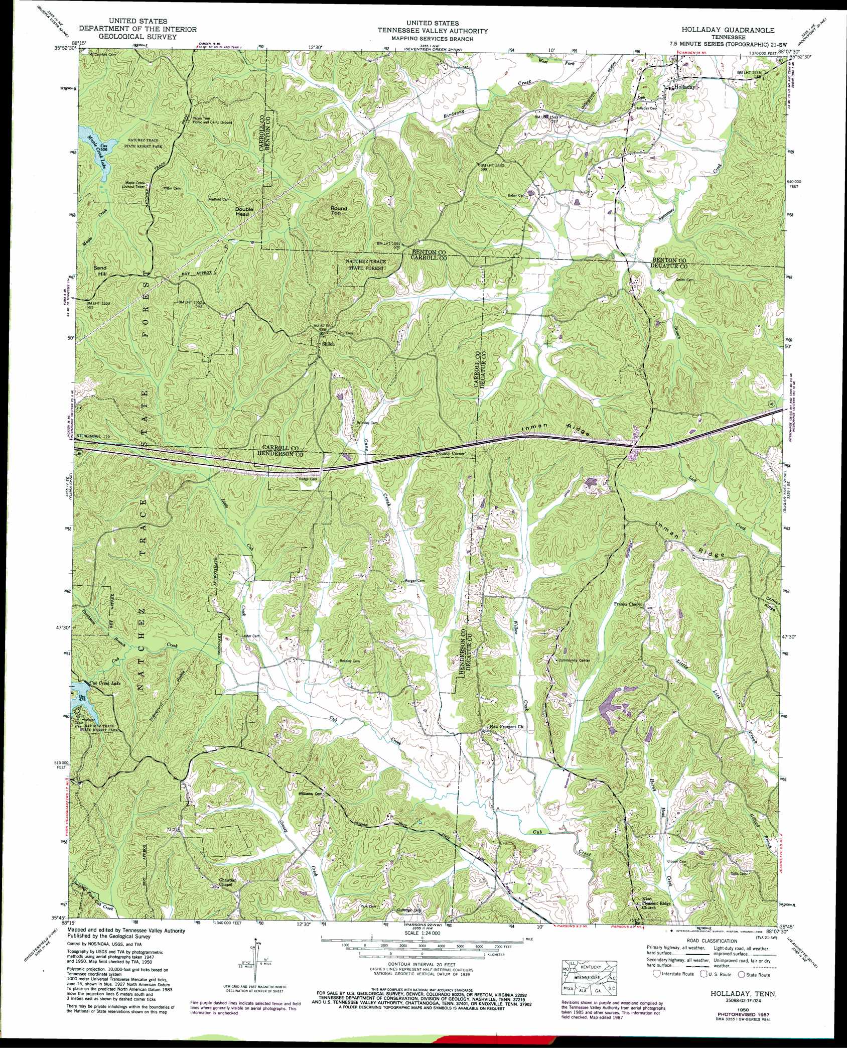
Holladay Topo Map Tennessee
To zoom in, hover over the map of Holladay
USGS Topo Quad 35088g2 - 1:24,000 scale
| Topo Map Name: | Holladay |
| USGS Topo Quad ID: | 35088g2 |
| Print Size: | ca. 21 1/4" wide x 27" high |
| Southeast Coordinates: | 35.75° N latitude / 88.125° W longitude |
| Map Center Coordinates: | 35.8125° N latitude / 88.1875° W longitude |
| U.S. State: | TN |
| Filename: | o35088g2.jpg |
| Download Map JPG Image: | Holladay topo map 1:24,000 scale |
| Map Type: | Topographic |
| Topo Series: | 7.5´ |
| Map Scale: | 1:24,000 |
| Source of Map Images: | United States Geological Survey (USGS) |
| Alternate Map Versions: |
Cavvia TN 1936 Download PDF Buy paper map Holladay TN 1950, updated 1953 Download PDF Buy paper map Holladay TN 1950, updated 1965 Download PDF Buy paper map Holladay TN 1950, updated 1988 Download PDF Buy paper map Holladay TN 2010 Download PDF Buy paper map Holladay TN 2013 Download PDF Buy paper map Holladay TN 2016 Download PDF Buy paper map |
1:24,000 Topo Quads surrounding Holladay
Huntingdon |
Vale |
Bruceton |
Camden |
Johnsonville |
Palmer Shelter |
Buena Vista |
Seventeen Creek |
Rockport |
Hustburg |
Clarksburg |
Yuma |
Holladay |
Sugar Tree |
Daniels Landing |
Lexington |
Chesterfield |
Parsons |
Jeanette |
Pine View |
Life |
Reagan |
Scotts Hill |
Perryville |
Pope |
> Back to 35088e1 at 1:100,000 scale
> Back to 35088a1 at 1:250,000 scale
> Back to U.S. Topo Maps home
Holladay topo map: Gazetteer
Holladay: Dams
Catfish Haven Dam Number One elevation 132m 433′Cub Creek Dam elevation 145m 475′
Holladay: Populated Places
Christian Chapel elevation 177m 580′Colwick (historical) elevation 152m 498′
Holladay elevation 144m 472′
Hydro elevation 166m 544′
Poplar Springs elevation 146m 479′
Shiloh elevation 182m 597′
Holladay: Post Offices
Holladay Post Office elevation 140m 459′Holladay: Reservoirs
Catfish Haven Reservoir elevation 132m 433′Cub Creek Lake elevation 145m 475′
Holladay: Ridges
Inman Ridge elevation 188m 616′Holladay: Streams
Cane Creek elevation 123m 403′Dutchman Branch elevation 135m 442′
Henson Creek elevation 129m 423′
Little Cub Creek elevation 130m 426′
Mill Branch elevation 134m 439′
North Fork Cub Creek elevation 145m 475′
South Fork Cub Creek elevation 145m 475′
Sulphur Creek elevation 137m 449′
West Fork Birdsong Creek elevation 125m 410′
Willow Creek elevation 122m 400′
Holladay: Summits
Double Head elevation 187m 613′Round Top elevation 206m 675′
Sand Hill elevation 213m 698′
Holladay digital topo map on disk
Buy this Holladay topo map showing relief, roads, GPS coordinates and other geographical features, as a high-resolution digital map file on DVD: