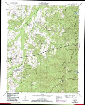
Yuma Topo Map Tennessee
To zoom in, hover over the map of Yuma
USGS Topo Quad 35088g3 - 1:24,000 scale
| Topo Map Name: | Yuma |
| USGS Topo Quad ID: | 35088g3 |
| Print Size: | ca. 21 1/4" wide x 27" high |
| Southeast Coordinates: | 35.75° N latitude / 88.25° W longitude |
| Map Center Coordinates: | 35.8125° N latitude / 88.3125° W longitude |
| U.S. State: | TN |
| Filename: | o35088g3.jpg |
| Download Map JPG Image: | Yuma topo map 1:24,000 scale |
| Map Type: | Topographic |
| Topo Series: | 7.5´ |
| Map Scale: | 1:24,000 |
| Source of Map Images: | United States Geological Survey (USGS) |
| Alternate Map Versions: |
Yuma TN 1936 Download PDF Buy paper map Yuma TN 1950, updated 1953 Download PDF Buy paper map Yuma TN 1950, updated 1965 Download PDF Buy paper map Yuma TN 1950, updated 1987 Download PDF Buy paper map Yuma TN 2010 Download PDF Buy paper map Yuma TN 2013 Download PDF Buy paper map Yuma TN 2016 Download PDF Buy paper map |
1:24,000 Topo Quads surrounding Yuma
> Back to 35088e1 at 1:100,000 scale
> Back to 35088a1 at 1:250,000 scale
> Back to U.S. Topo Maps home
Yuma topo map: Gazetteer
Yuma: Basins
Fairview Gullies elevation 164m 538′Yuma: Crossings
Interchange 116 elevation 186m 610′Yuma: Dams
Maple Creek Dam elevation 152m 498′Yuma: Forests
Natchez Trace State Forest elevation 196m 643′Yuma: Parks
Natchez Trace State Resort Park elevation 188m 616′Yuma: Populated Places
Farmville (historical) elevation 164m 538′Morgan (historical) elevation 151m 495′
Pleasant Exchange (historical) elevation 209m 685′
Wildersville elevation 146m 479′
Yuma elevation 147m 482′
Yuma: Post Offices
Wildersville Post Office elevation 146m 479′Yuma Post Office elevation 148m 485′
Yuma: Reservoirs
Maple Creek Lake elevation 152m 498′Yuma: Streams
Britt Creek elevation 133m 436′Cozark Branch elevation 137m 449′
Dabbs Creek elevation 135m 442′
Derryberry Branch elevation 151m 495′
Dry Branch elevation 138m 452′
Hopewell Branch elevation 133m 436′
Horn Creek elevation 129m 423′
Miller Branch elevation 150m 492′
Morris Creek elevation 130m 426′
Mud Creek elevation 132m 433′
North Fork Dabbs Creek elevation 149m 488′
Roan Creek elevation 132m 433′
Sandy Hollow Branch elevation 142m 465′
Scarce Creek elevation 139m 456′
South Fork Dabbs Creek elevation 149m 488′
South Fork Scarce Creek elevation 151m 495′
Todd Branch elevation 148m 485′
Turkeypen Branch elevation 134m 439′
Wolfpen Branch elevation 138m 452′
Yuma: Trails
Sulphur Fork Trail elevation 179m 587′Yuma: Valleys
Big Gully elevation 140m 459′Yuma digital topo map on disk
Buy this Yuma topo map showing relief, roads, GPS coordinates and other geographical features, as a high-resolution digital map file on DVD:


