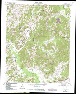
Cedar Grove Topo Map Tennessee
To zoom in, hover over the map of Cedar Grove
USGS Topo Quad 35088g5 - 1:24,000 scale
| Topo Map Name: | Cedar Grove |
| USGS Topo Quad ID: | 35088g5 |
| Print Size: | ca. 21 1/4" wide x 27" high |
| Southeast Coordinates: | 35.75° N latitude / 88.5° W longitude |
| Map Center Coordinates: | 35.8125° N latitude / 88.5625° W longitude |
| U.S. State: | TN |
| Filename: | o35088g5.jpg |
| Download Map JPG Image: | Cedar Grove topo map 1:24,000 scale |
| Map Type: | Topographic |
| Topo Series: | 7.5´ |
| Map Scale: | 1:24,000 |
| Source of Map Images: | United States Geological Survey (USGS) |
| Alternate Map Versions: |
Cedar Grove TN 1966, updated 1968 Download PDF Buy paper map Cedar Grove TN 2010 Download PDF Buy paper map Cedar Grove TN 2013 Download PDF Buy paper map Cedar Grove TN 2016 Download PDF Buy paper map |
1:24,000 Topo Quads surrounding Cedar Grove
> Back to 35088e1 at 1:100,000 scale
> Back to 35088a1 at 1:250,000 scale
> Back to U.S. Topo Maps home
Cedar Grove topo map: Gazetteer
Cedar Grove: Crossings
Interchange 101 elevation 157m 515′Cedar Grove: Dams
Indian Creek Number 87-1 Dam elevation 143m 469′Moss Creek OFDBA 87-4 Dam elevation 133m 436′
OFDBA 87-3 Dam elevation 142m 465′
Susan Branch 87-7 Dam elevation 147m 482′
Cedar Grove: Populated Places
Cedar Grove elevation 150m 492′Hickory Flat elevation 154m 505′
Law elevation 154m 505′
McHaney (historical) elevation 140m 459′
Mount Gilead elevation 171m 561′
Sharon elevation 162m 531′
Smith elevation 178m 583′
Spain (historical) elevation 192m 629′
Utley (historical) elevation 139m 456′
Woodhill (historical) elevation 126m 413′
Cedar Grove: Post Offices
Cedar Grove Post Office elevation 152m 498′Cedar Grove: Reservoirs
Hoopers Lake elevation 146m 479′Indian Creek Lake Number 87-1 elevation 143m 469′
Moss Creek Lake elevation 133m 436′
OFDBA 87-3 Lake elevation 142m 465′
Susan Branch Lake elevation 147m 482′
Cedar Grove: Streams
Cane Creek elevation 128m 419′Cane Creek elevation 137m 449′
Eubank Branch elevation 125m 410′
Griffin Creek elevation 122m 400′
Gurley Creek elevation 125m 410′
Indian Creek elevation 137m 449′
McHayneys Mill Creek elevation 131m 429′
Moss Creek elevation 122m 400′
Susan Branch elevation 133m 436′
Cedar Grove digital topo map on disk
Buy this Cedar Grove topo map showing relief, roads, GPS coordinates and other geographical features, as a high-resolution digital map file on DVD:


