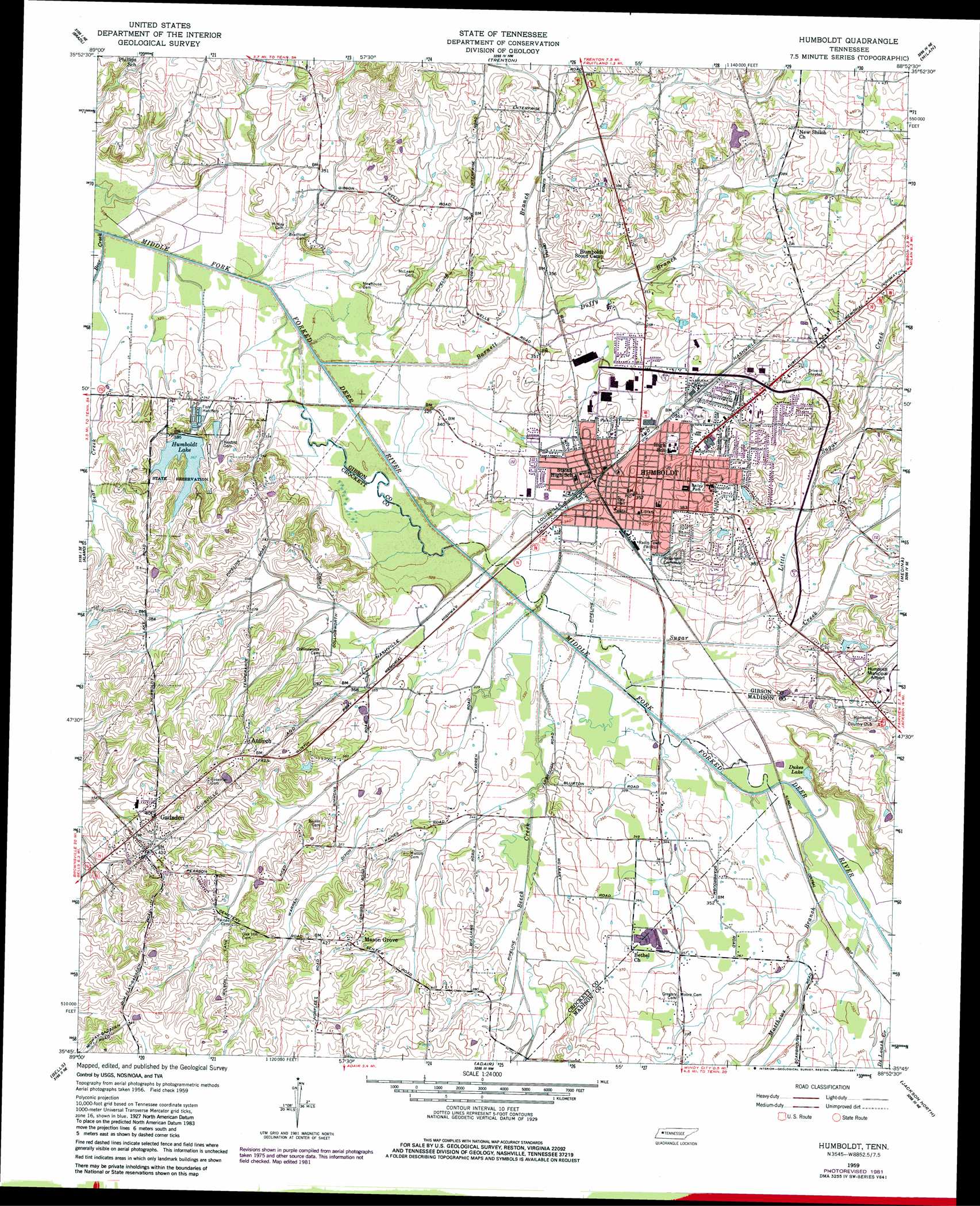
Humboldt Topo Map Tennessee
To zoom in, hover over the map of Humboldt
USGS Topo Quad 35088g8 - 1:24,000 scale
| Topo Map Name: | Humboldt |
| USGS Topo Quad ID: | 35088g8 |
| Print Size: | ca. 21 1/4" wide x 27" high |
| Southeast Coordinates: | 35.75° N latitude / 88.875° W longitude |
| Map Center Coordinates: | 35.8125° N latitude / 88.9375° W longitude |
| U.S. State: | TN |
| Filename: | o35088g8.jpg |
| Download Map JPG Image: | Humboldt topo map 1:24,000 scale |
| Map Type: | Topographic |
| Topo Series: | 7.5´ |
| Map Scale: | 1:24,000 |
| Source of Map Images: | United States Geological Survey (USGS) |
| Alternate Map Versions: |
Humboldt TN 1959, updated 1960 Download PDF Buy paper map Humboldt TN 1959, updated 1981 Download PDF Buy paper map Humboldt TN 2010 Download PDF Buy paper map Humboldt TN 2013 Download PDF Buy paper map Humboldt TN 2016 Download PDF Buy paper map |
1:24,000 Topo Quads surrounding Humboldt
Tatumville |
Yorkville |
Dyer |
Bradford |
Trezevant West |
Friendship |
Brazil |
Trenton |
Milan |
Atwood |
Maury City |
Alamo |
Humboldt |
Medina |
Spring Creek |
Jones |
Bells |
Adair |
Jackson North |
Claybrook |
Sunnyhill |
Denmark |
Westover |
Jackson South |
Beech Bluff |
> Back to 35088e1 at 1:100,000 scale
> Back to 35088a1 at 1:250,000 scale
> Back to U.S. Topo Maps home
Humboldt topo map: Gazetteer
Humboldt: Canals
Warren Ditch elevation 115m 377′Humboldt: Dams
Humboldt Dam elevation 112m 367′Jones Farm Dam elevation 121m 396′
Humboldt: Parks
Bailey Park elevation 125m 410′Humboldt: Populated Places
Antioch elevation 137m 449′Avondale elevation 126m 413′
Gadsden elevation 126m 413′
Humboldt elevation 111m 364′
Mason Grove elevation 127m 416′
New Shiloh elevation 125m 410′
Humboldt: Post Offices
Humboldt Post Office elevation 109m 357′Humboldt: Reservoirs
Dukes Lake elevation 101m 331′Humboldt Lake elevation 112m 367′
Jones Farm Lake elevation 121m 396′
Humboldt: Streams
Barnett Branch elevation 94m 308′Beech Creek elevation 97m 318′
Duffy Branch elevation 99m 324′
Little Sugar Creek elevation 100m 328′
Matthews Branch elevation 101m 331′
Sugar Creek elevation 97m 318′
Humboldt digital topo map on disk
Buy this Humboldt topo map showing relief, roads, GPS coordinates and other geographical features, as a high-resolution digital map file on DVD: