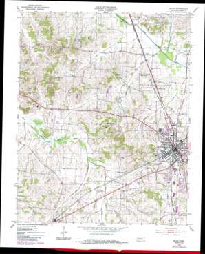
Milan Topo Map Tennessee
To zoom in, hover over the map of Milan
USGS Topo Quad 35088h7 - 1:24,000 scale
| Topo Map Name: | Milan |
| USGS Topo Quad ID: | 35088h7 |
| Print Size: | ca. 21 1/4" wide x 27" high |
| Southeast Coordinates: | 35.875° N latitude / 88.75° W longitude |
| Map Center Coordinates: | 35.9375° N latitude / 88.8125° W longitude |
| U.S. State: | TN |
| Filename: | o35088h7.jpg |
| Download Map JPG Image: | Milan topo map 1:24,000 scale |
| Map Type: | Topographic |
| Topo Series: | 7.5´ |
| Map Scale: | 1:24,000 |
| Source of Map Images: | United States Geological Survey (USGS) |
| Alternate Map Versions: |
Milan TN 1952, updated 1953 Download PDF Buy paper map Milan TN 1952, updated 1982 Download PDF Buy paper map Milan TN 1952, updated 1983 Download PDF Buy paper map Milan TN 2010 Download PDF Buy paper map Milan TN 2013 Download PDF Buy paper map Milan TN 2016 Download PDF Buy paper map |
1:24,000 Topo Quads surrounding Milan
> Back to 35088e1 at 1:100,000 scale
> Back to 35088a1 at 1:250,000 scale
> Back to U.S. Topo Maps home
Milan topo map: Gazetteer
Milan: Airports
Gibson County Airport elevation 105m 344′Milan: Parks
Johnnie Hall Stadium elevation 124m 406′Trostel Field elevation 130m 426′
Milan: Populated Places
Cades elevation 113m 370′Concord elevation 147m 482′
Gibson elevation 123m 403′
Hughes Loop elevation 123m 403′
Milan elevation 128m 419′
Moores Chapel elevation 117m 383′
New Enterprise elevation 116m 380′
Union Central elevation 121m 396′
Whitway elevation 116m 380′
Milan: Post Offices
Cades Post Office (historical) elevation 115m 377′Milan Post Office elevation 128m 419′
Milan: Reservoirs
Tyree Lake elevation 131m 429′Milan: Streams
Adams Branch elevation 108m 354′Bee Creek elevation 109m 357′
Browning Creek elevation 107m 351′
Flippen Creek elevation 109m 357′
Hog Creek elevation 104m 341′
Mayo Branch elevation 106m 347′
Roberson Creek elevation 109m 357′
Wallsmith Branch elevation 100m 328′
Milan: Summits
Caraway Hills elevation 144m 472′Milan digital topo map on disk
Buy this Milan topo map showing relief, roads, GPS coordinates and other geographical features, as a high-resolution digital map file on DVD:


