Trenton Topo Map Tennessee
To zoom in, hover over the map of Trenton
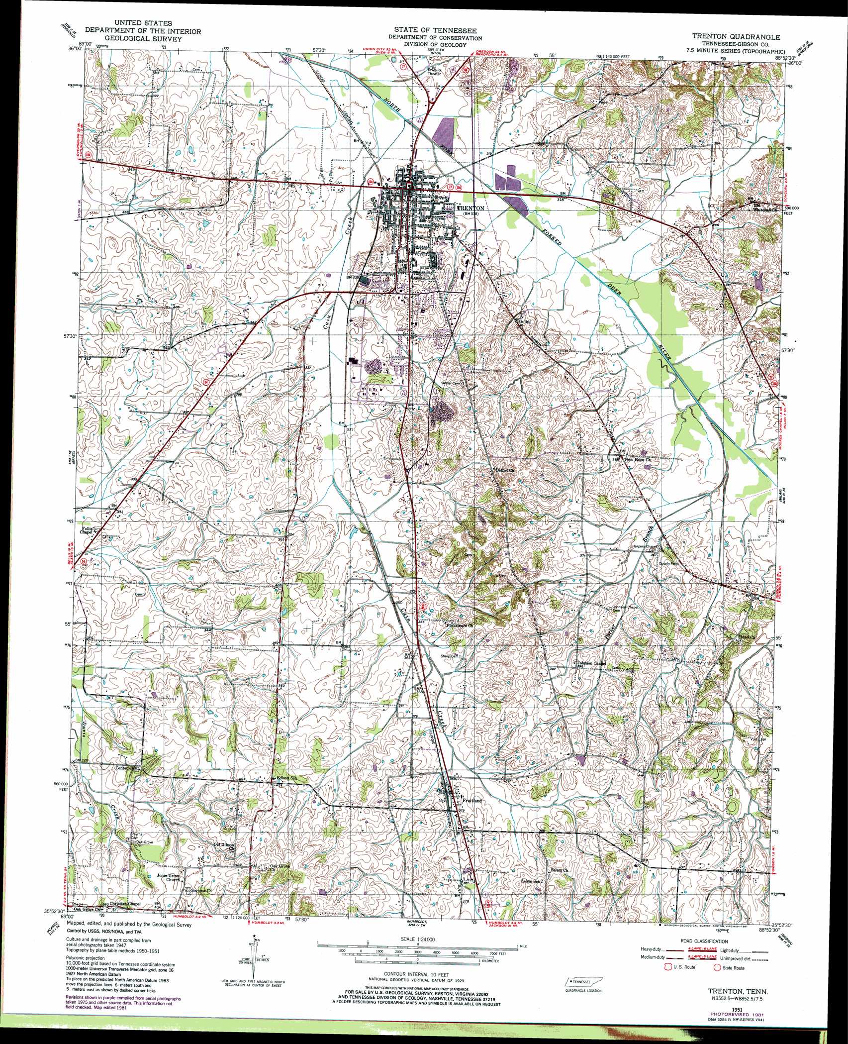
USGS Topo Quad 35088h8 - 1:24,000 scale
| Topo Map Name: | Trenton |
| USGS Topo Quad ID: | 35088h8 |
| Print Size: | ca. 21 1/4" wide x 27" high |
| Southeast Coordinates: | 35.875° N latitude / 88.875° W longitude |
| Map Center Coordinates: | 35.9375° N latitude / 88.9375° W longitude |
| U.S. State: | TN |
| Filename: | o35088h8.jpg |
| Download Map JPG Image: | Trenton topo map 1:24,000 scale |
| Map Type: | Topographic |
| Topo Series: | 7.5´ |
| Map Scale: | 1:24,000 |
| Source of Map Images: | United States Geological Survey (USGS) |
| Alternate Map Versions: |
Trenton TN 1951, updated 1952 Download PDF Buy paper map Trenton TN 1951, updated 1981 Download PDF Buy paper map Trenton TN 2010 Download PDF Buy paper map Trenton TN 2013 Download PDF Buy paper map Trenton TN 2016 Download PDF Buy paper map |
1:24,000 Topo Quads surrounding Trenton
Trimble |
Kenton |
Rutherford |
Greenfield |
Pillowville |
Tatumville |
Yorkville |
Dyer |
Bradford |
Trezevant West |
Friendship |
Brazil |
Trenton |
Milan |
Atwood |
Maury City |
Alamo |
Humboldt |
Medina |
Spring Creek |
Jones |
Bells |
Adair |
Jackson North |
Claybrook |
> Back to 35088e1 at 1:100,000 scale
> Back to 35088a1 at 1:250,000 scale
> Back to U.S. Topo Maps home
Trenton topo map: Gazetteer
Trenton: Dams
Hall Lake Dam elevation 113m 370′Trenton: Parks
Shady Acres Park elevation 107m 351′Trenton: Populated Places
Christian Chapel elevation 116m 380′Edison elevation 129m 423′
Fruitland elevation 113m 370′
New Hope elevation 111m 364′
Trenton elevation 101m 331′
Trenton: Post Offices
Fruitland Post Office elevation 112m 367′Trenton: Reservoirs
Hall Lake elevation 113m 370′Trenton: Streams
Cain Creek elevation 113m 370′Cain Creek elevation 93m 305′
Parker Branch elevation 97m 318′
Thompson Levee Creek elevation 95m 311′
Trenton digital topo map on disk
Buy this Trenton topo map showing relief, roads, GPS coordinates and other geographical features, as a high-resolution digital map file on DVD: