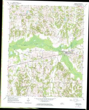
Moscow Topo Map Tennessee
To zoom in, hover over the map of Moscow
USGS Topo Quad 35089a4 - 1:24,000 scale
| Topo Map Name: | Moscow |
| USGS Topo Quad ID: | 35089a4 |
| Print Size: | ca. 21 1/4" wide x 27" high |
| Southeast Coordinates: | 35° N latitude / 89.375° W longitude |
| Map Center Coordinates: | 35.0625° N latitude / 89.4375° W longitude |
| U.S. State: | TN |
| Filename: | o35089a4.jpg |
| Download Map JPG Image: | Moscow topo map 1:24,000 scale |
| Map Type: | Topographic |
| Topo Series: | 7.5´ |
| Map Scale: | 1:24,000 |
| Source of Map Images: | United States Geological Survey (USGS) |
| Alternate Map Versions: |
Moscow TN 1965, updated 1966 Download PDF Buy paper map Moscow TN 2010 Download PDF Buy paper map Moscow TN 2013 Download PDF Buy paper map Moscow TN 2016 Download PDF Buy paper map |
1:24,000 Topo Quads surrounding Moscow
> Back to 35089a1 at 1:100,000 scale
> Back to 35088a1 at 1:250,000 scale
> Back to U.S. Topo Maps home
Moscow topo map: Gazetteer
Moscow: Dams
Burnette Lake Dam elevation 116m 380′Mitchell Lake Dam elevation 135m 442′
R L Lewis Dam elevation 120m 393′
Sand Creek Pilot Watershed Dam Number One elevation 128m 419′
Sand Creek Watershed Dam Number Two elevation 121m 396′
Moscow: Populated Places
Hays elevation 110m 360′Hays Crossing elevation 104m 341′
Moscow elevation 108m 354′
Moscow: Reservoirs
Burnette Lake elevation 116m 380′Butch McNabb Lake elevation 121m 396′
Kimery Lake elevation 128m 419′
Mitchell Lake elevation 135m 442′
R L Lewis Lake elevation 120m 393′
Moscow: Streams
Clear Creek elevation 106m 347′Clear Creek elevation 106m 347′
Golden Creek elevation 103m 337′
Golden Creek elevation 103m 337′
Grissum Creek elevation 96m 314′
Grissum Creek elevation 96m 314′
Hargis Creek elevation 104m 341′
North Fork Wolf River elevation 101m 331′
Sandy Creek elevation 101m 331′
Stafford Creek elevation 100m 328′
Stout Creek elevation 101m 331′
Stout Creek elevation 101m 331′
Teague Branch elevation 97m 318′
Teague Branch elevation 97m 318′
Moscow digital topo map on disk
Buy this Moscow topo map showing relief, roads, GPS coordinates and other geographical features, as a high-resolution digital map file on DVD:


