Stanton Topo Map Tennessee
To zoom in, hover over the map of Stanton
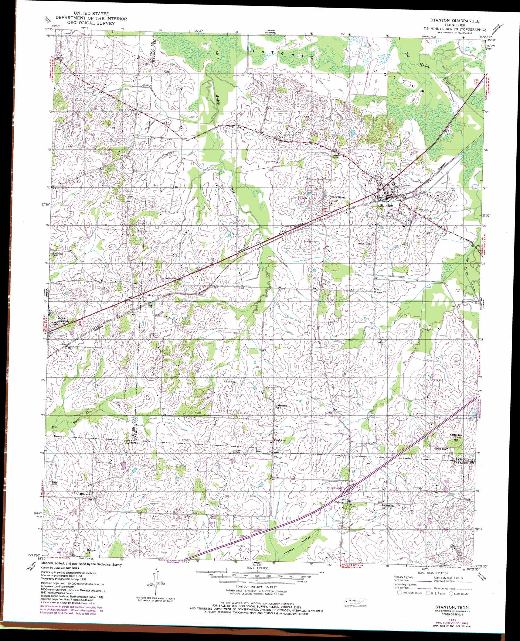
USGS Topo Quad 35089d4 - 1:24,000 scale
| Topo Map Name: | Stanton |
| USGS Topo Quad ID: | 35089d4 |
| Print Size: | ca. 21 1/4" wide x 27" high |
| Southeast Coordinates: | 35.375° N latitude / 89.375° W longitude |
| Map Center Coordinates: | 35.4375° N latitude / 89.4375° W longitude |
| U.S. State: | TN |
| Filename: | o35089d4.jpg |
| Download Map JPG Image: | Stanton topo map 1:24,000 scale |
| Map Type: | Topographic |
| Topo Series: | 7.5´ |
| Map Scale: | 1:24,000 |
| Source of Map Images: | United States Geological Survey (USGS) |
| Alternate Map Versions: |
Stanton TN 1952, updated 1952 Download PDF Buy paper map Stanton TN 1952, updated 1976 Download PDF Buy paper map Stanton TN 1952, updated 1983 Download PDF Buy paper map Stanton TN 2010 Download PDF Buy paper map Stanton TN 2013 Download PDF Buy paper map Stanton TN 2016 Download PDF Buy paper map |
1:24,000 Topo Quads surrounding Stanton
Fort Pillow |
Ripley South |
Durhamville |
Tibbs |
Jones |
Covington |
Gift |
Turnpike |
Brownsville |
Sunnyhill |
Brighton |
Mason |
Stanton |
Dancyville |
Hillville |
Arlington |
Gallaway |
Lambert |
Laconia |
Whiteville |
Eads |
Oakland |
Macon |
Somerville |
Hickory Valley |
> Back to 35089a1 at 1:100,000 scale
> Back to 35088a1 at 1:250,000 scale
> Back to U.S. Topo Maps home
Stanton topo map: Gazetteer
Stanton: Crossings
Interchange 42 elevation 106m 347′Stanton: Populated Places
Belmont elevation 111m 364′Birds Bower elevation 107m 351′
Fredonia elevation 110m 360′
Gailor elevation 103m 337′
Keeling elevation 114m 374′
Meux Corner elevation 98m 321′
Stanton elevation 96m 314′
Stanton: Summits
Fortescue Hill elevation 121m 396′Meux Hill elevation 119m 390′
Stanton digital topo map on disk
Buy this Stanton topo map showing relief, roads, GPS coordinates and other geographical features, as a high-resolution digital map file on DVD: