Turnpike Topo Map Tennessee
To zoom in, hover over the map of Turnpike
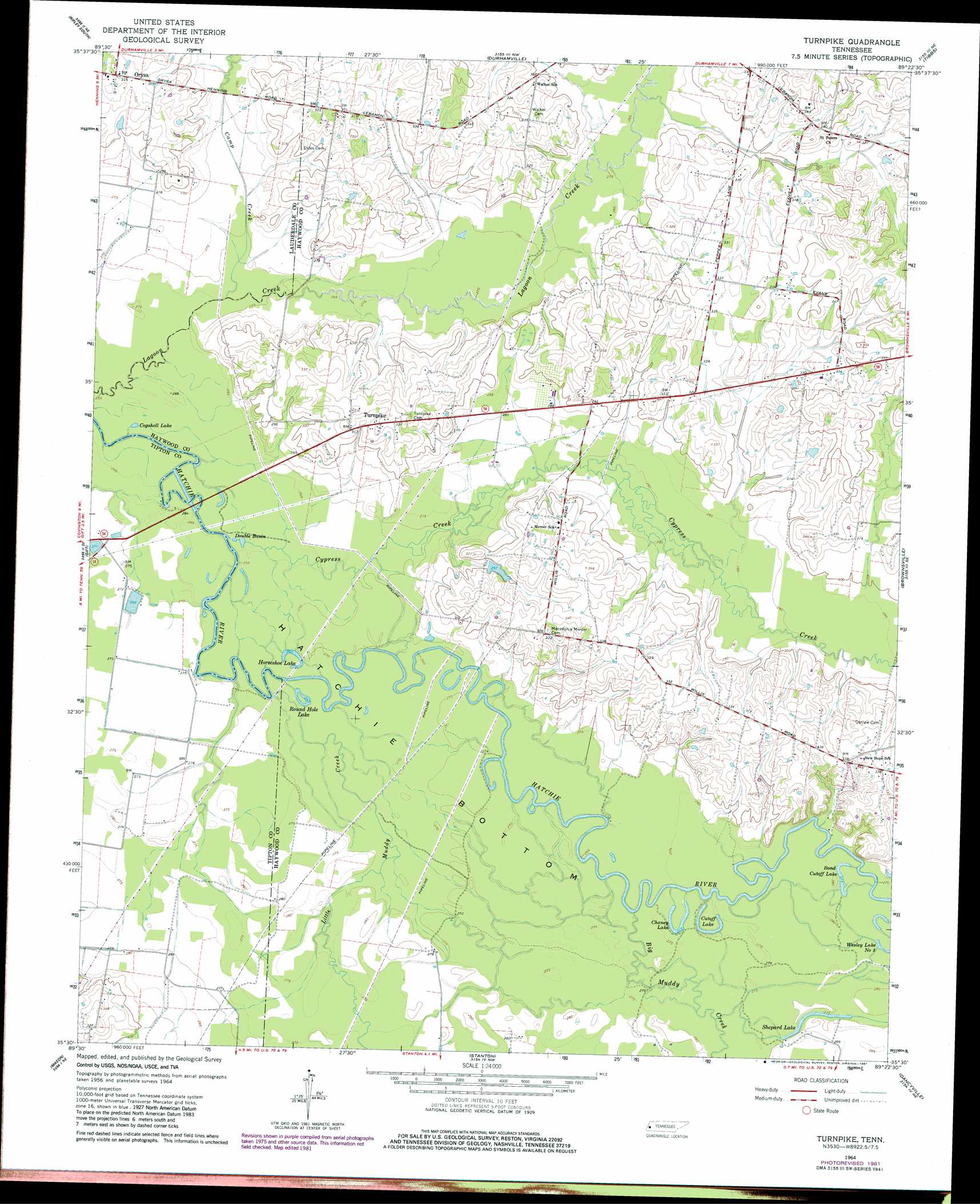
USGS Topo Quad 35089e4 - 1:24,000 scale
| Topo Map Name: | Turnpike |
| USGS Topo Quad ID: | 35089e4 |
| Print Size: | ca. 21 1/4" wide x 27" high |
| Southeast Coordinates: | 35.5° N latitude / 89.375° W longitude |
| Map Center Coordinates: | 35.5625° N latitude / 89.4375° W longitude |
| U.S. State: | TN |
| Filename: | o35089e4.jpg |
| Download Map JPG Image: | Turnpike topo map 1:24,000 scale |
| Map Type: | Topographic |
| Topo Series: | 7.5´ |
| Map Scale: | 1:24,000 |
| Source of Map Images: | United States Geological Survey (USGS) |
| Alternate Map Versions: |
Turnpike TN 1964, updated 1965 Download PDF Buy paper map Turnpike TN 1964, updated 1981 Download PDF Buy paper map Turnpike TN 2010 Download PDF Buy paper map Turnpike TN 2013 Download PDF Buy paper map Turnpike TN 2016 Download PDF Buy paper map |
1:24,000 Topo Quads surrounding Turnpike
Open Lake |
Ripley North |
Gates |
Chestnut Bluff |
Maury City |
Fort Pillow |
Ripley South |
Durhamville |
Tibbs |
Jones |
Covington |
Gift |
Turnpike |
Brownsville |
Sunnyhill |
Brighton |
Mason |
Stanton |
Dancyville |
Hillville |
Arlington |
Gallaway |
Lambert |
Laconia |
Whiteville |
> Back to 35089e1 at 1:100,000 scale
> Back to 35088a1 at 1:250,000 scale
> Back to U.S. Topo Maps home
Turnpike topo map: Gazetteer
Turnpike: Dams
Cannon Lake Dam elevation 90m 295′Turnpike: Lakes
Bond Cutoff Lake elevation 84m 275′Chaney Lake elevation 84m 275′
Cogshell Lake elevation 79m 259′
Cutoff Lake elevation 80m 262′
Double Basin elevation 79m 259′
Horseshoe Lake elevation 81m 265′
Round Hole Lake elevation 81m 265′
Shepard Lake elevation 84m 275′
Turnpike: Populated Places
Orysa elevation 98m 321′Saint Peters elevation 104m 341′
Turnpike: Reservoirs
Cannon Lake elevation 90m 295′Turnpike: Streams
Big Muddy Creek elevation 81m 265′Camp Creek elevation 80m 262′
Cypress Creek elevation 78m 255′
Little Muddy Creek elevation 79m 259′
Turnpike digital topo map on disk
Buy this Turnpike topo map showing relief, roads, GPS coordinates and other geographical features, as a high-resolution digital map file on DVD: