Rosa Topo Map Arkansas
To zoom in, hover over the map of Rosa
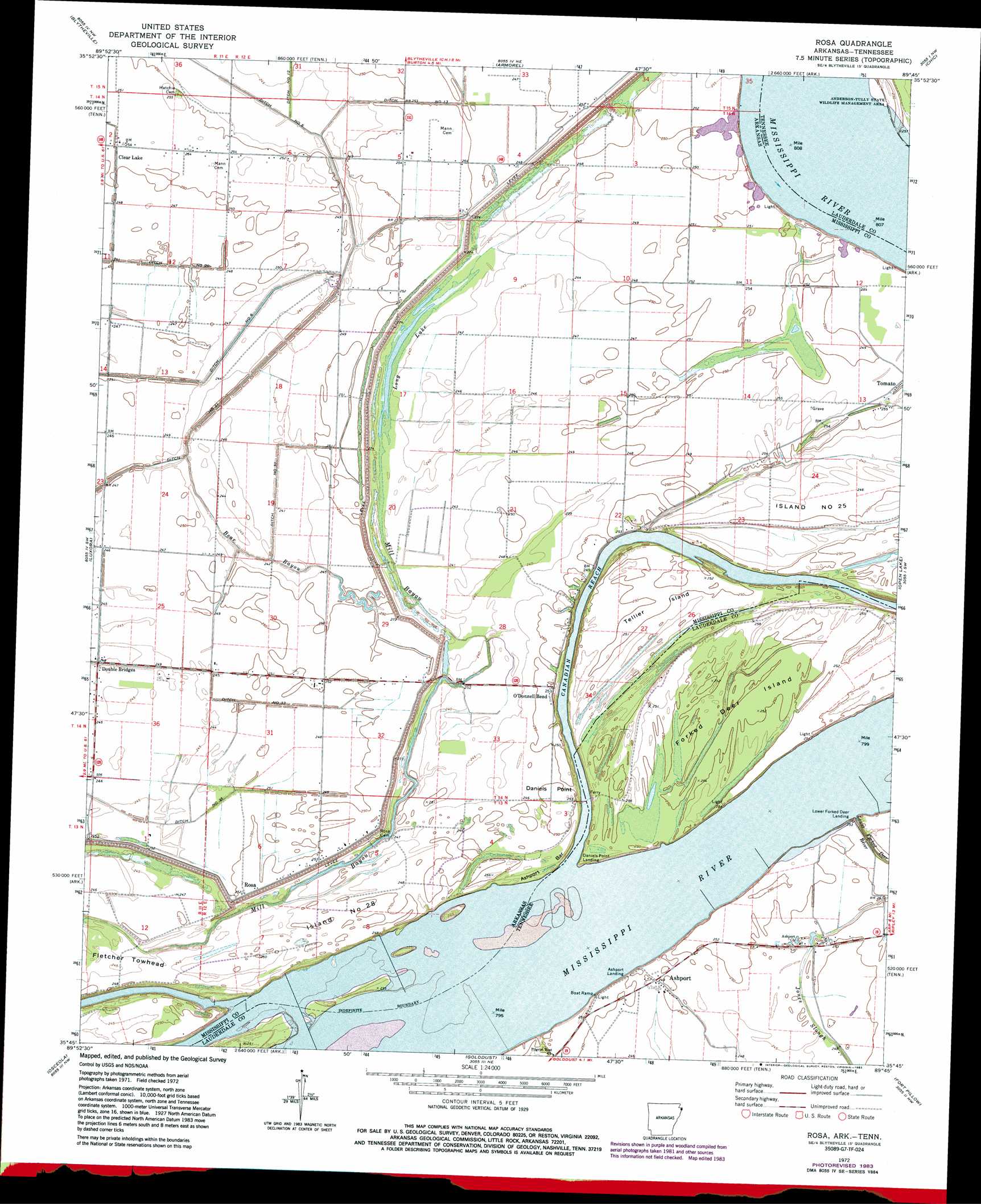
USGS Topo Quad 35089g7 - 1:24,000 scale
| Topo Map Name: | Rosa |
| USGS Topo Quad ID: | 35089g7 |
| Print Size: | ca. 21 1/4" wide x 27" high |
| Southeast Coordinates: | 35.75° N latitude / 89.75° W longitude |
| Map Center Coordinates: | 35.8125° N latitude / 89.8125° W longitude |
| U.S. States: | AR, TN |
| Filename: | o35089g7.jpg |
| Download Map JPG Image: | Rosa topo map 1:24,000 scale |
| Map Type: | Topographic |
| Topo Series: | 7.5´ |
| Map Scale: | 1:24,000 |
| Source of Map Images: | United States Geological Survey (USGS) |
| Alternate Map Versions: |
Rosa AR 1972, updated 1975 Download PDF Buy paper map Rosa AR 1972, updated 1983 Download PDF Buy paper map Rosa AR 2011 Download PDF Buy paper map Rosa AR 2014 Download PDF Buy paper map |
1:24,000 Topo Quads surrounding Rosa
Hornersville |
Denton |
Steele |
Cottonwood Point |
Caruthersville Se |
Half Moon |
Blytheville |
Armorel |
Chic |
Knob Creek |
Dell |
Luxora |
Rosa |
Open Lake |
Ripley North |
Keiser |
Osceola |
Golddust |
Fort Pillow |
Ripley South |
Wilson |
Nodena |
Gilt Edge |
Covington |
Gift |
> Back to 35089e1 at 1:100,000 scale
> Back to 35088a1 at 1:250,000 scale
> Back to U.S. Topo Maps home
Rosa topo map: Gazetteer
Rosa: Bars
Ashport Bar elevation 75m 246′Kate Aubrey Towhead Bar elevation 67m 219′
Rosa: Bends
Ashport Bend elevation 67m 219′Rosa: Canals
Ditch Number 13 elevation 74m 242′Ditch Number 32 elevation 74m 242′
Ditch Number 33 elevation 76m 249′
Rosa: Capes
Daniels Point elevation 77m 252′Rosa: Channels
Canadian Reach elevation 69m 226′Rosa: Crossings
Ashport Ferry (historical) elevation 67m 219′Rosa: Guts
West Bayou elevation 74m 242′Rosa: Islands
Forked Deer Island elevation 76m 249′Island Number 28 elevation 75m 246′
Island Number Twentyseven elevation 78m 255′
Island Number Twentysix elevation 77m 252′
Tellier Island elevation 75m 246′
Tow Head Island (historical) elevation 69m 226′
Rosa: Lakes
Long Lake elevation 72m 236′Woods Lake elevation 75m 246′
Rosa: Levees
Ashport Revetment elevation 68m 223′Daniels Point Revetment elevation 74m 242′
Island Number Twentysix Revetment elevation 72m 236′
Rosa: Populated Places
Ashport elevation 76m 249′Clear Lake elevation 74m 242′
O'Donnell Bend elevation 77m 252′
Rosa elevation 76m 249′
Rosa: Streams
Bear Bayou elevation 77m 252′Lower Forked Deer River elevation 67m 219′
Stiegers Eddy elevation 71m 232′
Rosa digital topo map on disk
Buy this Rosa topo map showing relief, roads, GPS coordinates and other geographical features, as a high-resolution digital map file on DVD: