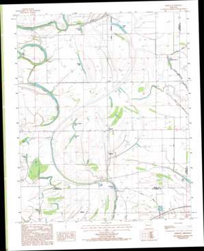
Gieseck Topo Map Arkansas
To zoom in, hover over the map of Gieseck
USGS Topo Quad 35090b5 - 1:24,000 scale
| Topo Map Name: | Gieseck |
| USGS Topo Quad ID: | 35090b5 |
| Print Size: | ca. 21 1/4" wide x 27" high |
| Southeast Coordinates: | 35.125° N latitude / 90.5° W longitude |
| Map Center Coordinates: | 35.1875° N latitude / 90.5625° W longitude |
| U.S. State: | AR |
| Filename: | o35090b5.jpg |
| Download Map JPG Image: | Gieseck topo map 1:24,000 scale |
| Map Type: | Topographic |
| Topo Series: | 7.5´ |
| Map Scale: | 1:24,000 |
| Source of Map Images: | United States Geological Survey (USGS) |
| Alternate Map Versions: |
Gieseck AR 1984, updated 1985 Download PDF Buy paper map Gieseck AR 1984, updated 1993 Download PDF Buy paper map Gieseck AR 2011 Download PDF Buy paper map Gieseck AR 2014 Download PDF Buy paper map |
1:24,000 Topo Quads surrounding Gieseck
> Back to 35090a1 at 1:100,000 scale
> Back to 35090a1 at 1:250,000 scale
> Back to U.S. Topo Maps home
Gieseck topo map: Gazetteer
Gieseck: Canals
Ditch Number 24 elevation 60m 196′Gieseck: Flats
Locust Lake elevation 61m 200′Smith Lake elevation 61m 200′
Gieseck: Lakes
Anderson Lake elevation 60m 196′Beaver Lake elevation 61m 200′
Dog Pond elevation 61m 200′
Fishing Lake elevation 62m 203′
Hill Lake elevation 62m 203′
Jack Lake elevation 59m 193′
Little Blackfish Lake elevation 62m 203′
Neelys Lake elevation 64m 209′
Old River elevation 63m 206′
Patterson Lake elevation 59m 193′
Prophet Lake elevation 65m 213′
Rainbow Lake elevation 63m 206′
Shaver Lake elevation 62m 203′
Snowden Lake elevation 61m 200′
Thompson Lake elevation 61m 200′
Walnut Timber Lake elevation 62m 203′
Gieseck: Populated Places
Bailes (historical) elevation 64m 209′Duvall elevation 63m 206′
Gieseck elevation 62m 203′
Gladden elevation 65m 213′
Midway elevation 63m 206′
Patterson (historical) elevation 65m 213′
Riverside elevation 62m 203′
Rose Place elevation 64m 209′
Gieseck: Streams
Parkin Slough elevation 55m 180′Gieseck digital topo map on disk
Buy this Gieseck topo map showing relief, roads, GPS coordinates and other geographical features, as a high-resolution digital map file on DVD:


