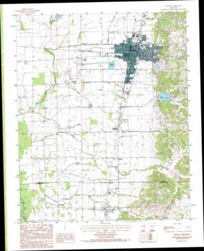
Wynne Topo Map Arkansas
To zoom in, hover over the map of Wynne
USGS Topo Quad 35090b7 - 1:24,000 scale
| Topo Map Name: | Wynne |
| USGS Topo Quad ID: | 35090b7 |
| Print Size: | ca. 21 1/4" wide x 27" high |
| Southeast Coordinates: | 35.125° N latitude / 90.75° W longitude |
| Map Center Coordinates: | 35.1875° N latitude / 90.8125° W longitude |
| U.S. State: | AR |
| Filename: | o35090b7.jpg |
| Download Map JPG Image: | Wynne topo map 1:24,000 scale |
| Map Type: | Topographic |
| Topo Series: | 7.5´ |
| Map Scale: | 1:24,000 |
| Source of Map Images: | United States Geological Survey (USGS) |
| Alternate Map Versions: |
Wynne AR 1984, updated 1985 Download PDF Buy paper map Wynne AR 1984, updated 1993 Download PDF Buy paper map Wynne AR 2011 Download PDF Buy paper map Wynne AR 2014 Download PDF Buy paper map |
1:24,000 Topo Quads surrounding Wynne
> Back to 35090a1 at 1:100,000 scale
> Back to 35090a1 at 1:250,000 scale
> Back to U.S. Topo Maps home
Wynne topo map: Gazetteer
Wynne: Airports
Cross County Hospital Heliport elevation 81m 265′Wynne Municipal Airport elevation 113m 370′
Wynne: Dams
Caney Creek Site Five Dam elevation 107m 351′Caney Creek Site Four Dam elevation 100m 328′
Caney Creek Site Seven Dam elevation 88m 288′
Caney Creek Site Six Dam elevation 106m 347′
Wynne: Populated Places
Colt elevation 77m 252′Fitzgerald Crossing elevation 75m 246′
McElroy elevation 70m 229′
Rosenbaum elevation 69m 226′
Smith Chapel elevation 68m 223′
Wilkins elevation 77m 252′
Wynne elevation 79m 259′
Wynne: Post Offices
Wynne Post Office elevation 80m 262′Wynne: Reservoirs
Caney Creek Site Five Reservoir elevation 107m 351′Caney Creek Site Four Reservoir elevation 100m 328′
Caney Creek Site Seven Reservoir elevation 88m 288′
Caney Creek Site Six Reservoir elevation 106m 347′
Cathy Lake elevation 89m 291′
Wynne: Streams
Bear Creek elevation 65m 213′Cane Creek elevation 68m 223′
Draw Creek elevation 75m 246′
Turkey Creek elevation 73m 239′
Williams Creek elevation 66m 216′
Wynne digital topo map on disk
Buy this Wynne topo map showing relief, roads, GPS coordinates and other geographical features, as a high-resolution digital map file on DVD:


