Powers Slough Topo Map Arkansas
To zoom in, hover over the map of Powers Slough
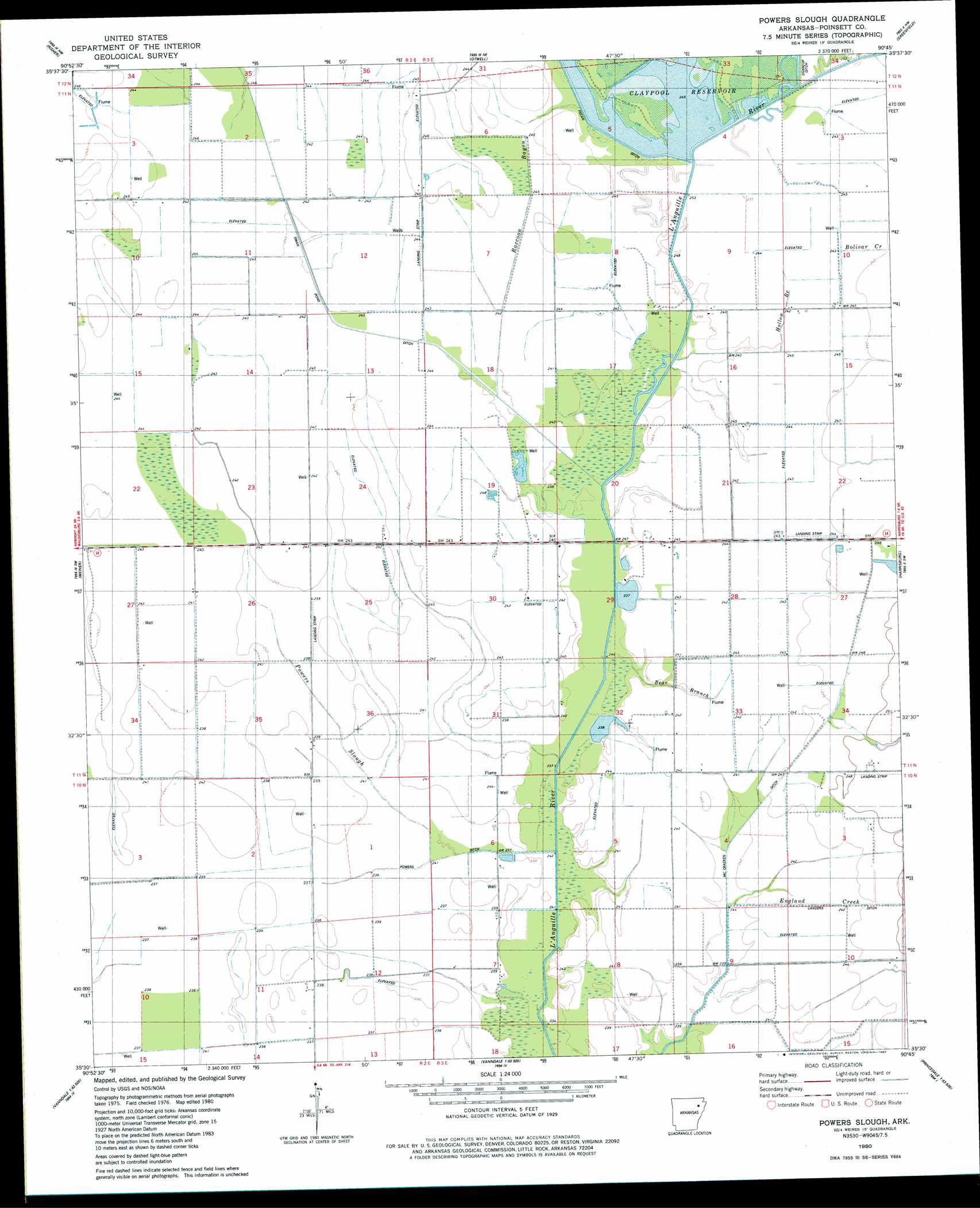
USGS Topo Quad 35090e7 - 1:24,000 scale
| Topo Map Name: | Powers Slough |
| USGS Topo Quad ID: | 35090e7 |
| Print Size: | ca. 21 1/4" wide x 27" high |
| Southeast Coordinates: | 35.5° N latitude / 90.75° W longitude |
| Map Center Coordinates: | 35.5625° N latitude / 90.8125° W longitude |
| U.S. State: | AR |
| Filename: | o35090e7.jpg |
| Download Map JPG Image: | Powers Slough topo map 1:24,000 scale |
| Map Type: | Topographic |
| Topo Series: | 7.5´ |
| Map Scale: | 1:24,000 |
| Source of Map Images: | United States Geological Survey (USGS) |
| Alternate Map Versions: |
Powers Slough AR 1980, updated 1980 Download PDF Buy paper map Powers Slough AR 2011 Download PDF Buy paper map Powers Slough AR 2014 Download PDF Buy paper map |
1:24,000 Topo Quads surrounding Powers Slough
Swifton East |
Cash |
Herman |
Jonesboro |
Needham |
Grubbs |
Risher |
Otwell |
Greenfield |
Trumann |
Amagon |
Weiner |
Powers Slough |
Harrisburg |
Mccormick |
Beedeville |
Hickory Ridge |
Cherry Valley West |
Cherry Valley East |
Monterey |
Tilton |
Central |
Vanndale |
Princedale |
Parkin |
> Back to 35090e1 at 1:100,000 scale
> Back to 35090a1 at 1:250,000 scale
> Back to U.S. Topo Maps home
Powers Slough topo map: Gazetteer
Powers Slough: Canals
Landers Ditch elevation 73m 239′McCracken Ditch elevation 72m 236′
Powers Ditch elevation 70m 229′
Swan Pond Ditch elevation 73m 239′
Powers Slough: Dams
John Kocher Lake Dam elevation 71m 232′Powers Slough: Reservoirs
Claypool Reservoir elevation 73m 239′John Kocher Lake elevation 71m 232′
Powers Slough: Streams
Bear Branch elevation 70m 229′Bolivar Creek elevation 75m 246′
England Creek elevation 72m 236′
Hollow Branch elevation 73m 239′
Mardis Branch elevation 73m 239′
Powers Slough elevation 74m 242′
Raccoon Bayou elevation 71m 232′
Powers Slough digital topo map on disk
Buy this Powers Slough topo map showing relief, roads, GPS coordinates and other geographical features, as a high-resolution digital map file on DVD: