Weiner Topo Map Arkansas
To zoom in, hover over the map of Weiner
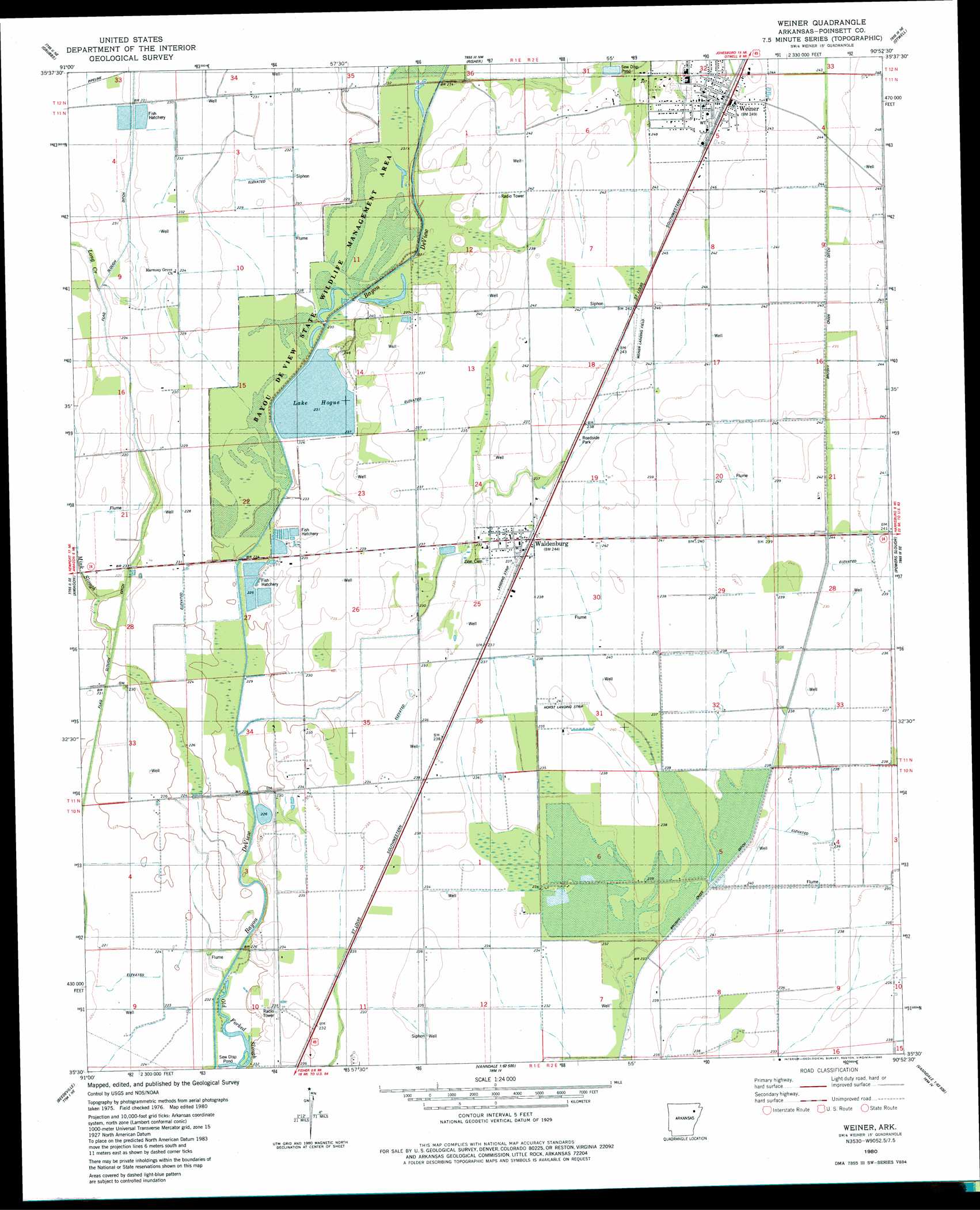
USGS Topo Quad 35090e8 - 1:24,000 scale
| Topo Map Name: | Weiner |
| USGS Topo Quad ID: | 35090e8 |
| Print Size: | ca. 21 1/4" wide x 27" high |
| Southeast Coordinates: | 35.5° N latitude / 90.875° W longitude |
| Map Center Coordinates: | 35.5625° N latitude / 90.9375° W longitude |
| U.S. State: | AR |
| Filename: | o35090e8.jpg |
| Download Map JPG Image: | Weiner topo map 1:24,000 scale |
| Map Type: | Topographic |
| Topo Series: | 7.5´ |
| Map Scale: | 1:24,000 |
| Source of Map Images: | United States Geological Survey (USGS) |
| Alternate Map Versions: |
Weiner AR 1980, updated 1980 Download PDF Buy paper map Weiner AR 2011 Download PDF Buy paper map Weiner AR 2014 Download PDF Buy paper map |
1:24,000 Topo Quads surrounding Weiner
Swifton West |
Swifton East |
Cash |
Herman |
Jonesboro |
Tuckerman |
Grubbs |
Risher |
Otwell |
Greenfield |
Auvergne |
Amagon |
Weiner |
Powers Slough |
Harrisburg |
Tupelo |
Beedeville |
Hickory Ridge |
Cherry Valley West |
Cherry Valley East |
Mccrory |
Tilton |
Central |
Vanndale |
Princedale |
> Back to 35090e1 at 1:100,000 scale
> Back to 35090a1 at 1:250,000 scale
> Back to U.S. Topo Maps home
Weiner topo map: Gazetteer
Weiner: Airports
Horst Landing Strip elevation 74m 242′Sally Wofford Airport elevation 72m 236′
Weiner Landing Field elevation 73m 239′
Weiner: Canals
Flag Slough Ditch elevation 68m 223′Weiner: Dams
Lake Hogue Dam elevation 69m 226′Weiner: Parks
Bayou De View State Wildlife Management Area elevation 71m 232′Bayou DeView Public Hunting Area elevation 68m 223′
Weiner: Populated Places
Waldenburg elevation 70m 229′Weiner elevation 75m 246′
Weiner: Reservoirs
Lake Hogue elevation 69m 226′Weiner: Streams
Long Creek elevation 66m 216′Mink Slough elevation 66m 216′
Weiner digital topo map on disk
Buy this Weiner topo map showing relief, roads, GPS coordinates and other geographical features, as a high-resolution digital map file on DVD: