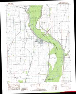
Lake City Topo Map Arkansas
To zoom in, hover over the map of Lake City
USGS Topo Quad 35090g4 - 1:24,000 scale
| Topo Map Name: | Lake City |
| USGS Topo Quad ID: | 35090g4 |
| Print Size: | ca. 21 1/4" wide x 27" high |
| Southeast Coordinates: | 35.75° N latitude / 90.375° W longitude |
| Map Center Coordinates: | 35.8125° N latitude / 90.4375° W longitude |
| U.S. State: | AR |
| Filename: | o35090g4.jpg |
| Download Map JPG Image: | Lake City topo map 1:24,000 scale |
| Map Type: | Topographic |
| Topo Series: | 7.5´ |
| Map Scale: | 1:24,000 |
| Source of Map Images: | United States Geological Survey (USGS) |
| Alternate Map Versions: |
Lake City AR 1983, updated 1984 Download PDF Buy paper map Lake City AR 2011 Download PDF Buy paper map Lake City AR 2014 Download PDF Buy paper map |
1:24,000 Topo Quads surrounding Lake City
> Back to 35090e1 at 1:100,000 scale
> Back to 35090a1 at 1:250,000 scale
> Back to U.S. Topo Maps home
Lake City topo map: Gazetteer
Lake City: Bridges
Saint Francis River Bridge elevation 70m 229′Lake City: Canals
Big Bay Ditch elevation 69m 226′Big Slough Ditch elevation 68m 223′
Cane Island Slough Ditch elevation 68m 223′
Cemmons Donick elevation 70m 229′
Ditch Number 10 elevation 69m 226′
Ditch Number 6 elevation 68m 223′
Ditch Number 7 elevation 70m 229′
Ditch Number 8 elevation 69m 226′
Marked Tree Floodway elevation 68m 223′
Taylors Ditch elevation 69m 226′
Thompson Creek Ditch elevation 69m 226′
Lake City: Flats
Maumelle Prairie elevation 68m 223′Lake City: Guts
Ironwood Slough (historical) elevation 69m 226′Spicewood Slough elevation 71m 232′
Lake City: Islands
Cane Island elevation 68m 223′Gum Island elevation 69m 226′
Rush Island elevation 69m 226′
Lake City: Parks
Saint Francis Sunken Lands State Wildlife Management Area elevation 66m 216′Lake City: Populated Places
Bowman elevation 72m 236′Cane Island (historical) elevation 69m 226′
Claunch elevation 70m 229′
Deglow elevation 68m 223′
Lake City elevation 70m 229′
Lunsford elevation 67m 219′
Poplar Ridge elevation 70m 229′
Sandy elevation 69m 226′
Southland elevation 69m 226′
Lake City digital topo map on disk
Buy this Lake City topo map showing relief, roads, GPS coordinates and other geographical features, as a high-resolution digital map file on DVD:


