Needham Topo Map Arkansas
To zoom in, hover over the map of Needham
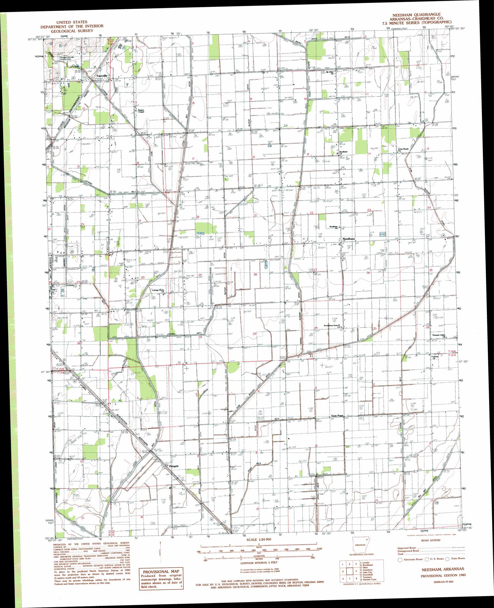
USGS Topo Quad 35090g5 - 1:24,000 scale
| Topo Map Name: | Needham |
| USGS Topo Quad ID: | 35090g5 |
| Print Size: | ca. 21 1/4" wide x 27" high |
| Southeast Coordinates: | 35.75° N latitude / 90.5° W longitude |
| Map Center Coordinates: | 35.8125° N latitude / 90.5625° W longitude |
| U.S. State: | AR |
| Filename: | o35090g5.jpg |
| Download Map JPG Image: | Needham topo map 1:24,000 scale |
| Map Type: | Topographic |
| Topo Series: | 7.5´ |
| Map Scale: | 1:24,000 |
| Source of Map Images: | United States Geological Survey (USGS) |
| Alternate Map Versions: |
Needham AR 1983, updated 1984 Download PDF Buy paper map Needham AR 2011 Download PDF Buy paper map Needham AR 2014 Download PDF Buy paper map |
1:24,000 Topo Quads surrounding Needham
Walnut Ridge Se |
Walcott |
Paragould West |
Paragould East |
Cardwell |
Bono |
Lorado |
Brookland |
Dixie |
Leachville |
Herman |
Jonesboro |
Needham |
Lake City |
Caraway |
Otwell |
Greenfield |
Trumann |
Hatchie Coon |
Riverdale |
Powers Slough |
Harrisburg |
Mccormick |
Marked Tree |
Lepanto |
> Back to 35090e1 at 1:100,000 scale
> Back to 35090a1 at 1:250,000 scale
> Back to U.S. Topo Maps home
Needham topo map: Gazetteer
Needham: Airports
Disinger-Farrville Landing Strip elevation 80m 262′John Parker Strip elevation 71m 232′
Needham: Canals
Butler Ditch elevation 72m 236′Ditch Number 2 elevation 69m 226′
Ditch Number 3 elevation 71m 232′
Ditch Number 7 elevation 68m 223′
Gum Slough Ditch elevation 70m 229′
Lateral Number 1 elevation 71m 232′
Lateral Number 2 elevation 71m 232′
Lateral Number 2 Moores Ditch elevation 74m 242′
Lateral Number 3 elevation 72m 236′
Little Bay Ditch elevation 69m 226′
Main Ditch elevation 64m 209′
Main Ditch elevation 69m 226′
Maple Slough Ditch elevation 70m 229′
Needham: Populated Places
Farrville elevation 77m 252′Gum Point elevation 70m 229′
Hergett elevation 72m 236′
Needham elevation 72m 236′
Pekin (historical) elevation 73m 239′
Phillips elevation 71m 232′
Webbs Mill (historical) elevation 71m 232′
Whitburg (historical) elevation 71m 232′
Needham: Streams
Bridger Creek elevation 70m 229′Murray Creek elevation 71m 232′
Needham digital topo map on disk
Buy this Needham topo map showing relief, roads, GPS coordinates and other geographical features, as a high-resolution digital map file on DVD: