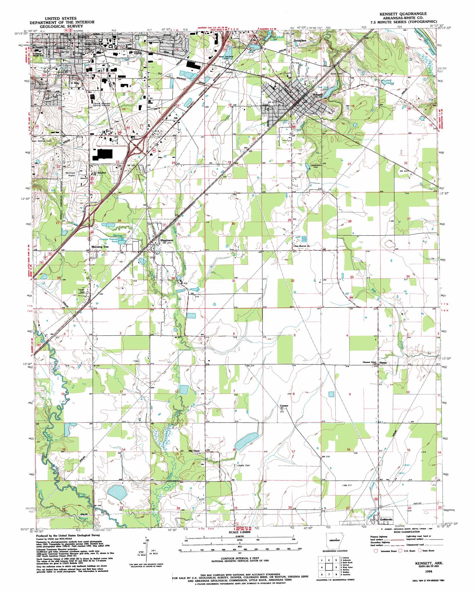
Kensett Topo Map Arkansas
To zoom in, hover over the map of Kensett
USGS Topo Quad 35091b6 - 1:24,000 scale
| Topo Map Name: | Kensett |
| USGS Topo Quad ID: | 35091b6 |
| Print Size: | ca. 21 1/4" wide x 27" high |
| Southeast Coordinates: | 35.125° N latitude / 91.625° W longitude |
| Map Center Coordinates: | 35.1875° N latitude / 91.6875° W longitude |
| U.S. State: | AR |
| Filename: | o35091b6.jpg |
| Download Map JPG Image: | Kensett topo map 1:24,000 scale |
| Map Type: | Topographic |
| Topo Series: | 7.5´ |
| Map Scale: | 1:24,000 |
| Source of Map Images: | United States Geological Survey (USGS) |
| Alternate Map Versions: |
Kensett AR 1964, updated 1965 Download PDF Buy paper map Kensett AR 1964, updated 1978 Download PDF Buy paper map Kensett AR 1964, updated 1982 Download PDF Buy paper map Kensett AR 1994, updated 1994 Download PDF Buy paper map Kensett AR 2011 Download PDF Buy paper map Kensett AR 2014 Download PDF Buy paper map |
1:24,000 Topo Quads surrounding Kensett
West Pangburn |
Pangburn |
Steprock |
Velvet Ridge |
Bradford |
Sidon |
Letona |
Judsonia |
Bald Knob |
Augusta Sw |
Floyd |
Garner |
Kensett |
West Point |
Georgetown |
Beebe |
Mcrae |
Walker |
Jasmine |
Gregory Sw |
Oak Grove |
Wattensaw |
Hickory Plains |
Des Arc West |
Des Arc East |
> Back to 35091a1 at 1:100,000 scale
> Back to 35090a1 at 1:250,000 scale
> Back to U.S. Topo Maps home
Kensett topo map: Gazetteer
Kensett: Airports
Central Arkansas Hospital Heliport elevation 81m 265′Searcy Municipal Airport elevation 77m 252′
Kensett: Populated Places
Conant elevation 69m 226′Doniphan elevation 67m 219′
Gum Springs (historical) elevation 71m 232′
Happy elevation 68m 223′
Hedrick (historical) elevation 66m 216′
Higginson elevation 67m 219′
Kensett elevation 66m 216′
Morning Sun elevation 68m 223′
Kensett: Streams
Gum Springs Creek elevation 63m 206′Kensett digital topo map on disk
Buy this Kensett topo map showing relief, roads, GPS coordinates and other geographical features, as a high-resolution digital map file on DVD: