Mccrory Topo Map Arkansas
To zoom in, hover over the map of Mccrory
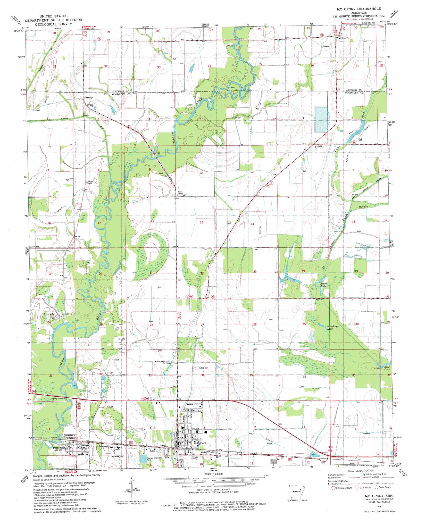
USGS Topo Quad 35091c2 - 1:24,000 scale
| Topo Map Name: | Mccrory |
| USGS Topo Quad ID: | 35091c2 |
| Print Size: | ca. 21 1/4" wide x 27" high |
| Southeast Coordinates: | 35.25° N latitude / 91.125° W longitude |
| Map Center Coordinates: | 35.3125° N latitude / 91.1875° W longitude |
| U.S. State: | AR |
| Filename: | o35091c2.jpg |
| Download Map JPG Image: | Mccrory topo map 1:24,000 scale |
| Map Type: | Topographic |
| Topo Series: | 7.5´ |
| Map Scale: | 1:24,000 |
| Source of Map Images: | United States Geological Survey (USGS) |
| Alternate Map Versions: |
Mc Crory AR 1980, updated 1980 Download PDF Buy paper map McCrory AR 2011 Download PDF Buy paper map McCrory AR 2014 Download PDF Buy paper map |
1:24,000 Topo Quads surrounding Mccrory
Olyphant |
Newport |
Auvergne |
Amagon |
Weiner |
Bradford |
Augusta Ne |
Tupelo |
Beedeville |
Hickory Ridge |
Augusta Sw |
Augusta |
Mccrory |
Tilton |
Central |
Georgetown |
Gregory |
Grays |
Fair Oaks |
Hamlin |
Gregory Sw |
Cotton Plant |
Hunter West |
Hunter East |
Hawkins |
> Back to 35091a1 at 1:100,000 scale
> Back to 35090a1 at 1:250,000 scale
> Back to U.S. Topo Maps home
Mccrory topo map: Gazetteer
Mccrory: Airports
Woodruff County Hospital and Nursing Home Heliport elevation 62m 203′Mccrory: Lakes
Hurricane Lake elevation 62m 203′White Lake elevation 62m 203′
Mccrory: Populated Places
Goodrich elevation 62m 203′McCrory elevation 60m 196′
Overcup elevation 68m 223′
Patterson elevation 59m 193′
Riverside elevation 61m 200′
Simmons (historical) elevation 63m 206′
Sturdevant (historical) elevation 59m 193′
Taylorville (historical) elevation 63m 206′
Mccrory: Ridges
Pulltight Ridge elevation 61m 200′Mccrory: Streams
Little Cow Lake elevation 64m 209′Old Channel Bayou De View elevation 60m 196′
Mccrory digital topo map on disk
Buy this Mccrory topo map showing relief, roads, GPS coordinates and other geographical features, as a high-resolution digital map file on DVD: