Salado Topo Map Arkansas
To zoom in, hover over the map of Salado
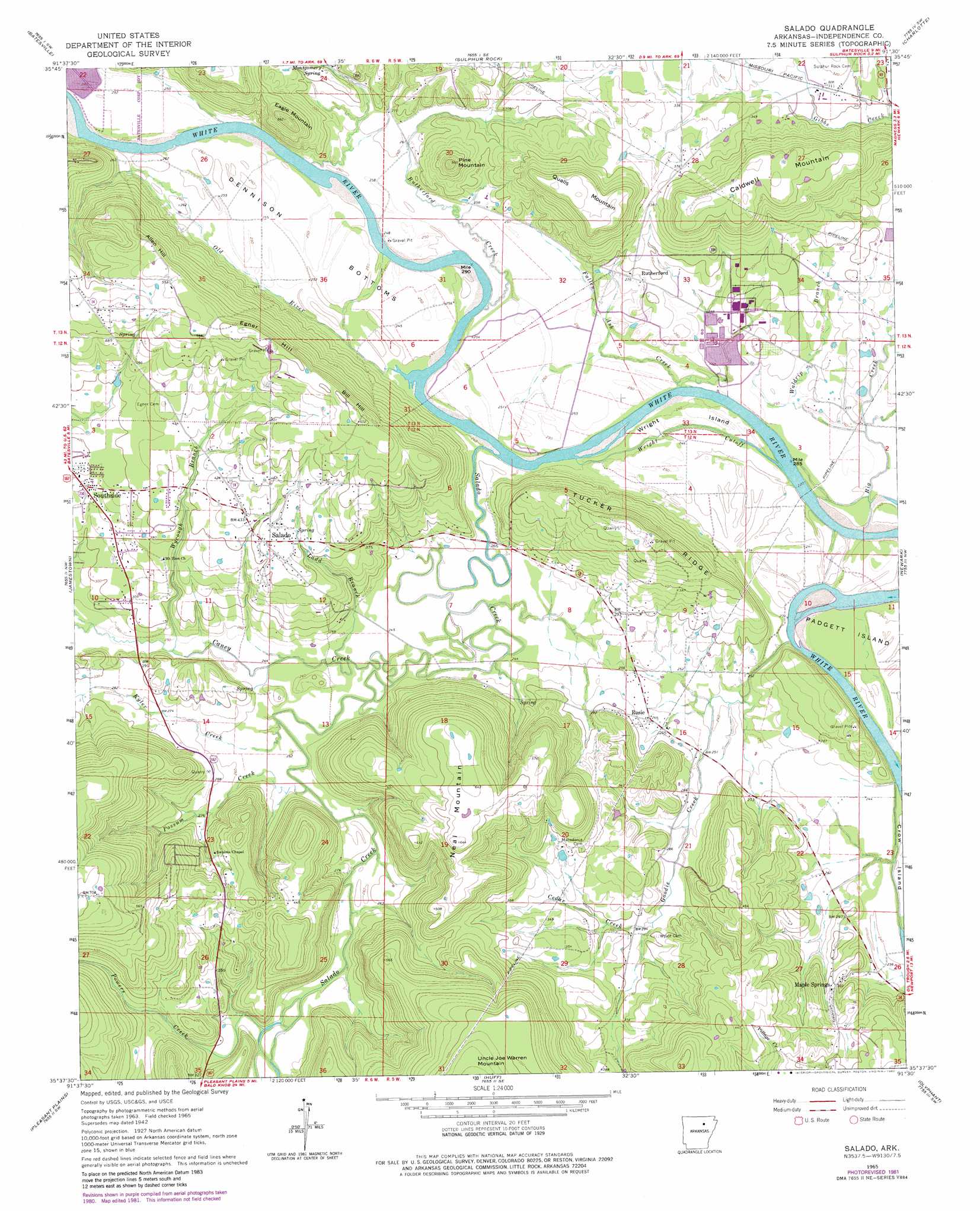
USGS Topo Quad 35091f5 - 1:24,000 scale
| Topo Map Name: | Salado |
| USGS Topo Quad ID: | 35091f5 |
| Print Size: | ca. 21 1/4" wide x 27" high |
| Southeast Coordinates: | 35.625° N latitude / 91.5° W longitude |
| Map Center Coordinates: | 35.6875° N latitude / 91.5625° W longitude |
| U.S. State: | AR |
| Filename: | o35091f5.jpg |
| Download Map JPG Image: | Salado topo map 1:24,000 scale |
| Map Type: | Topographic |
| Topo Series: | 7.5´ |
| Map Scale: | 1:24,000 |
| Source of Map Images: | United States Geological Survey (USGS) |
| Alternate Map Versions: |
Salado AR 1942, updated 1956 Download PDF Buy paper map Salado AR 1965, updated 1966 Download PDF Buy paper map Salado AR 1965, updated 1982 Download PDF Buy paper map Salado AR 2011 Download PDF Buy paper map Salado AR 2014 Download PDF Buy paper map |
1:24,000 Topo Quads surrounding Salado
Mount Pleasant |
Sandtown |
Cave City |
Grange |
Strawberry |
Bethesda |
Batesville |
Sulphur Rock |
Charlotte |
Cord |
Concord |
Jamestown |
Salado |
Newark |
Jacksonport |
Floral |
Pleasant Plains |
Huff |
Olyphant |
Newport |
Pangburn |
Steprock |
Velvet Ridge |
Bradford |
Augusta Ne |
> Back to 35091e1 at 1:100,000 scale
> Back to 35090a1 at 1:250,000 scale
> Back to U.S. Topo Maps home
Salado topo map: Gazetteer
Salado: Bends
Dennison Bottoms elevation 73m 239′Salado: Crossings
Magness Ferry (historical) elevation 57m 187′Salado: Islands
Wright Island elevation 71m 232′Salado: Populated Places
Maple Springs elevation 100m 328′Rosie elevation 83m 272′
Rutherford elevation 83m 272′
Salado elevation 128m 419′
Southside elevation 108m 354′
Salado: Post Offices
Rosie Post Office elevation 86m 282′Salado: Ridges
Tucker Ridge elevation 160m 524′Salado: Streams
Big Creek elevation 67m 219′Caney Creek elevation 74m 242′
Cedar Creek elevation 83m 272′
Fallen Ash Creek elevation 65m 213′
Goodie Creek elevation 67m 219′
Kyler Creek elevation 74m 242′
Ladd Branch elevation 75m 246′
Old River elevation 67m 219′
Possum Creek elevation 75m 246′
Powers Creek elevation 80m 262′
Rutherford Creek elevation 63m 206′
Salado Creek elevation 72m 236′
Waldrip Branch elevation 72m 236′
Wright Cutoff elevation 68m 223′
Wycough Branch elevation 76m 249′
Salado: Summits
Allen Hill elevation 169m 554′Bill Hill elevation 180m 590′
Caldwell Mountain elevation 160m 524′
Eagle Mountain elevation 166m 544′
Egner Hill elevation 186m 610′
Neal Mountain elevation 198m 649′
Pine Mountain elevation 167m 547′
Qualls Mountain elevation 164m 538′
Salado digital topo map on disk
Buy this Salado topo map showing relief, roads, GPS coordinates and other geographical features, as a high-resolution digital map file on DVD: