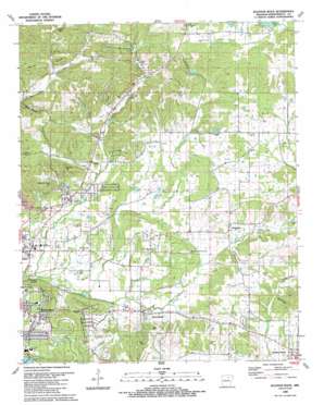
Sulphur Rock Topo Map Arkansas
To zoom in, hover over the map of Sulphur Rock
USGS Topo Quad 35091g5 - 1:24,000 scale
| Topo Map Name: | Sulphur Rock |
| USGS Topo Quad ID: | 35091g5 |
| Print Size: | ca. 21 1/4" wide x 27" high |
| Southeast Coordinates: | 35.75° N latitude / 91.5° W longitude |
| Map Center Coordinates: | 35.8125° N latitude / 91.5625° W longitude |
| U.S. State: | AR |
| Filename: | o35091g5.jpg |
| Download Map JPG Image: | Sulphur Rock topo map 1:24,000 scale |
| Map Type: | Topographic |
| Topo Series: | 7.5´ |
| Map Scale: | 1:24,000 |
| Source of Map Images: | United States Geological Survey (USGS) |
| Alternate Map Versions: |
Sulphur Rock AR 1943, updated 1956 Download PDF Buy paper map Sulphur Rock AR 1943, updated 1973 Download PDF Buy paper map Sulphur Rock AR 1943, updated 1978 Download PDF Buy paper map Sulphur Rock AR 1943, updated 1982 Download PDF Buy paper map Sulphur Rock AR 1989, updated 1990 Download PDF Buy paper map Sulphur Rock AR 2011 Download PDF Buy paper map Sulphur Rock AR 2014 Download PDF Buy paper map |
1:24,000 Topo Quads surrounding Sulphur Rock
> Back to 35091e1 at 1:100,000 scale
> Back to 35090a1 at 1:250,000 scale
> Back to U.S. Topo Maps home
Sulphur Rock topo map: Gazetteer
Sulphur Rock: Dams
Goforth Lake Dam elevation 182m 597′Lake Kimberly Dam elevation 165m 541′
Lee Britten Lake Dam elevation 147m 482′
R L Knies Lake Dam elevation 192m 629′
Sulphur Rock: Mines
Bales Mine elevation 198m 649′Dunegan Prospect elevation 187m 613′
G A Wilson Mine elevation 161m 528′
Henley Mine elevation 163m 534′
Hunt Hollow Mine elevation 150m 492′
J A Reves Mine elevation 203m 666′
M W Reves Prospect elevation 174m 570′
Matheny Mine elevation 157m 515′
Moyer Mine elevation 160m 524′
O'Flinn Prospect elevation 163m 534′
Ozark Mine elevation 201m 659′
Schlieper Mine elevation 191m 626′
Searcy Mine elevation 161m 528′
Silberstein Prospect elevation 161m 528′
Walbert Mine elevation 150m 492′
Sulphur Rock: Populated Places
Balch Addition elevation 128m 419′Bryant Woodland Heights elevation 113m 370′
College Heights Addition elevation 126m 413′
Eastwood Addition elevation 117m 383′
Gainsboro elevation 124m 406′
Moorefield elevation 92m 301′
Pfeiffer elevation 119m 390′
Quail Valley elevation 113m 370′
Rogers Addition elevation 143m 469′
Sharp elevation 128m 419′
Sulphur Rock elevation 98m 321′
Wolford Addition elevation 129m 423′
Sulphur Rock: Reservoirs
Goforth Reservoir elevation 182m 597′Lake Kimberly elevation 165m 541′
Lee Britten Lake elevation 147m 482′
R L Knies Lake elevation 192m 629′
Sulphur Rock: Springs
Ford Spring elevation 110m 360′Montgomery Spring elevation 91m 298′
Saint Clair Spring elevation 146m 479′
Schlieper Spring elevation 180m 590′
Searcy Spring elevation 148m 485′
Sulphur Rock: Streams
Blue Creek elevation 87m 285′Cooper Cane Creek elevation 109m 357′
Gravel Creek elevation 100m 328′
Miller Creek elevation 153m 501′
Moorefield Creek elevation 91m 298′
Pfeiffer Creek elevation 82m 269′
Watson Creek elevation 102m 334′
Sulphur Rock: Summits
Adler Hill elevation 216m 708′Brewer Hill elevation 181m 593′
Davis Hill elevation 204m 669′
Goforth Mountain elevation 223m 731′
Meacham Cave Hill elevation 188m 616′
Waits Hill elevation 139m 456′
Sulphur Rock: Valleys
Davidson Hollow elevation 121m 396′Gum Hollow elevation 115m 377′
Modlin Hollow elevation 116m 380′
Sulphur Rock: Woods
Deer Lick Woods elevation 123m 403′Sulphur Rock digital topo map on disk
Buy this Sulphur Rock topo map showing relief, roads, GPS coordinates and other geographical features, as a high-resolution digital map file on DVD:


