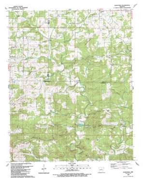
Sandtown Topo Map Arkansas
To zoom in, hover over the map of Sandtown
USGS Topo Quad 35091h6 - 1:24,000 scale
| Topo Map Name: | Sandtown |
| USGS Topo Quad ID: | 35091h6 |
| Print Size: | ca. 21 1/4" wide x 27" high |
| Southeast Coordinates: | 35.875° N latitude / 91.625° W longitude |
| Map Center Coordinates: | 35.9375° N latitude / 91.6875° W longitude |
| U.S. State: | AR |
| Filename: | o35091h6.jpg |
| Download Map JPG Image: | Sandtown topo map 1:24,000 scale |
| Map Type: | Topographic |
| Topo Series: | 7.5´ |
| Map Scale: | 1:24,000 |
| Source of Map Images: | United States Geological Survey (USGS) |
| Alternate Map Versions: |
Sandtown AR 1943 Download PDF Buy paper map Sandtown AR 1943, updated 1956 Download PDF Buy paper map Sandtown AR 1989, updated 1990 Download PDF Buy paper map Sandtown AR 2011 Download PDF Buy paper map Sandtown AR 2014 Download PDF Buy paper map |
1:24,000 Topo Quads surrounding Sandtown
> Back to 35091e1 at 1:100,000 scale
> Back to 35090a1 at 1:250,000 scale
> Back to U.S. Topo Maps home
Sandtown topo map: Gazetteer
Sandtown: Dams
United States Mag Corp Lake Dam elevation 118m 387′Sandtown: Mines
Adler-Southard Mine elevation 161m 528′Barnett Mine elevation 176m 577′
Bell Hill Prospect elevation 169m 554′
Blue Ridge Mine elevation 242m 793′
Bone Prospect elevation 189m 620′
C C Johnson Prospect elevation 202m 662′
C W Maxfield Prospect elevation 211m 692′
Chapel Hill Mine elevation 192m 629′
Cripple Hill Prospect elevation 200m 656′
Dead Tree Hill Prospect elevation 210m 688′
Friday Prospect elevation 227m 744′
G W W Patterson Prospect elevation 162m 531′
Galloway Mine elevation 197m 646′
Grub Cut Mine elevation 195m 639′
Helms Prospect elevation 199m 652′
Henry King Prospect elevation 190m 623′
Kimmer Mine elevation 183m 600′
Klondike Mine elevation 212m 695′
Lassiter Mine elevation 179m 587′
Maxfield Prospect elevation 214m 702′
Montgomery Hill Mine elevation 184m 603′
Montgomery Mine elevation 182m 597′
Montgomery Prospect elevation 124m 406′
Polk Southard Mines elevation 206m 675′
Pool Prospect elevation 179m 587′
Pritchett Prospect elevation 214m 702′
Reed Mine elevation 180m 590′
Roach Mine elevation 154m 505′
Rogers Mine elevation 198m 649′
Roseborough Mine elevation 182m 597′
Rowe Field Mine elevation 228m 748′
Section 34 Prospect elevation 218m 715′
Simpson Prospect elevation 211m 692′
Sis Clark Corner Prospect elevation 187m 613′
Sis Clark Mine elevation 183m 600′
Southern Mine elevation 216m 708′
Turner Mine elevation 205m 672′
Wren Mine elevation 202m 662′
Sandtown: Populated Places
Alvis (historical) elevation 187m 613′Sandtown elevation 121m 396′
Sandtown: Reservoirs
Beatty Pond elevation 117m 383′United States Mag Corp Lake elevation 118m 387′
Sandtown: Ridges
Blue Ridge elevation 245m 803′Sandtown: Springs
Tate Spring elevation 137m 449′Sandtown: Streams
Barren Fork elevation 146m 479′Brushy Branch elevation 107m 351′
Coon Creek elevation 105m 344′
Dishwater Branch elevation 115m 377′
Dry Creek elevation 119m 390′
Hackley Branch elevation 141m 462′
Miller Prong elevation 166m 544′
Montgomery Branch elevation 132m 433′
Pine Branch elevation 138m 452′
Rocky Branch elevation 130m 426′
Sidney Creek elevation 148m 485′
Watkins Branch elevation 129m 423′
Sandtown: Summits
Bell Hill elevation 173m 567′Chapel Hill elevation 197m 646′
Clark Hill elevation 188m 616′
Dead Tree Hill elevation 212m 695′
Fall Hill elevation 175m 574′
Galloway Hill elevation 187m 613′
Montgomery Hill elevation 208m 682′
Napoleon Hill elevation 201m 659′
Peter Martin Hill elevation 238m 780′
Southern Hill elevation 235m 770′
Sandtown: Valleys
Beatty Hollow elevation 113m 370′Big Hollow elevation 118m 387′
Cooper Hollow elevation 155m 508′
Wildcat Hollow elevation 144m 472′
Sandtown digital topo map on disk
Buy this Sandtown topo map showing relief, roads, GPS coordinates and other geographical features, as a high-resolution digital map file on DVD:


