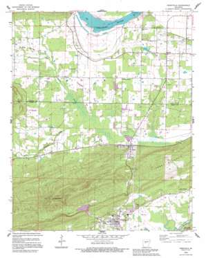
Perryville Topo Map Arkansas
To zoom in, hover over the map of Perryville
USGS Topo Quad 35092a7 - 1:24,000 scale
| Topo Map Name: | Perryville |
| USGS Topo Quad ID: | 35092a7 |
| Print Size: | ca. 21 1/4" wide x 27" high |
| Southeast Coordinates: | 35° N latitude / 92.75° W longitude |
| Map Center Coordinates: | 35.0625° N latitude / 92.8125° W longitude |
| U.S. State: | AR |
| Filename: | o35092a7.jpg |
| Download Map JPG Image: | Perryville topo map 1:24,000 scale |
| Map Type: | Topographic |
| Topo Series: | 7.5´ |
| Map Scale: | 1:24,000 |
| Source of Map Images: | United States Geological Survey (USGS) |
| Alternate Map Versions: |
Perryville AR 1961, updated 1962 Download PDF Buy paper map Perryville AR 1961, updated 1975 Download PDF Buy paper map Perryville AR 1961, updated 1984 Download PDF Buy paper map Perryville AR 2011 Download PDF Buy paper map Perryville AR 2014 Download PDF Buy paper map |
1:24,000 Topo Quads surrounding Perryville
> Back to 35092a1 at 1:100,000 scale
> Back to 35092a1 at 1:250,000 scale
> Back to U.S. Topo Maps home
Perryville topo map: Gazetteer
Perryville: Airports
Brickey Private Airport elevation 94m 308′Perryville: Bends
Willow Bend elevation 88m 288′Perryville: Dams
Payne Lake Dam elevation 85m 278′Timberlake Dam elevation 92m 301′
Womack Lake Dam elevation 100m 328′
Perryville: Parks
Sequoya Park elevation 88m 288′Perryville: Populated Places
Ada elevation 103m 337′Oppelo elevation 100m 328′
Perry elevation 93m 305′
Perryville elevation 91m 298′
Rehms Corner elevation 100m 328′
Riverview elevation 93m 305′
Sweet Home elevation 90m 295′
Perryville: Reservoirs
Payne Lake elevation 85m 278′South Fouche Site Seven Reservoir elevation 114m 374′
Timberlake Reservoir elevation 92m 301′
Womack Lake elevation 100m 328′
Perryville: Streams
Crane Creek elevation 85m 278′Flat Cypress Creek elevation 89m 291′
Harris Creek elevation 78m 255′
Haydon Branch elevation 87m 285′
Rocky Cypress Creek elevation 87m 285′
Perryville: Summits
Fourche Pinnacle elevation 387m 1269′Perry Mountain elevation 221m 725′
Perryville: Valleys
Ada Valley elevation 85m 278′Perryville digital topo map on disk
Buy this Perryville topo map showing relief, roads, GPS coordinates and other geographical features, as a high-resolution digital map file on DVD:


