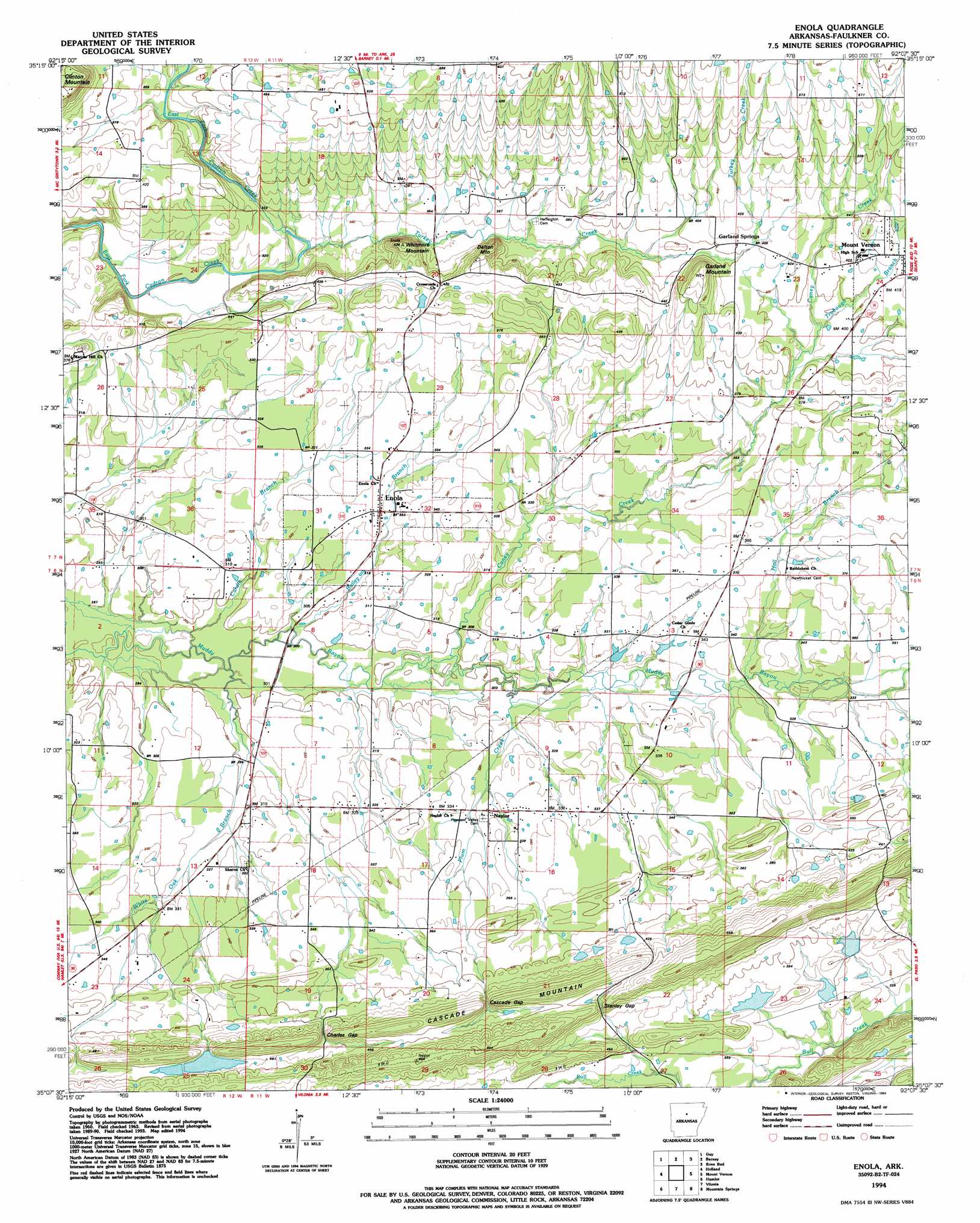
Enola Topo Map Arkansas
To zoom in, hover over the map of Enola
USGS Topo Quad 35092b2 - 1:24,000 scale
| Topo Map Name: | Enola |
| USGS Topo Quad ID: | 35092b2 |
| Print Size: | ca. 21 1/4" wide x 27" high |
| Southeast Coordinates: | 35.125° N latitude / 92.125° W longitude |
| Map Center Coordinates: | 35.1875° N latitude / 92.1875° W longitude |
| U.S. State: | AR |
| Filename: | o35092b2.jpg |
| Download Map JPG Image: | Enola topo map 1:24,000 scale |
| Map Type: | Topographic |
| Topo Series: | 7.5´ |
| Map Scale: | 1:24,000 |
| Source of Map Images: | United States Geological Survey (USGS) |
| Alternate Map Versions: |
Enola AR 1963, updated 1964 Download PDF Buy paper map Enola AR 1963, updated 1986 Download PDF Buy paper map Enola AR 1994, updated 1994 Download PDF Buy paper map Enola AR 2011 Download PDF Buy paper map Enola AR 2014 Download PDF Buy paper map |
1:24,000 Topo Quads surrounding Enola
Bee Branch |
Morganton |
Quitman |
Heber Springs |
West Pangburn |
Damascus |
Guy |
Barney |
Rose Bud |
Sidon |
Greenbrier |
Holland |
Enola |
Mount Vernon |
Floyd |
Conway |
Hamlet |
Vilonia |
Mountain Springs |
Beebe |
Mayflower |
Cato |
Olmstead |
Cabot |
Oak Grove |
> Back to 35092a1 at 1:100,000 scale
> Back to 35092a1 at 1:250,000 scale
> Back to U.S. Topo Maps home
Enola topo map: Gazetteer
Enola: Crossings
Red River Ford elevation 92m 301′West Ford elevation 111m 364′
Enola: Dams
Nalholz Lake Dam elevation 144m 472′Enola: Gaps
Cascade Gap elevation 133m 436′Charles Gap elevation 128m 419′
Stanley Gap elevation 141m 462′
Enola: Populated Places
Bristol (historical) elevation 108m 354′Enola elevation 97m 318′
Garland Springs elevation 123m 403′
Hawthicket (historical) elevation 111m 364′
Naylor elevation 98m 321′
Enola: Reservoirs
Nalholz Lake elevation 144m 472′Enola: Streams
Bailey Branch elevation 89m 291′Caney Creek elevation 89m 291′
Cardin Branch elevation 86m 282′
Hall Branch elevation 97m 318′
Plum Creek elevation 91m 298′
Trobough Branch elevation 118m 387′
Turkey Creek elevation 96m 314′
White Oak Branch elevation 87m 285′
Enola: Summits
Cascade Mountain elevation 169m 554′Dalton Mountain elevation 160m 524′
Garland Mountain elevation 171m 561′
Whitmore Mountain elevation 114m 374′
Enola digital topo map on disk
Buy this Enola topo map showing relief, roads, GPS coordinates and other geographical features, as a high-resolution digital map file on DVD: