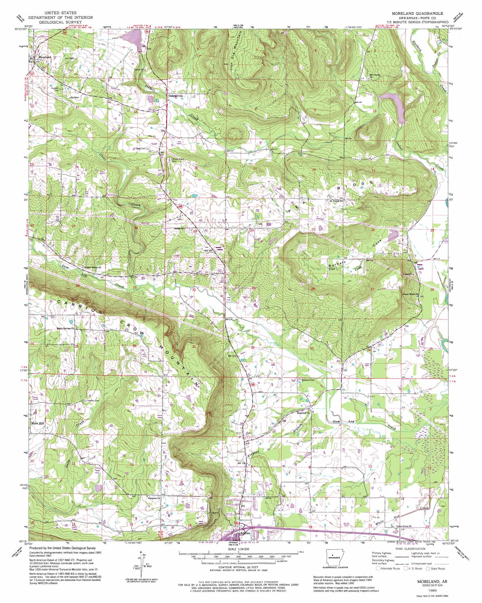
Moreland Topo Map Arkansas
To zoom in, hover over the map of Moreland
USGS Topo Quad 35092c8 - 1:24,000 scale
| Topo Map Name: | Moreland |
| USGS Topo Quad ID: | 35092c8 |
| Print Size: | ca. 21 1/4" wide x 27" high |
| Southeast Coordinates: | 35.25° N latitude / 92.875° W longitude |
| Map Center Coordinates: | 35.3125° N latitude / 92.9375° W longitude |
| U.S. State: | AR |
| Filename: | o35092c8.jpg |
| Download Map JPG Image: | Moreland topo map 1:24,000 scale |
| Map Type: | Topographic |
| Topo Series: | 7.5´ |
| Map Scale: | 1:24,000 |
| Source of Map Images: | United States Geological Survey (USGS) |
| Alternate Map Versions: |
Moreland AR 1962, updated 1963 Download PDF Buy paper map Moreland AR 1962, updated 1983 Download PDF Buy paper map Moreland AR 1989, updated 1995 Download PDF Buy paper map Moreland AR 2011 Download PDF Buy paper map Moreland AR 2014 Download PDF Buy paper map |
1:24,000 Topo Quads surrounding Moreland
Treat |
Simpson |
Solo |
Lost Corner |
Rex |
Lee Mountain |
Dover |
Hector |
Jerusalem |
Cleveland |
Russellville West |
Russellville East |
Moreland |
Hattieville |
Solgohachia |
Dardanelle |
Holla Bend |
Atkins |
Morrilton West |
Morrilton East |
Ola |
Casa |
Adona |
Perryville |
Houston |
> Back to 35092a1 at 1:100,000 scale
> Back to 35092a1 at 1:250,000 scale
> Back to U.S. Topo Maps home
Moreland topo map: Gazetteer
Moreland: Crossings
Interchange 94 elevation 111m 364′Moreland: Dams
West Fork Point Remove Creek Site 17 Dam elevation 98m 321′West Fork Point Remove Creek Site 18 Dam elevation 113m 370′
West Fork Point Remove Creek Site 19 Dam elevation 184m 603′
Moreland: Populated Places
Economy elevation 102m 334′Mars Hill elevation 230m 754′
Moreland elevation 228m 748′
Oak Grove elevation 165m 541′
Moreland: Post Offices
Moreland Post Office (historical) elevation 227m 744′Moreland: Reservoirs
West Fork Point Remove Creek Site 17 Reservoir elevation 98m 321′West Fork Point Remove Creek Site 18 Reservoir elevation 113m 370′
West Fork Point Remove Creek Site 19 Reservoir elevation 184m 603′
Moreland: Ridges
Pea Ridge elevation 224m 734′Moreland: Streams
Alewine Branch elevation 93m 305′Cedar Creek elevation 99m 324′
Clear Creek elevation 102m 334′
Cove Creek elevation 96m 314′
White Oak Creek elevation 90m 295′
Moreland: Summits
Carrion Crow Mountain elevation 329m 1079′Moreland: Valleys
Burnett Cove elevation 96m 314′Steep Hollow elevation 109m 357′
Moreland digital topo map on disk
Buy this Moreland topo map showing relief, roads, GPS coordinates and other geographical features, as a high-resolution digital map file on DVD: