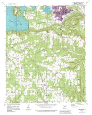
Heber Springs Topo Map Arkansas
To zoom in, hover over the map of Heber Springs
USGS Topo Quad 35092d1 - 1:24,000 scale
| Topo Map Name: | Heber Springs |
| USGS Topo Quad ID: | 35092d1 |
| Print Size: | ca. 21 1/4" wide x 27" high |
| Southeast Coordinates: | 35.375° N latitude / 92° W longitude |
| Map Center Coordinates: | 35.4375° N latitude / 92.0625° W longitude |
| U.S. State: | AR |
| Filename: | o35092d1.jpg |
| Download Map JPG Image: | Heber Springs topo map 1:24,000 scale |
| Map Type: | Topographic |
| Topo Series: | 7.5´ |
| Map Scale: | 1:24,000 |
| Source of Map Images: | United States Geological Survey (USGS) |
| Alternate Map Versions: |
Heber Springs AR 1963, updated 1964 Download PDF Buy paper map Heber Springs AR 1963, updated 1990 Download PDF Buy paper map Heber Springs AR 1989, updated 1995 Download PDF Buy paper map Heber Springs AR 2011 Download PDF Buy paper map Heber Springs AR 2014 Download PDF Buy paper map |
1:24,000 Topo Quads surrounding Heber Springs
> Back to 35092a1 at 1:100,000 scale
> Back to 35092a1 at 1:250,000 scale
> Back to U.S. Topo Maps home
Heber Springs topo map: Gazetteer
Heber Springs: Dams
Eden Isle Lake Dam elevation 146m 479′Parish Lake Dam elevation 224m 734′
Heber Springs: Falls
Bridal Veil Falls elevation 178m 583′Heber Springs: Parks
Spring Park elevation 99m 324′Heber Springs: Populated Places
Driftwood Shores elevation 201m 659′Heber Springs elevation 106m 347′
Hopewell elevation 273m 895′
South Shore Park elevation 227m 744′
Heber Springs: Reservoirs
Lake Eden elevation 146m 479′Parish Lake elevation 224m 734′
Heber Springs: Springs
Seven Natural Springs elevation 98m 321′Stacy Springs elevation 217m 711′
Heber Springs: Streams
Badders Creek elevation 210m 688′Brush Creek elevation 159m 521′
Candlestick Creek elevation 192m 629′
Cunningham Creek elevation 203m 666′
Flat Rock Branch elevation 210m 688′
Mecum Branch elevation 207m 679′
Pierce Branch elevation 192m 629′
Pleasant Springs Branch elevation 222m 728′
Sexton Creek elevation 188m 616′
Waterfall Branch elevation 194m 636′
Waters Creek elevation 187m 613′
Heber Springs: Summits
Round Mountain elevation 279m 915′Heber Springs: Valleys
Bridal Veil Hollow elevation 116m 380′Happy Hollow elevation 103m 337′
Kickback Hollow elevation 176m 577′
Wallace Hollow elevation 93m 305′
Heber Springs digital topo map on disk
Buy this Heber Springs topo map showing relief, roads, GPS coordinates and other geographical features, as a high-resolution digital map file on DVD:


