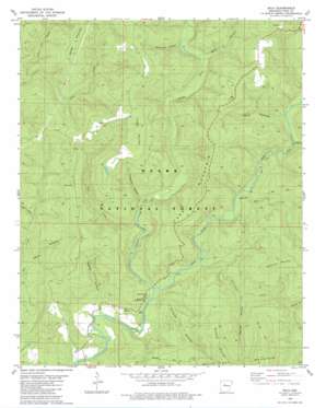
Solo Topo Map Arkansas
To zoom in, hover over the map of Solo
USGS Topo Quad 35092e8 - 1:24,000 scale
| Topo Map Name: | Solo |
| USGS Topo Quad ID: | 35092e8 |
| Print Size: | ca. 21 1/4" wide x 27" high |
| Southeast Coordinates: | 35.5° N latitude / 92.875° W longitude |
| Map Center Coordinates: | 35.5625° N latitude / 92.9375° W longitude |
| U.S. State: | AR |
| Filename: | o35092e8.jpg |
| Download Map JPG Image: | Solo topo map 1:24,000 scale |
| Map Type: | Topographic |
| Topo Series: | 7.5´ |
| Map Scale: | 1:24,000 |
| Source of Map Images: | United States Geological Survey (USGS) |
| Alternate Map Versions: |
Smyrna SW AR 1974, updated 1975 Download PDF Buy paper map Solo AR 1980, updated 1980 Download PDF Buy paper map Solo AR 2011 Download PDF Buy paper map Solo AR 2014 Download PDF Buy paper map |
| FStopo: | US Forest Service topo Solo is available: Download FStopo PDF Download FStopo TIF |
1:24,000 Topo Quads surrounding Solo
> Back to 35092e1 at 1:100,000 scale
> Back to 35092a1 at 1:250,000 scale
> Back to U.S. Topo Maps home
Solo topo map: Gazetteer
Solo: Parks
Bayou Bluff Recreation Area elevation 193m 633′Solo: Populated Places
Gabriel (historical) elevation 245m 803′Retta elevation 206m 675′
Solo elevation 500m 1640′
Solo: Springs
Blue Hole elevation 279m 915′Solo: Streams
East Fork Illinois Bayou elevation 187m 613′Hurricane Creek elevation 200m 656′
Little Dry Creek elevation 235m 770′
Meyer Branch elevation 253m 830′
Middle Fork Illinois Bayou elevation 187m 613′
Mill Creek elevation 241m 790′
Snow Creek elevation 208m 682′
Sycamore Creek elevation 242m 793′
Solo: Summits
Buckeye Mountain elevation 563m 1847′Divide Mountain elevation 502m 1646′
Grapevine Mountain elevation 493m 1617′
Younger Mountain elevation 553m 1814′
Solo: Valleys
Bear Hollow elevation 266m 872′Bear Hollow elevation 231m 757′
Crouch Hollow elevation 193m 633′
Elm Hollow elevation 196m 643′
Fall-Off Hollow elevation 253m 830′
Mathis Hollow elevation 180m 590′
Mine Hollow elevation 210m 688′
Penhook Hollow elevation 211m 692′
Sugartree Hollow elevation 256m 839′
Wolf Den Hollow elevation 277m 908′
Solo digital topo map on disk
Buy this Solo topo map showing relief, roads, GPS coordinates and other geographical features, as a high-resolution digital map file on DVD:


