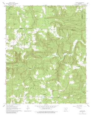
Alread Topo Map Arkansas
To zoom in, hover over the map of Alread
USGS Topo Quad 35092f6 - 1:24,000 scale
| Topo Map Name: | Alread |
| USGS Topo Quad ID: | 35092f6 |
| Print Size: | ca. 21 1/4" wide x 27" high |
| Southeast Coordinates: | 35.625° N latitude / 92.625° W longitude |
| Map Center Coordinates: | 35.6875° N latitude / 92.6875° W longitude |
| U.S. State: | AR |
| Filename: | o35092f6.jpg |
| Download Map JPG Image: | Alread topo map 1:24,000 scale |
| Map Type: | Topographic |
| Topo Series: | 7.5´ |
| Map Scale: | 1:24,000 |
| Source of Map Images: | United States Geological Survey (USGS) |
| Alternate Map Versions: |
Alread AR 1965, updated 1966 Download PDF Buy paper map Alread AR 1965, updated 1980 Download PDF Buy paper map Alread AR 2011 Download PDF Buy paper map Alread AR 2014 Download PDF Buy paper map |
1:24,000 Topo Quads surrounding Alread
> Back to 35092e1 at 1:100,000 scale
> Back to 35092a1 at 1:250,000 scale
> Back to U.S. Topo Maps home
Alread topo map: Gazetteer
Alread: Populated Places
Alread elevation 509m 1669′Archey Valley elevation 571m 1873′
Booster elevation 510m 1673′
Chimes elevation 567m 1860′
Copeland elevation 460m 1509′
Rupert elevation 502m 1646′
Woolum elevation 538m 1765′
Alread: Ridges
Trace Ridge elevation 529m 1735′Alread: Summits
Pine Mountain elevation 538m 1765′Reves Knob elevation 618m 2027′
Alread: Valleys
Alum Cave Canyon elevation 272m 892′Briar Hollow elevation 291m 954′
Dollar Hollow elevation 330m 1082′
Lick Hollow elevation 279m 915′
Rattlesnake Hollow elevation 314m 1030′
Woods Hollow elevation 315m 1033′
Alread digital topo map on disk
Buy this Alread topo map showing relief, roads, GPS coordinates and other geographical features, as a high-resolution digital map file on DVD:


