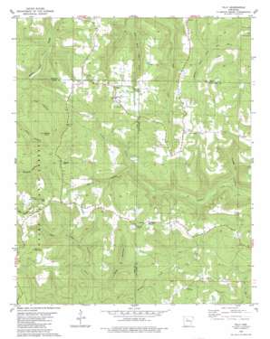
Tilly Topo Map Arkansas
To zoom in, hover over the map of Tilly
USGS Topo Quad 35092f7 - 1:24,000 scale
| Topo Map Name: | Tilly |
| USGS Topo Quad ID: | 35092f7 |
| Print Size: | ca. 21 1/4" wide x 27" high |
| Southeast Coordinates: | 35.625° N latitude / 92.75° W longitude |
| Map Center Coordinates: | 35.6875° N latitude / 92.8125° W longitude |
| U.S. State: | AR |
| Filename: | o35092f7.jpg |
| Download Map JPG Image: | Tilly topo map 1:24,000 scale |
| Map Type: | Topographic |
| Topo Series: | 7.5´ |
| Map Scale: | 1:24,000 |
| Source of Map Images: | United States Geological Survey (USGS) |
| Alternate Map Versions: |
Smyrna NE AR 1974, updated 1975 Download PDF Buy paper map Tilly AR 1980, updated 1981 Download PDF Buy paper map Tilly AR 1980, updated 1981 Download PDF Buy paper map Tilly AR 2011 Download PDF Buy paper map Tilly AR 2014 Download PDF Buy paper map |
| FStopo: | US Forest Service topo Tilly is available: Download FStopo PDF Download FStopo TIF |
1:24,000 Topo Quads surrounding Tilly
> Back to 35092e1 at 1:100,000 scale
> Back to 35092a1 at 1:250,000 scale
> Back to U.S. Topo Maps home
Tilly topo map: Gazetteer
Tilly: Populated Places
Dabney elevation 463m 1519′Ella (historical) elevation 528m 1732′
Tilly elevation 593m 1945′
Zion Hill elevation 551m 1807′
Tilly: Post Offices
Tilly Post Office elevation 612m 2007′Tilly: Streams
Burnett Creek elevation 312m 1023′Tilly: Summits
Alread Hill elevation 626m 2053′Brown Mountain elevation 630m 2066′
Shields Knob elevation 598m 1961′
Walker Mountain elevation 647m 2122′
Tilly: Valleys
Bear Hollow elevation 314m 1030′Lick Hollow elevation 390m 1279′
Turkey Pen Hollow elevation 353m 1158′
Tilly digital topo map on disk
Buy this Tilly topo map showing relief, roads, GPS coordinates and other geographical features, as a high-resolution digital map file on DVD:


