Casa Topo Map Arkansas
To zoom in, hover over the map of Casa
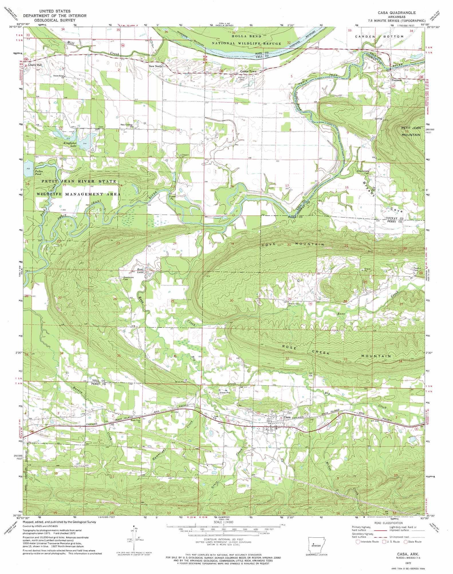
USGS Topo Quad 35093a1 - 1:24,000 scale
| Topo Map Name: | Casa |
| USGS Topo Quad ID: | 35093a1 |
| Print Size: | ca. 21 1/4" wide x 27" high |
| Southeast Coordinates: | 35° N latitude / 93° W longitude |
| Map Center Coordinates: | 35.0625° N latitude / 93.0625° W longitude |
| U.S. State: | AR |
| Filename: | o35093a1.jpg |
| Download Map JPG Image: | Casa topo map 1:24,000 scale |
| Map Type: | Topographic |
| Topo Series: | 7.5´ |
| Map Scale: | 1:24,000 |
| Source of Map Images: | United States Geological Survey (USGS) |
| Alternate Map Versions: |
Casa AR 1972, updated 1974 Download PDF Buy paper map Casa AR 1972, updated 1974 Download PDF Buy paper map Casa AR 2011 Download PDF Buy paper map Casa AR 2014 Download PDF Buy paper map |
1:24,000 Topo Quads surrounding Casa
Delaware |
Russellville West |
Russellville East |
Moreland |
Hattieville |
Chickalah Mountain East |
Dardanelle |
Holla Bend |
Atkins |
Morrilton West |
Danville Mountain |
Ola |
Casa |
Adona |
Perryville |
Plainview |
Nimrod Dam |
Nimrod |
Aplin |
Thornburg |
Steve |
Nimrod Sw |
Nimrod Se |
Paron Sw |
Paron |
> Back to 35093a1 at 1:100,000 scale
> Back to 35092a1 at 1:250,000 scale
> Back to U.S. Topo Maps home
Casa topo map: Gazetteer
Casa: Bends
Sadler Bend elevation 85m 278′Casa: Crossings
Slaty Crossing elevation 90m 295′Casa: Dams
Kingfisher Lake Dam elevation 92m 301′Pond Creek Lake Dam elevation 92m 301′
Casa: Lakes
Rose Lake elevation 88m 288′Casa: Populated Places
Casa elevation 113m 370′Cotton Town elevation 98m 321′
New Neely elevation 102m 334′
Pontoon elevation 95m 311′
Casa: Reservoirs
Kingfisher Lake elevation 92m 301′Pullen Pond elevation 92m 301′
Casa: Streams
Big Creek elevation 92m 301′Grace Creek elevation 100m 328′
Hambright Creek elevation 104m 341′
McGee Creek elevation 111m 364′
Mill Creek elevation 85m 278′
Pond Creek elevation 88m 288′
Rose Creek elevation 93m 305′
Casa: Summits
Cove Mountain elevation 249m 816′Casa: Valleys
Bryant Cove elevation 91m 298′Casa digital topo map on disk
Buy this Casa topo map showing relief, roads, GPS coordinates and other geographical features, as a high-resolution digital map file on DVD: