Danville Mountain Topo Map Arkansas
To zoom in, hover over the map of Danville Mountain
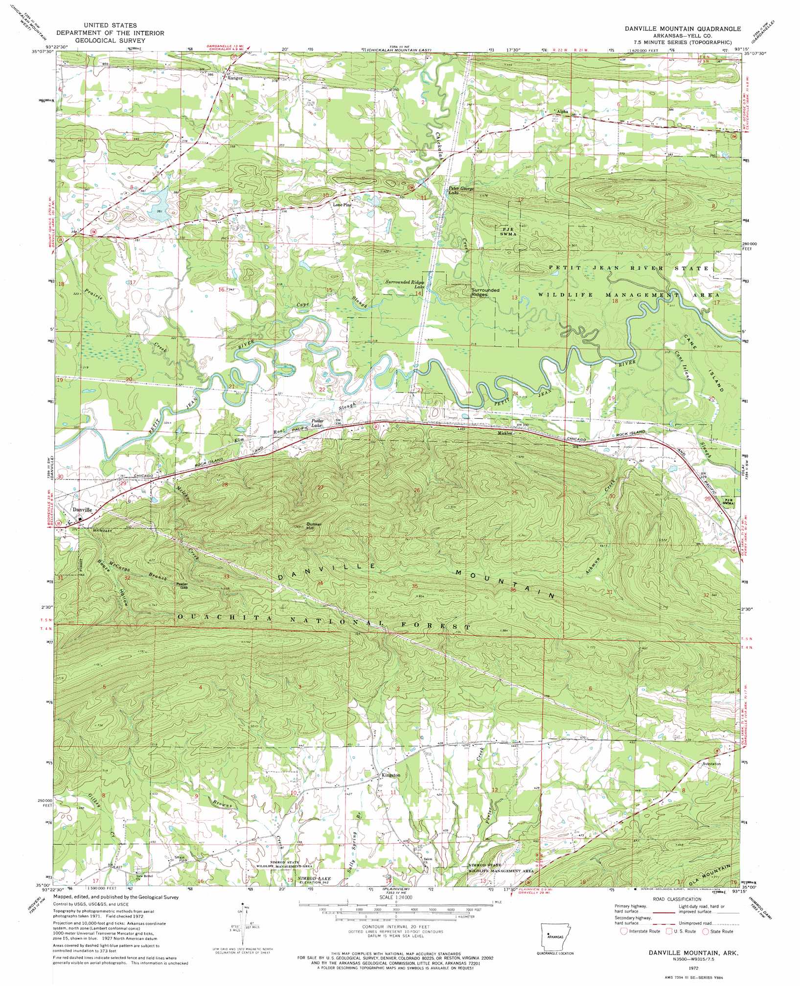
USGS Topo Quad 35093a3 - 1:24,000 scale
| Topo Map Name: | Danville Mountain |
| USGS Topo Quad ID: | 35093a3 |
| Print Size: | ca. 21 1/4" wide x 27" high |
| Southeast Coordinates: | 35° N latitude / 93.25° W longitude |
| Map Center Coordinates: | 35.0625° N latitude / 93.3125° W longitude |
| U.S. State: | AR |
| Filename: | o35093a3.jpg |
| Download Map JPG Image: | Danville Mountain topo map 1:24,000 scale |
| Map Type: | Topographic |
| Topo Series: | 7.5´ |
| Map Scale: | 1:24,000 |
| Source of Map Images: | United States Geological Survey (USGS) |
| Alternate Map Versions: |
Danville Mountain AR 1972, updated 1974 Download PDF Buy paper map Danville Mountain AR 2011 Download PDF Buy paper map Danville Mountain AR 2014 Download PDF Buy paper map |
| FStopo: | US Forest Service topo Danville Mountain is available: Download FStopo PDF Download FStopo TIF |
1:24,000 Topo Quads surrounding Danville Mountain
Scranton |
New Blaine |
Delaware |
Russellville West |
Russellville East |
Magazine Mountain Ne |
Chickalah Mountain West |
Chickalah Mountain East |
Dardanelle |
Holla Bend |
Havana |
Danville |
Danville Mountain |
Ola |
Casa |
Bluffton |
Rover |
Plainview |
Nimrod Dam |
Nimrod |
Chula Mountain |
Onyx |
Steve |
Nimrod Sw |
Nimrod Se |
> Back to 35093a1 at 1:100,000 scale
> Back to 35092a1 at 1:250,000 scale
> Back to U.S. Topo Maps home
Danville Mountain topo map: Gazetteer
Danville Mountain: Bridges
Achmun Creek Bridge elevation 101m 331′Danville Mountain: Dams
Harris Fish Farm Dam elevation 105m 344′Danville Mountain: Flats
Cane Island elevation 94m 308′Danville Mountain: Gaps
Peeler Gap elevation 204m 669′Danville Mountain: Guts
Cane Island Slough elevation 94m 308′Danville Mountain: Lakes
Peeler Lake elevation 98m 321′Peter George Lake elevation 96m 314′
Surrounded Ridges Lake elevation 97m 318′
Danville Mountain: Parks
Nimrod State Wildlife Management Area elevation 116m 380′Danville Mountain: Populated Places
Alpha elevation 115m 377′Kingston elevation 131m 429′
Lone Pine elevation 111m 364′
Mickles elevation 103m 337′
Ranger elevation 119m 390′
Danville Mountain: Reservoirs
Harris Fish Farm Reservoir elevation 105m 344′Danville Mountain: Ridges
Danville Mountain elevation 255m 836′Danville Mountain: Streams
Achmun Creek elevation 93m 305′Cape Slough elevation 97m 318′
Chickalah Creek elevation 94m 308′
Elm Root Slough elevation 94m 308′
Jake Creek elevation 101m 331′
Melchor Creek elevation 96m 314′
Prairie Creek elevation 94m 308′
Danville Mountain: Summits
Bunker Hill elevation 368m 1207′Surrounded Ridges elevation 113m 370′
Danville Mountain: Valleys
Booze Hollow elevation 120m 393′Danville Mountain digital topo map on disk
Buy this Danville Mountain topo map showing relief, roads, GPS coordinates and other geographical features, as a high-resolution digital map file on DVD: