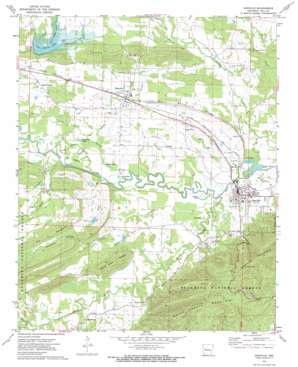
Danville Topo Map Arkansas
To zoom in, hover over the map of Danville
USGS Topo Quad 35093a4 - 1:24,000 scale
| Topo Map Name: | Danville |
| USGS Topo Quad ID: | 35093a4 |
| Print Size: | ca. 21 1/4" wide x 27" high |
| Southeast Coordinates: | 35° N latitude / 93.375° W longitude |
| Map Center Coordinates: | 35.0625° N latitude / 93.4375° W longitude |
| U.S. State: | AR |
| Filename: | o35093a4.jpg |
| Download Map JPG Image: | Danville topo map 1:24,000 scale |
| Map Type: | Topographic |
| Topo Series: | 7.5´ |
| Map Scale: | 1:24,000 |
| Source of Map Images: | United States Geological Survey (USGS) |
| Alternate Map Versions: |
Danville AR 1972, updated 1974 Download PDF Buy paper map Danville AR 2011 Download PDF Buy paper map Danville AR 2014 Download PDF Buy paper map |
| FStopo: | US Forest Service topo Danville is available: Download FStopo PDF Download FStopo TIF |
1:24,000 Topo Quads surrounding Danville
> Back to 35093a1 at 1:100,000 scale
> Back to 35092a1 at 1:250,000 scale
> Back to U.S. Topo Maps home
Danville topo map: Gazetteer
Danville: Airports
Yell County Hospital Heliport elevation 104m 341′Danville: Dams
Bailey Branch R C and D Structure One Dam elevation 108m 354′Cedar Piney Lake Dam elevation 123m 403′
Chambers Lake Dam elevation 124m 406′
Danville: Islands
The Island elevation 104m 341′Danville: Lakes
Buckman Lake elevation 100m 328′Cowger Lake elevation 98m 321′
Horseshoe Lake elevation 101m 331′
Mason Lake elevation 101m 331′
Danville: Populated Places
Belleville elevation 113m 370′Corinth elevation 109m 357′
Danville elevation 106m 347′
Macedonia elevation 109m 357′
Millan (historical) elevation 107m 351′
Riley Creek (historical) elevation 116m 380′
Danville: Reservoirs
Bailey Branch Lake elevation 108m 354′Cedar-Piney Lake elevation 123m 403′
Chambers Lake elevation 124m 406′
Danville: Ridges
Belleville Ridge elevation 116m 380′Dowel Town Ridges elevation 158m 518′
Jones Ridge elevation 185m 606′
The Backbone elevation 158m 518′
Danville: Streams
Bailey Branch elevation 99m 324′Caroline Branch elevation 98m 321′
Deadman Creek elevation 100m 328′
Dry Branch elevation 116m 380′
Dutch Creek elevation 100m 328′
Few Branch elevation 103m 337′
Little Petit Jean River elevation 99m 324′
McCargo Branch elevation 96m 314′
Moss Creek elevation 105m 344′
Petite Branch elevation 98m 321′
Riley Creek elevation 104m 341′
Russell Branch elevation 102m 334′
Spring Creek elevation 95m 311′
Surrat Slough elevation 100m 328′
Danville: Swamps
Fox Lake elevation 99m 324′Danville: Valleys
Blackman Hollow elevation 125m 410′Danville digital topo map on disk
Buy this Danville topo map showing relief, roads, GPS coordinates and other geographical features, as a high-resolution digital map file on DVD:


