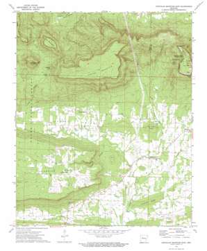
Chickalah Mountain East Topo Map Arkansas
To zoom in, hover over the map of Chickalah Mountain East
USGS Topo Quad 35093b3 - 1:24,000 scale
| Topo Map Name: | Chickalah Mountain East |
| USGS Topo Quad ID: | 35093b3 |
| Print Size: | ca. 21 1/4" wide x 27" high |
| Southeast Coordinates: | 35.125° N latitude / 93.25° W longitude |
| Map Center Coordinates: | 35.1875° N latitude / 93.3125° W longitude |
| U.S. State: | AR |
| Filename: | o35093b3.jpg |
| Download Map JPG Image: | Chickalah Mountain East topo map 1:24,000 scale |
| Map Type: | Topographic |
| Topo Series: | 7.5´ |
| Map Scale: | 1:24,000 |
| Source of Map Images: | United States Geological Survey (USGS) |
| Alternate Map Versions: |
Chickalah Mountain East AR 1972, updated 1974 Download PDF Buy paper map Chickalah Mountain East AR 1972, updated 1974 Download PDF Buy paper map Chickalah Mountain East AR 2011 Download PDF Buy paper map Chickalah Mountain East AR 2014 Download PDF Buy paper map |
| FStopo: | US Forest Service topo Chickalah Mountain East is available: Download FStopo PDF Download FStopo TIF |
1:24,000 Topo Quads surrounding Chickalah Mountain East
> Back to 35093a1 at 1:100,000 scale
> Back to 35092a1 at 1:250,000 scale
> Back to U.S. Topo Maps home
Chickalah Mountain East topo map: Gazetteer
Chickalah Mountain East: Capes
Sunrise Point elevation 443m 1453′Sunset Point elevation 514m 1686′
Chickalah Mountain East: Parks
Mount Nebo State Park elevation 529m 1735′Chickalah Mountain East: Populated Places
Chickalah elevation 124m 406′Mosley elevation 136m 446′
Mount Nebo elevation 532m 1745′
Sulphur Springs elevation 134m 439′
Chickalah Mountain East: Post Offices
Mount Nebo Post Office (historical) elevation 531m 1742′Chickalah Mountain East: Reservoirs
Bogs Lake elevation 99m 324′Chickalah Mountain East: Ridges
Christian Ridge elevation 142m 465′Mc Cray Ridge elevation 177m 580′
Chickalah Mountain East: Springs
Darling Spring elevation 433m 1420′Chickalah Mountain East: Streams
Carter Branch elevation 106m 347′Gwin River elevation 103m 337′
Jordan Branch elevation 119m 390′
Little Chickalah Creek elevation 103m 337′
Rock Creek elevation 107m 351′
Chickalah Mountain East: Summits
Bear Mountain elevation 437m 1433′Dean Reid Knob elevation 377m 1236′
Gobblers Knob elevation 354m 1161′
Moore Mountain elevation 396m 1299′
Mount Nebo elevation 537m 1761′
Spring Mountain elevation 553m 1814′
Tater Hill elevation 452m 1482′
Chickalah Mountain East: Valleys
Haags Hollow elevation 118m 387′Harkey Valley elevation 108m 354′
Chickalah Mountain East digital topo map on disk
Buy this Chickalah Mountain East topo map showing relief, roads, GPS coordinates and other geographical features, as a high-resolution digital map file on DVD:


