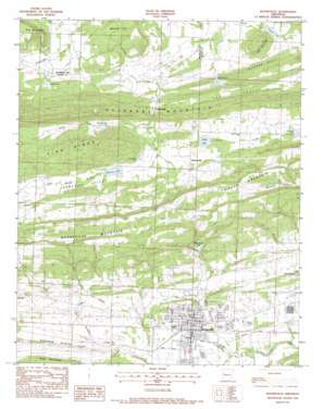
Booneville Topo Map Arkansas
To zoom in, hover over the map of Booneville
USGS Topo Quad 35093b8 - 1:24,000 scale
| Topo Map Name: | Booneville |
| USGS Topo Quad ID: | 35093b8 |
| Print Size: | ca. 21 1/4" wide x 27" high |
| Southeast Coordinates: | 35.125° N latitude / 93.875° W longitude |
| Map Center Coordinates: | 35.1875° N latitude / 93.9375° W longitude |
| U.S. State: | AR |
| Filename: | o35093b8.jpg |
| Download Map JPG Image: | Booneville topo map 1:24,000 scale |
| Map Type: | Topographic |
| Topo Series: | 7.5´ |
| Map Scale: | 1:24,000 |
| Source of Map Images: | United States Geological Survey (USGS) |
| Alternate Map Versions: |
Booneville AR 1983, updated 1983 Download PDF Buy paper map Booneville AR 2011 Download PDF Buy paper map Booneville AR 2014 Download PDF Buy paper map |
1:24,000 Topo Quads surrounding Booneville
> Back to 35093a1 at 1:100,000 scale
> Back to 35092a1 at 1:250,000 scale
> Back to U.S. Topo Maps home
Booneville topo map: Gazetteer
Booneville: Cliffs
Buzzard Bluff elevation 181m 593′Booneville: Dams
Booneville Reservoir Dam elevation 183m 600′Sixmile Creek Watershed Site 10 Dam elevation 168m 551′
Sixmile Creek Watershed Site 11 Dam elevation 159m 521′
Sixmile Creek Watershed Site Five Dam elevation 151m 495′
Sixmile Creek Watershed Site Four Dam elevation 143m 469′
Sixmile Creek Watershed Site Nine Dam elevation 163m 534′
Sixmile Creek Watershed Site Seven Dam elevation 162m 531′
Sixmile Creek Watershed Site Six Dam elevation 181m 593′
Booneville: Oilfields
Chismville Extension Gas Field elevation 173m 567′Chismville Gas Field elevation 160m 524′
Booneville: Parks
Bearcat Stadium elevation 155m 508′Marcelle Phillips Park elevation 147m 482′
Booneville: Populated Places
Booneville elevation 154m 505′Brownsville elevation 169m 554′
Chismville elevation 153m 501′
Booneville: Post Offices
Booneville Post Office elevation 145m 475′Booneville: Reservoirs
Boneville Lake elevation 185m 606′Booneville Reservoir elevation 183m 600′
Caney Lake elevation 138m 452′
Fletcher Lake elevation 178m 583′
Parker Lake elevation 161m 528′
Sixmile Creek Watershed Site 10 Reservoir elevation 168m 551′
Sixmile Creek Watershed Site 11 Reservoir elevation 159m 521′
Sixmile Creek Watershed Site Five Reservoir elevation 151m 495′
Sixmile Creek Watershed Site Four Reservoir elevation 143m 469′
Sixmile Creek Watershed Site Nine Reservoir elevation 163m 534′
Sixmile Creek Watershed Site Seven Reservoir elevation 162m 531′
Williams Lake elevation 163m 534′
Booneville: Ridges
Pine Ridge elevation 256m 839′Booneville: Streams
Booneville Creek elevation 132m 433′Coal Creek elevation 148m 485′
Little Sixmile Creek elevation 154m 505′
Racoon Creek elevation 137m 449′
Rattlesnake Creek elevation 132m 433′
Rocky Creek elevation 152m 498′
Booneville: Summits
Booneville Mountain elevation 267m 875′Pilot Mountain elevation 224m 734′
Pine Mountain elevation 226m 741′
Booneville: Valleys
Ferguson Valley elevation 157m 515′Fox Valley elevation 156m 511′
Booneville digital topo map on disk
Buy this Booneville topo map showing relief, roads, GPS coordinates and other geographical features, as a high-resolution digital map file on DVD:


