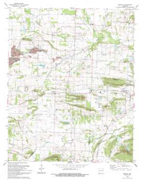
Branch Topo Map Arkansas
To zoom in, hover over the map of Branch
USGS Topo Quad 35093c8 - 1:24,000 scale
| Topo Map Name: | Branch |
| USGS Topo Quad ID: | 35093c8 |
| Print Size: | ca. 21 1/4" wide x 27" high |
| Southeast Coordinates: | 35.25° N latitude / 93.875° W longitude |
| Map Center Coordinates: | 35.3125° N latitude / 93.9375° W longitude |
| U.S. State: | AR |
| Filename: | o35093c8.jpg |
| Download Map JPG Image: | Branch topo map 1:24,000 scale |
| Map Type: | Topographic |
| Topo Series: | 7.5´ |
| Map Scale: | 1:24,000 |
| Source of Map Images: | United States Geological Survey (USGS) |
| Alternate Map Versions: |
Branch AR 1966, updated 1967 Download PDF Buy paper map Branch AR 1966, updated 1986 Download PDF Buy paper map Branch AR 1993, updated 1993 Download PDF Buy paper map Branch AR 2011 Download PDF Buy paper map Branch AR 2014 Download PDF Buy paper map |
1:24,000 Topo Quads surrounding Branch
> Back to 35093a1 at 1:100,000 scale
> Back to 35092a1 at 1:250,000 scale
> Back to U.S. Topo Maps home
Branch topo map: Gazetteer
Branch: Dams
Hewitt Lake Dam elevation 123m 403′Six Mile Creek Watershed Site Eight Dam elevation 133m 436′
Sixmile Creek Site 13 Dam elevation 130m 426′
Sixmile Creek Site 23 Dam elevation 128m 419′
Sixmile Creek Site 24 Dam elevation 129m 423′
Sixmile Creek Site 25 Dam elevation 118m 387′
Sixmile Creek Watershed Site Three Dam elevation 144m 472′
Watson Lake Dam elevation 121m 396′
Branch: Populated Places
Branch elevation 141m 462′Dahoma (historical) elevation 129m 423′
Donald (historical) elevation 132m 433′
Effa (historical) elevation 133m 436′
Fealey (historical) elevation 152m 498′
Peter Pender elevation 129m 423′
Ratcliff elevation 128m 419′
Branch: Reservoirs
Hewitt Lake elevation 123m 403′Lake Number Eight elevation 133m 436′
Lake Number Thirteen elevation 130m 426′
Lake Number Three elevation 145m 475′
Lake Number Twentyfive elevation 118m 387′
Lake Number Twentyfour elevation 129m 423′
Lake Number Twentythree elevation 130m 426′
Sixmile Creek Site 13 Reservoir elevation 130m 426′
Sixmile Creek Site 23 Reservoir elevation 128m 419′
Sixmile Creek Site 24 Reservoir elevation 129m 423′
Sixmile Creek Site 25 Reservoir elevation 118m 387′
Sixmile Creek Watershed Site Three Reservoir elevation 144m 472′
Watson Lake elevation 121m 396′
Branch: Streams
Caney Creek elevation 116m 380′Dry Fork elevation 114m 374′
Lowes Creek elevation 113m 370′
Perry Creek elevation 113m 370′
Pony Creek elevation 121m 396′
Prairie Creek elevation 126m 413′
Spirits Creek elevation 156m 511′
Branch: Summits
Metcalf Hill elevation 237m 777′Branch digital topo map on disk
Buy this Branch topo map showing relief, roads, GPS coordinates and other geographical features, as a high-resolution digital map file on DVD:


