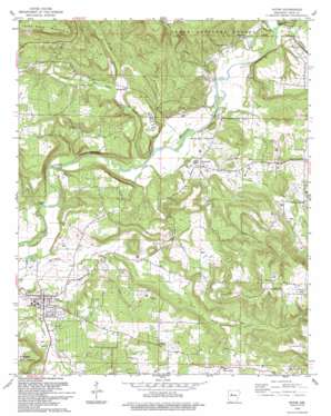
Dover Topo Map Arkansas
To zoom in, hover over the map of Dover
USGS Topo Quad 35093d1 - 1:24,000 scale
| Topo Map Name: | Dover |
| USGS Topo Quad ID: | 35093d1 |
| Print Size: | ca. 21 1/4" wide x 27" high |
| Southeast Coordinates: | 35.375° N latitude / 93° W longitude |
| Map Center Coordinates: | 35.4375° N latitude / 93.0625° W longitude |
| U.S. State: | AR |
| Filename: | o35093d1.jpg |
| Download Map JPG Image: | Dover topo map 1:24,000 scale |
| Map Type: | Topographic |
| Topo Series: | 7.5´ |
| Map Scale: | 1:24,000 |
| Source of Map Images: | United States Geological Survey (USGS) |
| Alternate Map Versions: |
Dover AR 1961, updated 1963 Download PDF Buy paper map Dover AR 1961, updated 1973 Download PDF Buy paper map Dover AR 1961, updated 1979 Download PDF Buy paper map Dover AR 1993, updated 1993 Download PDF Buy paper map Dover AR 2011 Download PDF Buy paper map Dover AR 2014 Download PDF Buy paper map |
| FStopo: | US Forest Service topo Dover is available: Download FStopo PDF Download FStopo TIF |
1:24,000 Topo Quads surrounding Dover
> Back to 35093a1 at 1:100,000 scale
> Back to 35092a1 at 1:250,000 scale
> Back to U.S. Topo Maps home
Dover topo map: Gazetteer
Dover: Airports
Landers Loop Airport elevation 215m 705′Dover: Oilfields
Dover Gas Field elevation 187m 613′Scottsville Gas Field elevation 180m 590′
Dover: Populated Places
Broomfield elevation 168m 551′Dover elevation 137m 449′
Scottsville elevation 151m 495′
Dover: Streams
Gum Creek elevation 136m 446′Little Creek elevation 128m 419′
Little Creek elevation 131m 429′
Mill Creek elevation 148m 485′
Mud Creek elevation 134m 439′
North Fork Illinois Bayou elevation 145m 475′
Dover: Summits
College Hill elevation 147m 482′Three Knob Mountain elevation 382m 1253′
Dover digital topo map on disk
Buy this Dover topo map showing relief, roads, GPS coordinates and other geographical features, as a high-resolution digital map file on DVD:


