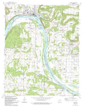
Ozark Topo Map Arkansas
To zoom in, hover over the map of Ozark
USGS Topo Quad 35093d7 - 1:24,000 scale
| Topo Map Name: | Ozark |
| USGS Topo Quad ID: | 35093d7 |
| Print Size: | ca. 21 1/4" wide x 27" high |
| Southeast Coordinates: | 35.375° N latitude / 93.75° W longitude |
| Map Center Coordinates: | 35.4375° N latitude / 93.8125° W longitude |
| U.S. State: | AR |
| Filename: | o35093d7.jpg |
| Download Map JPG Image: | Ozark topo map 1:24,000 scale |
| Map Type: | Topographic |
| Topo Series: | 7.5´ |
| Map Scale: | 1:24,000 |
| Source of Map Images: | United States Geological Survey (USGS) |
| Alternate Map Versions: |
Ozark AR 1966, updated 1967 Download PDF Buy paper map Ozark AR 1966, updated 1979 Download PDF Buy paper map Ozark AR 1993, updated 1993 Download PDF Buy paper map Ozark AR 2011 Download PDF Buy paper map Ozark AR 2014 Download PDF Buy paper map |
1:24,000 Topo Quads surrounding Ozark
> Back to 35093a1 at 1:100,000 scale
> Back to 35092a1 at 1:250,000 scale
> Back to U.S. Topo Maps home
Ozark topo map: Gazetteer
Ozark: Bridges
Ozark Bridge elevation 123m 403′Ozark: Dams
Ozark-Jeta Taylor Lock and Dam elevation 110m 360′Ozark: Islands
Guthrie Island elevation 110m 360′Honea Island elevation 101m 331′
Moores Island elevation 108m 354′
Ozark: Oilfields
Aetna Gas Field elevation 188m 616′Ozark Gas Field elevation 165m 541′
Ozark: Parks
Aux Arc Park elevation 115m 377′East Side Park elevation 111m 364′
Eastside Park elevation 111m 364′
Reed Mountain Park elevation 123m 403′
West City Park elevation 149m 488′
West Creek Park (historical) elevation 111m 364′
West Side Park elevation 153m 501′
Ozark: Populated Places
Altus elevation 165m 541′Denning elevation 136m 446′
Greenwood elevation 123m 403′
Ozark elevation 119m 390′
Roseville elevation 117m 383′
South Ozark elevation 114m 374′
Webb City elevation 131m 429′
Wiederkehr Village elevation 165m 541′
Ozark: Post Offices
Denning Post Office (historical) elevation 135m 442′Ozark: Reservoirs
Ozark Lake elevation 110m 360′Ozark: Streams
East Fork Gar Creek elevation 109m 357′Gar Creek elevation 110m 360′
Hicks Creek elevation 112m 367′
Mikes Creek elevation 105m 344′
Moores Creek elevation 102m 334′
Pond Creek elevation 107m 351′
Smith Creek elevation 102m 334′
West Creek elevation 101m 331′
Ozark digital topo map on disk
Buy this Ozark topo map showing relief, roads, GPS coordinates and other geographical features, as a high-resolution digital map file on DVD:


