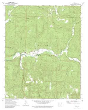
Oark Topo Map Arkansas
To zoom in, hover over the map of Oark
USGS Topo Quad 35093f5 - 1:24,000 scale
| Topo Map Name: | Oark |
| USGS Topo Quad ID: | 35093f5 |
| Print Size: | ca. 21 1/4" wide x 27" high |
| Southeast Coordinates: | 35.625° N latitude / 93.5° W longitude |
| Map Center Coordinates: | 35.6875° N latitude / 93.5625° W longitude |
| U.S. State: | AR |
| Filename: | o35093f5.jpg |
| Download Map JPG Image: | Oark topo map 1:24,000 scale |
| Map Type: | Topographic |
| Topo Series: | 7.5´ |
| Map Scale: | 1:24,000 |
| Source of Map Images: | United States Geological Survey (USGS) |
| Alternate Map Versions: |
Oark AR 1973, updated 1976 Download PDF Buy paper map Oark AR 1973, updated 1989 Download PDF Buy paper map Oark AR 2011 Download PDF Buy paper map Oark AR 2014 Download PDF Buy paper map |
| FStopo: | US Forest Service topo Oark is available: Download FStopo PDF Download FStopo TIF |
1:24,000 Topo Quads surrounding Oark
Japton |
Witter |
Weathers |
Boxley |
Murray |
Saint Paul |
Pettigrew |
Boston |
Fallsville |
Swain |
Cass |
Yale |
Oark |
Ozone |
Rosetta |
Watalula |
Hunt |
Harmony |
Ludwig |
Hagerville |
Ozark |
Coal Hill |
Hartman |
Clarksville |
Knoxville |
> Back to 35093e1 at 1:100,000 scale
> Back to 35092a1 at 1:250,000 scale
> Back to U.S. Topo Maps home
Oark topo map: Gazetteer
Oark: Gaps
Hignite Gap elevation 616m 2020′Oark: Oilfields
Low Gap Gas Field elevation 472m 1548′Oark: Populated Places
Catalpa elevation 332m 1089′Oark elevation 310m 1017′
Oark: Post Offices
Oark Post Office elevation 311m 1020′Oark: Streams
Bear Branch elevation 323m 1059′Bowen Creek elevation 284m 931′
Bull Creek elevation 299m 980′
Cowan Branch elevation 352m 1154′
Dry Creek elevation 321m 1053′
Estep Creek elevation 291m 954′
Lewis Prong elevation 358m 1174′
Panther Creek elevation 326m 1069′
Washita Creek elevation 289m 948′
Wolf Pen Creek elevation 285m 935′
Oark: Trails
Ozark Highlands Trail elevation 443m 1453′Oark: Valleys
Acord Hollow elevation 313m 1026′Coon Hollow elevation 406m 1332′
Devil Jump Hollow elevation 376m 1233′
Dry Hollow elevation 351m 1151′
Sie Hollow elevation 399m 1309′
Wolf Pen Hollow elevation 288m 944′
Oark digital topo map on disk
Buy this Oark topo map showing relief, roads, GPS coordinates and other geographical features, as a high-resolution digital map file on DVD:


