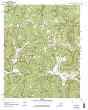
Swain Topo Map Arkansas
To zoom in, hover over the map of Swain
USGS Topo Quad 35093g3 - 1:24,000 scale
| Topo Map Name: | Swain |
| USGS Topo Quad ID: | 35093g3 |
| Print Size: | ca. 21 1/4" wide x 27" high |
| Southeast Coordinates: | 35.75° N latitude / 93.25° W longitude |
| Map Center Coordinates: | 35.8125° N latitude / 93.3125° W longitude |
| U.S. State: | AR |
| Filename: | o35093g3.jpg |
| Download Map JPG Image: | Swain topo map 1:24,000 scale |
| Map Type: | Topographic |
| Topo Series: | 7.5´ |
| Map Scale: | 1:24,000 |
| Source of Map Images: | United States Geological Survey (USGS) |
| Alternate Map Versions: |
Swain AR 1968, updated 1969 Download PDF Buy paper map Swain AR 1968, updated 1980 Download PDF Buy paper map Swain AR 2011 Download PDF Buy paper map Swain AR 2014 Download PDF Buy paper map |
| FStopo: | US Forest Service topo Swain is available: Download FStopo PDF Download FStopo TIF |
1:24,000 Topo Quads surrounding Swain
Kingston |
Osage Sw |
Ponca |
Jasper |
Hasty |
Weathers |
Boxley |
Murray |
Parthenon |
Mount Judea |
Boston |
Fallsville |
Swain |
Deer |
Lurton |
Oark |
Ozone |
Rosetta |
Fort Douglas |
Sand Gap |
Harmony |
Ludwig |
Hagerville |
Treat |
Simpson |
> Back to 35093e1 at 1:100,000 scale
> Back to 35092a1 at 1:250,000 scale
> Back to U.S. Topo Maps home
Swain topo map: Gazetteer
Swain: Capes
Reeves Point elevation 568m 1863′Swain: Populated Places
Edwards Junction elevation 675m 2214′Limestone elevation 276m 905′
Nail elevation 691m 2267′
Swain elevation 625m 2050′
Walnut elevation 325m 1066′
Swain: Post Offices
Nail Post Office elevation 690m 2263′Swain: Ridges
Gillian Ridge elevation 498m 1633′Pilot Knob Ridge elevation 563m 1847′
Stone Ridge elevation 458m 1502′
Swain: Streams
Barberry Creek elevation 468m 1535′Bear Creek elevation 303m 994′
Cole Creek elevation 340m 1115′
Cooley Creek elevation 375m 1230′
Curtis Creek elevation 259m 849′
Dismal Creek elevation 327m 1072′
Dog Branch elevation 456m 1496′
East Branch elevation 293m 961′
East Cole Creek elevation 383m 1256′
Flat Rock Creek elevation 295m 967′
Gladon Creek elevation 443m 1453′
Home Creek elevation 264m 866′
Steel Creek elevation 274m 898′
Walnut Creek elevation 312m 1023′
Willis Branch elevation 433m 1420′
Swain: Summits
Clayburn Point elevation 651m 2135′County Line Knob elevation 567m 1860′
Culbertson Point elevation 635m 2083′
Gobblers Knob elevation 617m 2024′
Little Round Mountain elevation 702m 2303′
Lost Mountain elevation 677m 2221′
Paxton Knob elevation 653m 2142′
Swain: Trails
Turkey Trail elevation 393m 1289′Swain: Valleys
Beckham Hollow elevation 324m 1062′Bee Run Hollow elevation 291m 954′
Buckner Hollow elevation 451m 1479′
Coon Hollow elevation 505m 1656′
Dismal Hollow elevation 461m 1512′
Lee Hollow elevation 450m 1476′
Ode Hollow elevation 302m 990′
Owl Hollow elevation 300m 984′
Possum Trot Hollow elevation 386m 1266′
Red Lick Hollow elevation 282m 925′
Spradley Hollow elevation 281m 921′
Watson Hollow elevation 495m 1624′
Swain digital topo map on disk
Buy this Swain topo map showing relief, roads, GPS coordinates and other geographical features, as a high-resolution digital map file on DVD:


