Fallsville Topo Map Arkansas
To zoom in, hover over the map of Fallsville
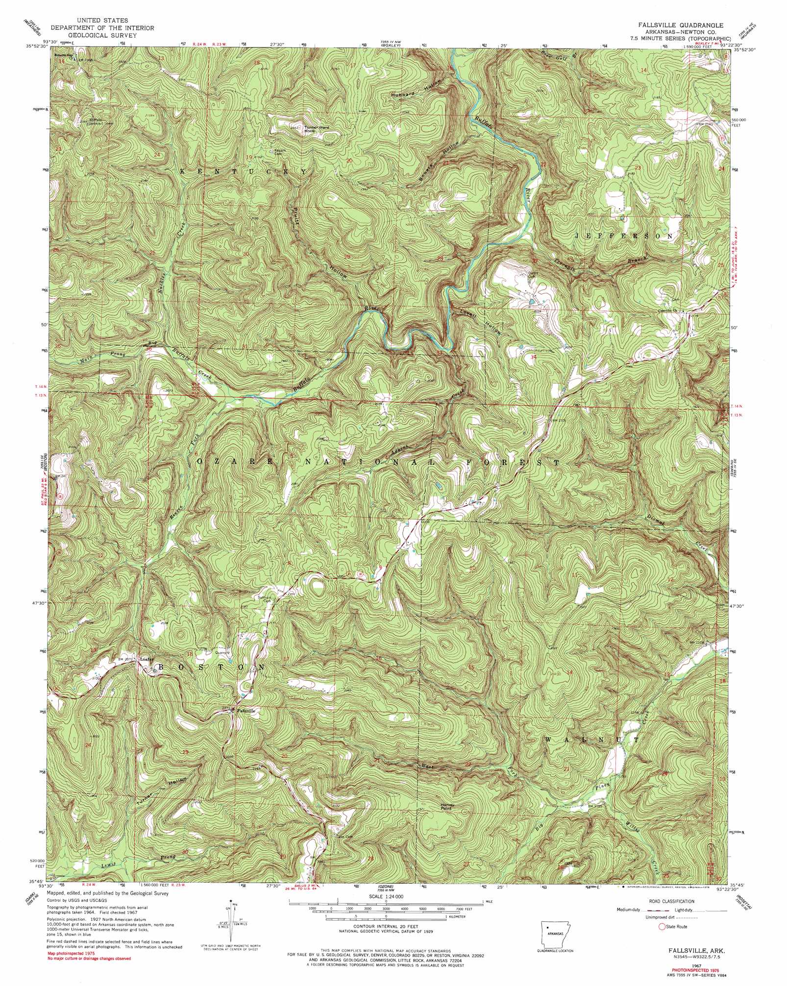
USGS Topo Quad 35093g4 - 1:24,000 scale
| Topo Map Name: | Fallsville |
| USGS Topo Quad ID: | 35093g4 |
| Print Size: | ca. 21 1/4" wide x 27" high |
| Southeast Coordinates: | 35.75° N latitude / 93.375° W longitude |
| Map Center Coordinates: | 35.8125° N latitude / 93.4375° W longitude |
| U.S. State: | AR |
| Filename: | o35093g4.jpg |
| Download Map JPG Image: | Fallsville topo map 1:24,000 scale |
| Map Type: | Topographic |
| Topo Series: | 7.5´ |
| Map Scale: | 1:24,000 |
| Source of Map Images: | United States Geological Survey (USGS) |
| Alternate Map Versions: |
Fallsville AR 1967, updated 1968 Download PDF Buy paper map Fallsville AR 1967, updated 1978 Download PDF Buy paper map Fallsville AR 1967, updated 1978 Download PDF Buy paper map Fallsville AR 2011 Download PDF Buy paper map Fallsville AR 2014 Download PDF Buy paper map |
| FStopo: | US Forest Service topo Fallsville is available: Download FStopo PDF Download FStopo TIF |
1:24,000 Topo Quads surrounding Fallsville
Huntsville |
Kingston |
Osage Sw |
Ponca |
Jasper |
Witter |
Weathers |
Boxley |
Murray |
Parthenon |
Pettigrew |
Boston |
Fallsville |
Swain |
Deer |
Yale |
Oark |
Ozone |
Rosetta |
Fort Douglas |
Hunt |
Harmony |
Ludwig |
Hagerville |
Treat |
> Back to 35093e1 at 1:100,000 scale
> Back to 35092a1 at 1:250,000 scale
> Back to U.S. Topo Maps home
Fallsville topo map: Gazetteer
Fallsville: Populated Places
Fallsville elevation 680m 2230′Loafer elevation 630m 2066′
Fallsville: Streams
Adkins Creek elevation 459m 1505′Boen Gulf Branch elevation 409m 1341′
Main Prong Big Buffalo Creek elevation 500m 1640′
Nuckles Creek elevation 524m 1719′
Reeves Fork elevation 501m 1643′
Terrapin Branch elevation 436m 1430′
West Fork Big Piney Creek elevation 357m 1171′
Willis Creek elevation 347m 1138′
Fallsville: Summits
Harvey Point elevation 592m 1942′Turner Ward Knob elevation 746m 2447′
Fallsville: Valleys
Bowers Hollow elevation 436m 1430′Hubbard Hollow elevation 411m 1348′
Lovell Hollow elevation 493m 1617′
Pruitt Hollow elevation 476m 1561′
Turner Hollow elevation 442m 1450′
Waterfall Hollow elevation 459m 1505′
Fallsville digital topo map on disk
Buy this Fallsville topo map showing relief, roads, GPS coordinates and other geographical features, as a high-resolution digital map file on DVD: