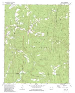
Boston Topo Map Arkansas
To zoom in, hover over the map of Boston
USGS Topo Quad 35093g5 - 1:24,000 scale
| Topo Map Name: | Boston |
| USGS Topo Quad ID: | 35093g5 |
| Print Size: | ca. 21 1/4" wide x 27" high |
| Southeast Coordinates: | 35.75° N latitude / 93.5° W longitude |
| Map Center Coordinates: | 35.8125° N latitude / 93.5625° W longitude |
| U.S. State: | AR |
| Filename: | o35093g5.jpg |
| Download Map JPG Image: | Boston topo map 1:24,000 scale |
| Map Type: | Topographic |
| Topo Series: | 7.5´ |
| Map Scale: | 1:24,000 |
| Source of Map Images: | United States Geological Survey (USGS) |
| Alternate Map Versions: |
Boston AR 1973, updated 1976 Download PDF Buy paper map Boston AR 1973, updated 1983 Download PDF Buy paper map Boston AR 2011 Download PDF Buy paper map Boston AR 2014 Download PDF Buy paper map |
| FStopo: | US Forest Service topo Boston is available: Download FStopo PDF Download FStopo TIF |
1:24,000 Topo Quads surrounding Boston
Hartwell |
Huntsville |
Kingston |
Osage Sw |
Ponca |
Japton |
Witter |
Weathers |
Boxley |
Murray |
Saint Paul |
Pettigrew |
Boston |
Fallsville |
Swain |
Cass |
Yale |
Oark |
Ozone |
Rosetta |
Watalula |
Hunt |
Harmony |
Ludwig |
Hagerville |
> Back to 35093e1 at 1:100,000 scale
> Back to 35092a1 at 1:250,000 scale
> Back to U.S. Topo Maps home
Boston topo map: Gazetteer
Boston: Forests
Ozark National Forest elevation 495m 1624′Boston: Gaps
Locust Gap elevation 648m 2125′Muddy Gap elevation 720m 2362′
Boston: Populated Places
Arbaugh elevation 716m 2349′Boston elevation 710m 2329′
Red Star elevation 639m 2096′
Boston: Ridges
Smith Ridge elevation 660m 2165′Boston: Streams
Beech Hurricane Creek elevation 401m 1315′Boston: Valleys
Clifty Hollow elevation 395m 1295′Eldrige Hollow elevation 343m 1125′
Lynn Hollow elevation 396m 1299′
Pour Off Hollow elevation 386m 1266′
Spoke Plant Hollow elevation 351m 1151′
Boston digital topo map on disk
Buy this Boston topo map showing relief, roads, GPS coordinates and other geographical features, as a high-resolution digital map file on DVD:


